
Moselsteig Hike from Mehring to Leiwen
Serious views with one massive climb with slight feels of the Alps.

I’ve always wanted to do one of Germany’s famous “wine hikes” but the timing or knowledge of when they are has kept me from finding one. But like most things hiking and outdoors in Europe, a big plan isn’t needed for a delicious culinary outdoor experience.
tl;dr: This is a hiking guide to the steep and incredible views-packed Section 7 of the 24 section “Moselsteig”, the long distance hiking trail from the French-German border through the horseshoe-bending Mosel River Valley to the Roman city of Koblenz.
Each hike includes detailed GPS guidance so it’s simple and not frustrating to find your way, food recommendations, and history highlights.
The “Moselsteig” hiking trail winds 250 miles through some of the steepest vineyards in the world (and the almost Alpine like craggy cliffs next to them).
- The best homebase to explore the Moselsteig is the idyllic town of Cochem. Here’s my guide to the best things to do in Cochem Germany.
- The second best town would be the oldest Roman city in Germany – Trier with it’s Roman ruins and Porta Nigra wall.
Not only is Trier a great culture hub, but it’s also really great for food, fun and the Outdoors. Here’s my guide to the best things to do in Trier Germany.
You’ll get a Nature and forest experience that ends each stage in an impossibly cute wine town filled with family wineries and their many Wine Probe Stube (wine tasting rooms). No event needed for delicious local wines and hiking one stage at a time, or combine a few of them and stay in local winery/guesthouses on a multi day trek.

This post links to products and services we love, which we may make a small commission from, at no extra cost to you. Thank you for supporting our blog!! – Morgan
Trail Map Mosel River Valley Hike: Section 7 of Moselsteig – 9.4 Miles or 15 km
This hike is for you if you want to challenge yourself and have great views of the Mosel River Valley.
Trail Name: Mosel River Valley Hike: Section 7 of Moselsteig Mehring to Leiwen
How to use this map: Use your computer mouse or fingers to zoom in and out. Click on the icons to get more information. Click the arrow on the top left corner for the written index. Click the star next to the title of the map to add this map to your google maps account. To view the saved map on your smartphone or PC, open google maps, click the menu button, and go to “your places”/ “maps.”
Getting to the Mosel River Valley Hike: Section 7 of Moselsteig Hikes & Area Guide
Skip Directly to Trail Guide
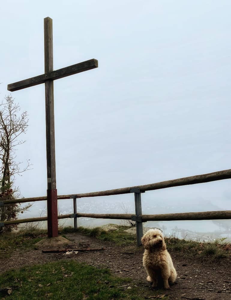
German Word: Steig = Steep path.
The trailhead is at the bridge crossing over the Mosel River and you’ll head directly up the staircase.
The best way to access the Mosel River hikes is by train. The VRN bus system services this area from the city of Trier. From Leiwen back to your car in Mehring, the bus comes at :54 on the hour but check schedules as they may change.
You’ll likely not find directions on google maps, so it can be a bit confusing but buses typically run once per hour through these villages along the Mosel.
The easiest way is to use a car and park directly behind the Sportplatz in Mehring.
The Frankfurt Hahn airport is 50 minutes away by car and the Frankfurt International Airport is 2 hours away, both with bus access to this area by way of the city of Trier or bus and train from Koblenz. From Trier you can use the local bus system to get to these villages along the Mosel.
The Mosel River winds 338 miles from the western border of the Vosges mountains of eastern France and meets the River Rhine in Koblenz. Called the Moselle in France, it creates a natural border between the Hunsrück and Eifel mountain ranges within Germany.
To listen while you walk or bike along the Mosel, this audiobook will give you some background of the history of Germany.

Who is This Guide NOT for and What are the Alternatives?
This guide is not for strollers or small children, it’s a long day with ups and downs. If not enchanted with wineries but want more dramatic mountains the Italian Dolomites might be your preference.
If you are looking for an alternative in Germany, the gorgeous Rhine River offers vineyard and gorgeous river views hiking as well. It also has the possibility to hike from one castle hotel to the next castle hotel directly on the trail.
Mosel River Valley Hike: Section 7 of MoselsteigTrail Guide Mehring to Leiwen & Back with Bus
Komoot App with GPS Tracking: You get one free zone with this awesome app.
https://www.komoot.com/tour/632028807?ref=wtd
Location: Mehring, Germany, 1 Hour from Ramstein Air Base
Trail Guide: Mosel River Valley Hike : Section 7
Type of Hike: Point to Point, Return with Bus 220 departs at :54 back to Mehring
Distance: 9.4 miles
Elevation: 1300 ft up,1400 ft down
Duration: Approx. 4-5 hours
Difficulty: Moderate, All the action is up front then it mellows
Start/end point: Parking Lot
Kid-friendly: yes, 10+
Stroller-friendly: no
Dog-friendly: yes
Fees: No
Camino de Santiago: No
Something Good to Eat: Hotel zum Moseltal with friendly service right on the river.

Coming from Out of Town? Best Places to Stay
Budget
Going budget and have an SUV? It’s completely legal to sleep in your car (but only one night in each place) in Germany in a parking lot with a comfy SUV air mattress.
▶️ Stay in a Winegut (Winery) at Weingut***Pension Günther Scholtes
▶️ Have your own cute 3 Bedroom apartment at Ferienwohnung Cäcilia im idyllischen Haus Kommeles – Leiwen an der Mosel
▶️ Gorgeous chic apartment with homemade jam and wine at “REH”-sidenz Moselschleife
Tips for Hiking Section 7 of Moselsteig Trail Mehring to Leiwen & Back with Bus
These paths are pretty steep in the beginning so a good trail shoe or boot and trekking poles would be a good idea if you have any joint issues or prone to falls.
The tower for the 5 see views is under renovation due to rotted wood, bummer.
Despite being in the forest, please ensure proper sun protection during the summer months and protect your eyes from the damage inflicted by the sun.
Try to time your finish in Leiwen to half past the hour, that way you can catch the bus back to Mehring without waiting so long. The station is in the center of town at the water fountain.
Follow street signs to the “bushaltstelle”. When coming back to Mehring get off at the first stop, the “bridge” stop.
Bring your own water as the spring water is questionable and buying water in Germany tends to be rather expensive both at restaurants and at convenience stores.
It is never free to get tap water in Germany unless you have a serious hook up with a restaurateur.
Other Cool Outdoor things to do
🚠 If you love riding non-ski chairlifts above rivers and vineyards, you can ride UP the mountain on the Cochem chairlift, also ride the Assmannshausen chairlift or the Boppard chairlift.
⌚ Explore more with confidence with our top-rated hiking and navigational watch!
If you need a reliable GPS watch for your trip, then my personal recommendation is to choose Garmin Fenix 7X Sapphire Watch, an award winning navigation watch with advanced features like GPS tracking, altimeter and long battery life. Plus with durable and waterproof design, you can take on any weather.
Buy a watch HEREWe hope this guide filled with interesting information about hiking on the Moselsteig and it has given you the proper information to plan your next adventure.
More Resources
Discover gear that elevates your outdoor adventures. As a physical therapist, I’ve curated product comparisons to enhance safety and enjoyment, perfect for beginners or those with weary knees.
Physical Therapist Curated Gear Guides for Hikers & Skiers
- 🧎 Make your knees feel better while hiking and walking: Best Knee Braces for Hiking
- 🌳Make the downhills stop hurting and hike with more confidence Best Trekking Poles Review
- ⌚ Never get lost on the trail and navigate the wilderness safely with My Review of the Best GPS Watches for Hiking
- ❄️ Go hiking on uneven terrain safely: The Best Hiking Boots with Ankle Support
- Don’t get lost in the backcountry with : My Review of the Best 2 Way Radios for the Mountains
My Guides to Bucketlist Hikes in Europe
(That I’ve personally done and loved.)
Like it? Share it to promote sustainable tourism.
Author profile: Morgan Fielder is a Doctor of Physical Therapy and passionate hiker who believes in exploring the world on foot with good food. Follow her journey as she shares science-based hiking tips and advocates for sustainable tourism.