
Experience the Hard but Epic Hike to Olpererhütte Bridge and Mountain Hut with my Hiking and Photography Guide for Normal People.
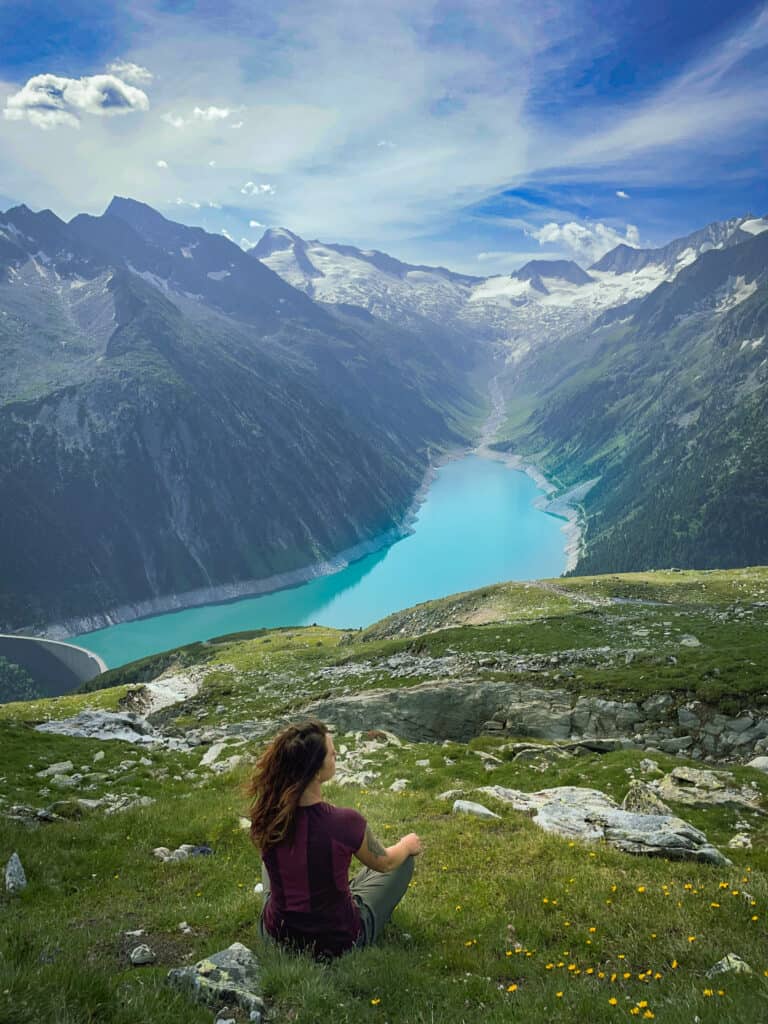
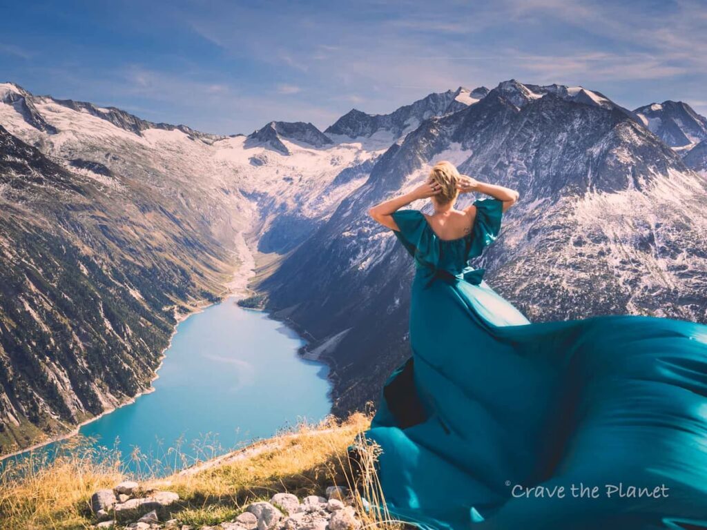
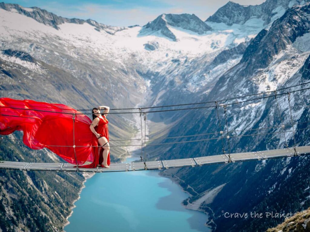
How to take an epic swing bridge photo like this? 👎
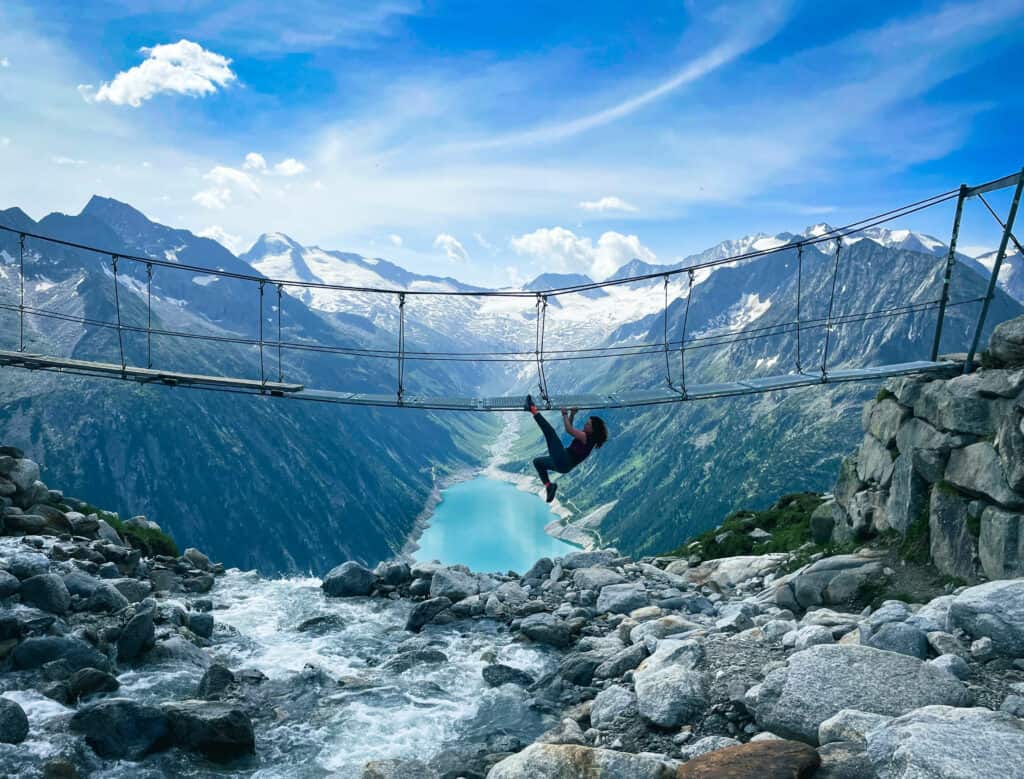
It’s an illusion that makes normal hikers look like wild mountaineers. (That’s me, and I have vertigo, so it’s not REALLY scary at all.)
I’ll share with you how to get to the trail, all the exact details of the hike and how to get the best images in Austria’s most instagrammable summer hike.
Make Lifetime Memories with a Photo on the famous Zillertal Alps Bridge.
Quick Guide Olpererhutte Hike:
Author’s TL;DR: Soak in the impressive Zillertal Alpine scenery with these 3 hiking trail guides of varying difficulty to the Olpererhütte bridge and tasty mountain hut.
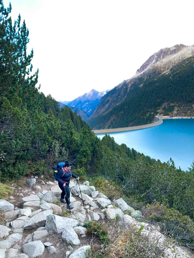
NOTE: While this hike does not require any special equipment or dangerous exposure, it is physically hard as it’s almost all uphill for 1.5-2 hours (depending on your fitness).
You MUST be able to hike there, there is no vehicle or gondola access.
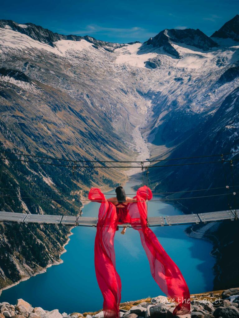
On a hike to Olpererhütte, it’s not hard at all to get shots like these! The images you can get at the Zillertal Alps bridge in Austria are unreal!
Overview Olpererhütte Bridge Hike
Location: Ginzling, Austria
Distance: 4.04 miles, 6.5 km
Time: Approx 3 hours
Elevation: 600m, 1970 ft up/down
Difficulty: Moderate due to rocky terrain and steepness
Where to Stay: Friendliest – Olpererhütte Mountain Hut
Best Eco-Friendly Luxury – MalisGarten GreenSpa Hotel
Best Budget Hotel – Der Siegler B&B
Best for Families – Hotel Neue Post
⛰ Craving Adventure? Book a Hut to Hut Hiking Tour
Olpererhütte Hike Map
How to use this map: Use your computer mouse or fingers to zoom in and out. Click on the icons to get more information. Click the arrow on the top left corner for the written index. Click the star next to the title of the map to add this map to your google maps account. To view the saved map on your smartphone or PC, open google maps, click the menu button, and go to “your places”/ “maps.”
Short Guide: How to Hike to the Olpererhutte Bridge (Shortest Way of 3)
- Free GPS Komoot: Zillertal Austria Map of 3 Olpererhutte Hikes: Komoot has one free region to download for offline use.
- Start/end point: Free Parking near Schlegeis Reservoir.
- Kid-friendly: yes, 5+. Small children will likely need to be carried in packs.
Stroller-friendly: not even a little bit - Dog-friendly: Yes, most mountain huts here accept dogs, contact them directly to ask.
- Fees: Toll road 14.50 euros. Toll Road website to check opening days. No hiking pass needed.
- Behind the Scenes Stories: Web Stories ******Olpererhutte********
- Public Transportation: Yes (read below for exact buses)
- Day hike: Yes you can do this on a day trip from Munich, Innsbruck with public transport
Why Go to Olpererhutte?
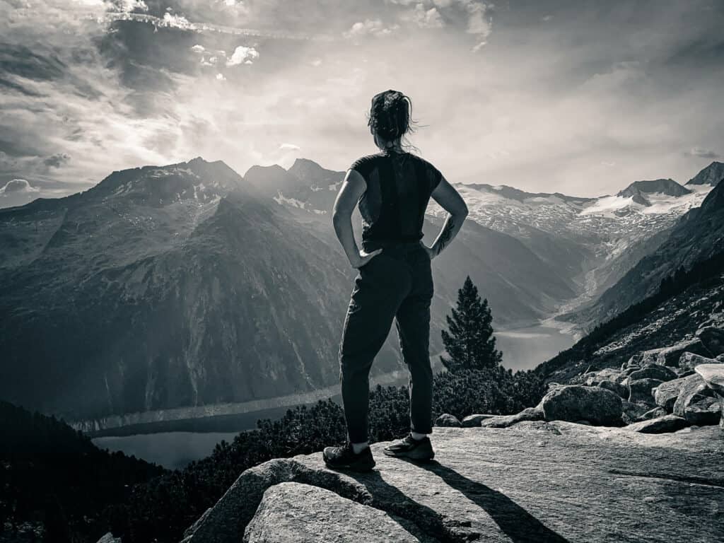
In my 30 years of hiking in Idaho, Europe, and along the Green, White and Smoky Mountains, I’ve never felt more of a baddass than getting that iphone shot of me hanging off the bridge.
This hiking and Nature-filled paradise is located near Mayrhofen, Austria in the Zillertal Alps.
Morgan’s Olpererhutte Bridge Video
Located about 2 hours south of Munich, it’s your quintessential Austrian Alps town filled with geranium adorned balconies, cow parades and tons of delicious restaurants.
It’s impossibly cute and inviting you to adventure!
Olpererhütte Bridge & Trail Report: 3 Ways to Hike There
How long is the Hike to Olpererhutte in Austria?
It depends 😉 There are 3 routes (or more) for day hikes to Olpererhütte from the parking at the Schlegeis reservoir next to Dominikushutte.
You can also reach Olpererhutte if you’re on the multi day Berlin Höhenweg long distance trail.
#1 Shortest: Direct Blue Route : 4 miles
- Distance: 4.04 miles, 6.5 km Out and Back
- Elevation: 600 meters, 1970 ft up/down
- Duration: Approx 3 hours walking time
- Difficulty: Moderate due to rocky terrain and steepnes
- GPS: Hiking App BLUE route
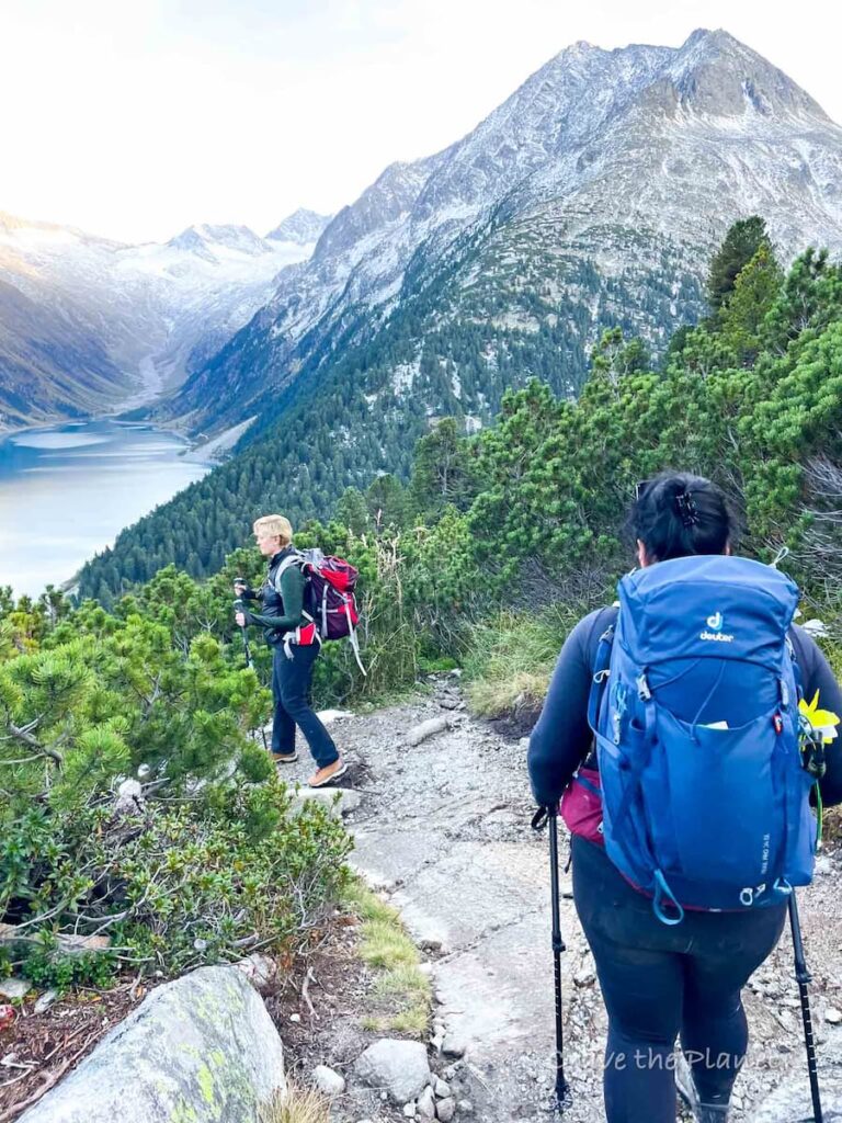
This is the most common path as it’s a direct straight up & down from the parking area to the Olpererhütte and its famous suspension bridge.
Expect crowds. It’s rocky and steep but very manageable. There’s almost always an impressive view and lovely places to stop and get once in a lifetime selfies.
This will be the descent for the other 2 routes that are loops. You can always reverse this if desired.
#2: Longest : Friesenberghaus Yellow Trail 532 /526 8.5 miles
- Distance: 8.44 miles, 13.6 km Loop
- Elevation: 815 meters, 2675 ft up/down
- Duration: Approx. 6-7 hours
- Difficulty: Moderate due to rocky terrain and parts covered in snow
- GPS: Hiking App Yellow Route
Head up the mountain to the northwest of Dominikushütte and enjoy the vast valley going toward the Friesenberghaus.
I made it just shy of this hütte that supposedly has great food before I hit a lightning storm and had to turn around and run back to the valley.
There’s not much cover here as it’s somewhat barren of trees. Great views, but no protection.
Other hikers told me that it’s not a bad hike, but you’ll almost all summer encounter snowy passes so wear some gaiters around your boots to stay dry.
#3: Waterfall : Neumarkter Green 535/502
- Distance: 8.44 miles, 13.6 km Loop
- Elevation: 815 meters, 2675 ft up/down
- Duration: Approx. 6-7 hours
- Difficulty: Moderate due to rocky terrain and parts covered in snow
- GPS: Hiking App Green Route
Another longer route to enjoy. I’ve not done it as I chose to hike to Italy on my third day there instead of going back to Olpererhutte (i wanted to try that Sudtyrolean cuisine!).
Other hiking reports recommend it due to the fantastic views and interesting statues along the trail.
More Great Hikes Around the Schlegeis Reservoir
For you hut to hut hikers the Peter Habeler Trail and the Berlin Höhenweg emerge through these amazing glacier topped Zillertal Alps between tasty hütten.
Morgan’s Experience Hiking to Olpererhutte
So what was awesome about Olpererhutte?
- Does it feel like you’ve stepped back in time? Yes.
- Is the world in technicolor? Yes. Especially the color-changing Schlegeis Lake you view from the Olperer bridge.
- Does the terrain make you FORGET YOUR TO-DO-LIST? Absolutely. It’s challenging, but not technical.
- Can you hike to Italy from Austria for lunch?? Yes, most definitely. And…it’s not even that hard!
- Running into legit shepherds bringing the flock home for the winter wearing red gortex.
What was NOT awesome about the Olpererhutte hike?
- Crowds. You literally have to wait in line on the bridge to get photos.
- Steep, rocky hike. Some people with bad knees may not enjoy it.
- The drive to get there was a little sketchy. One way tunnels and lots of switchbacks.
- Getting reservations at the hut is really hard.
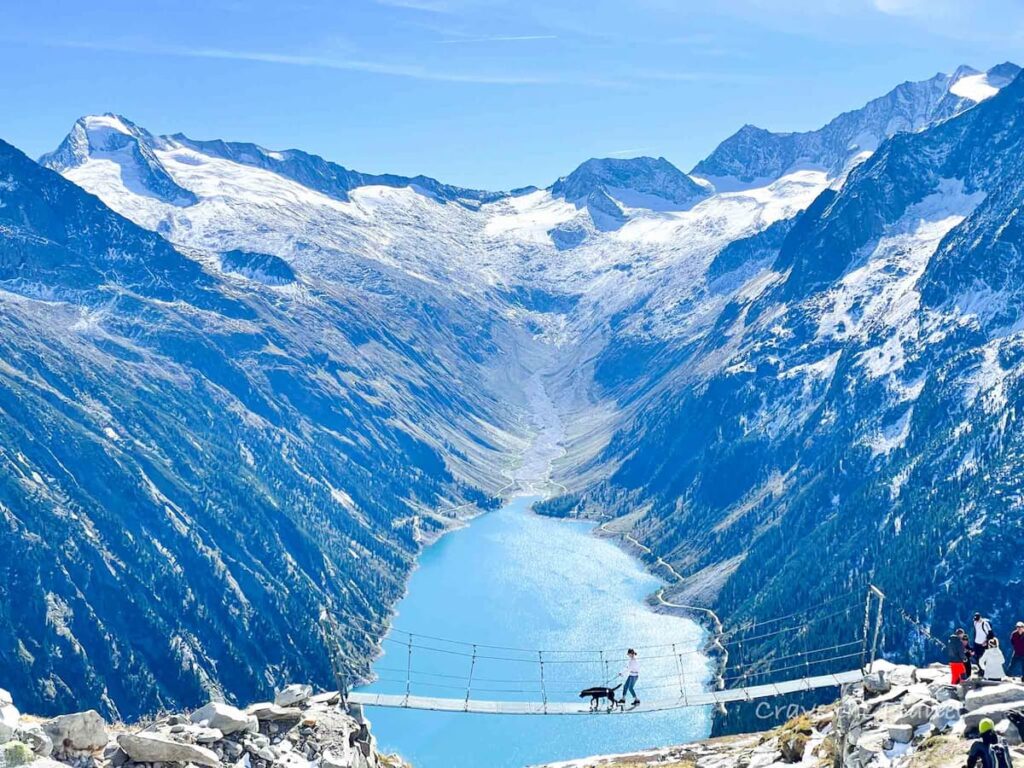
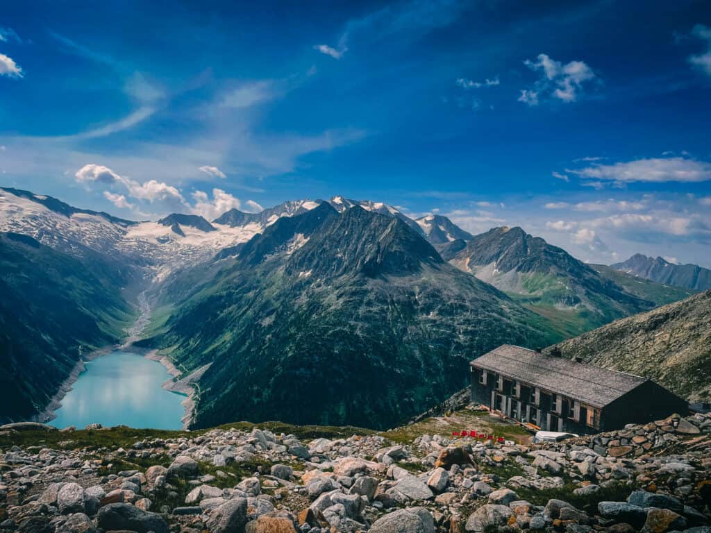
Olpererhütte Bridge
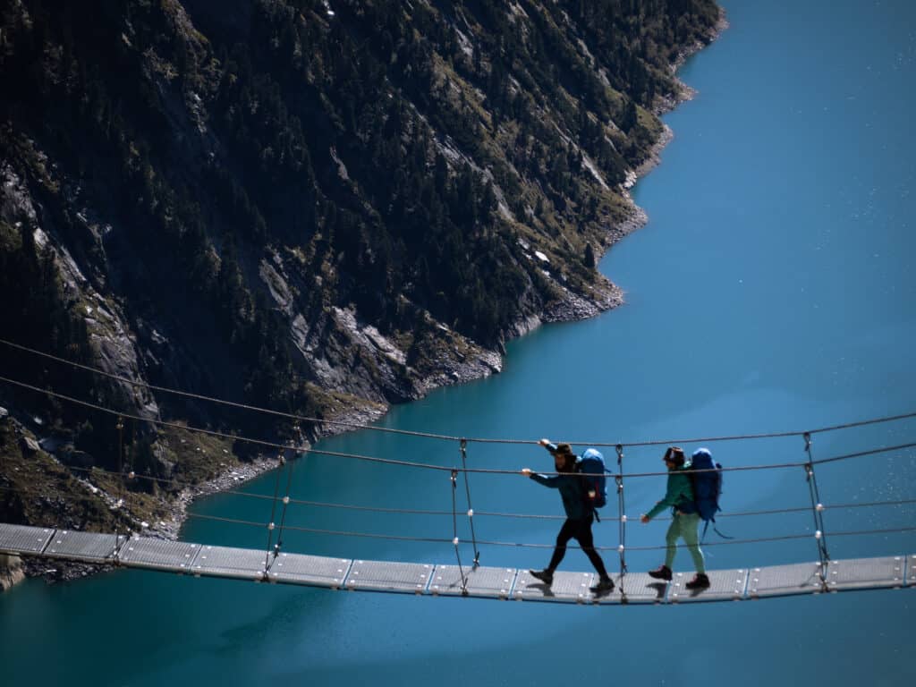
Wow, right?!?
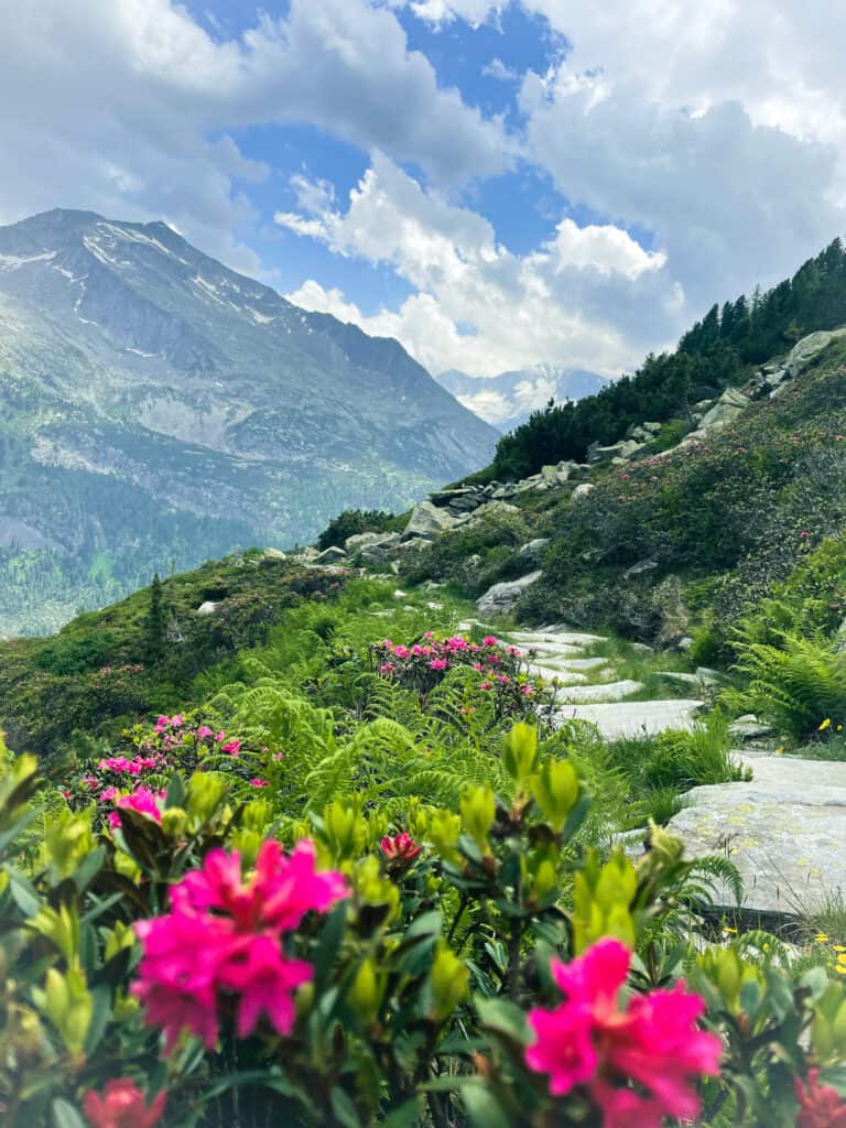
The hike to Olpererhütte is just views, views, views almost the entire way. It’s impossible to get lost and the hut at the top serves an elderberry infused Spritz that is fantastically delicious.
The beer is great too – but an elderberry drink after a 1.5 hour slog uphill? Yes, please!
Olpererhütte Bridge Photography
To get the bridge you simply walk uphill past the actual hut. It’s about a 5 minute walk. There you’ll have to set up a tripod in the stream with a timer. Or better yet, just ask someone to take your photo with your own phone and do the same for them.
It is likely you’ll have to wait in line. The best lighting for the lake is when the sun is overhead at noon, but that is also the harshest light on your face so it’s a trade off. As the sun goes down the mountain shadows play onto the lake for dramatic effect.
It’s more crowded than what I’m used to, so shoulder season is my preference. Better yet, book a stay at the Olpererhutte overnight and have the bridge and sunrise and sunset to yourselves.
Zillertal Alps Austria
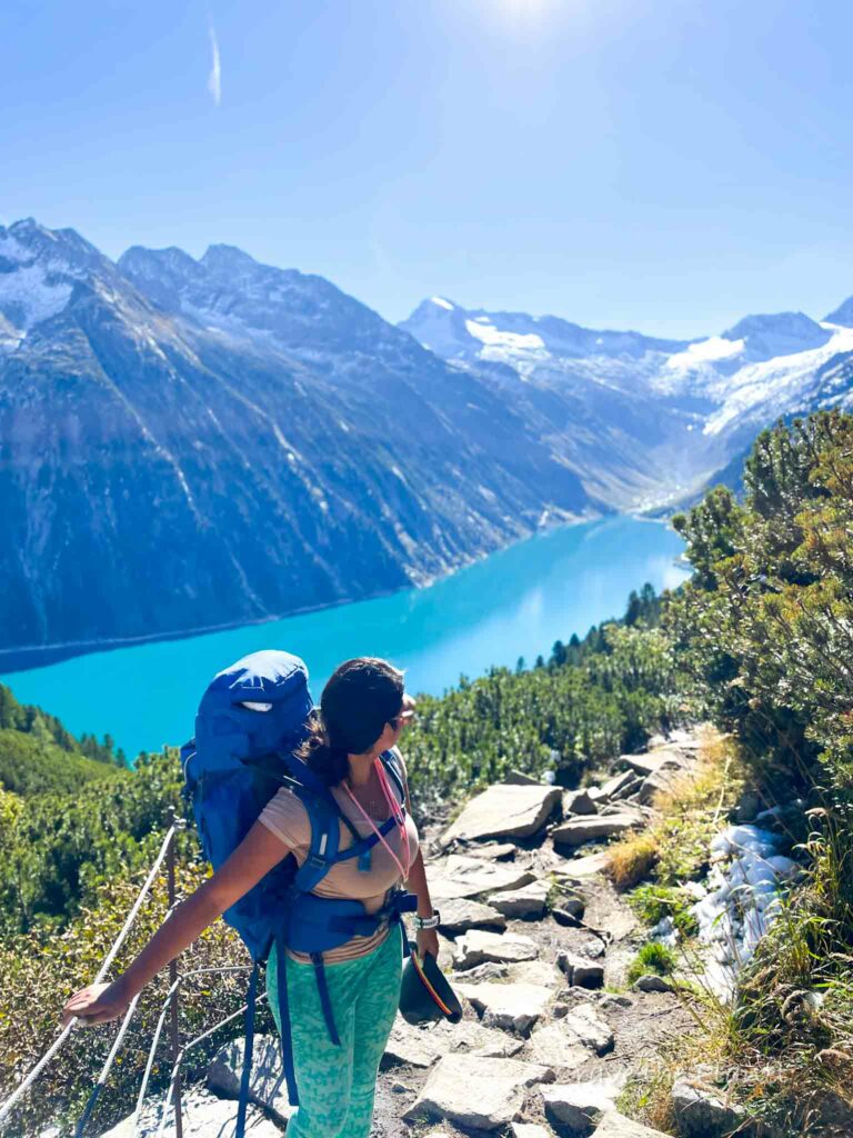
If you go just 100 meters past the bridge, you’ll frequently have much more privacy and the photos with the Schlegeis lake are amazing. It’s really weird how people hike a ton and then just stop at the bridge and don’t go a meter past it.
Olpererhütte Brücke (Olpererhutte bridge) – Is it worth it?
In 2022 I went there twice to figure out this question.
I went in mid-June for the Austria bridge hike and it was amazing, breathtaking, magical and fun!
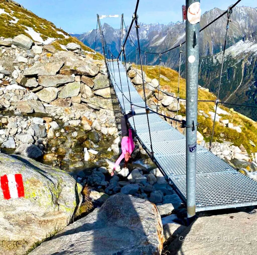
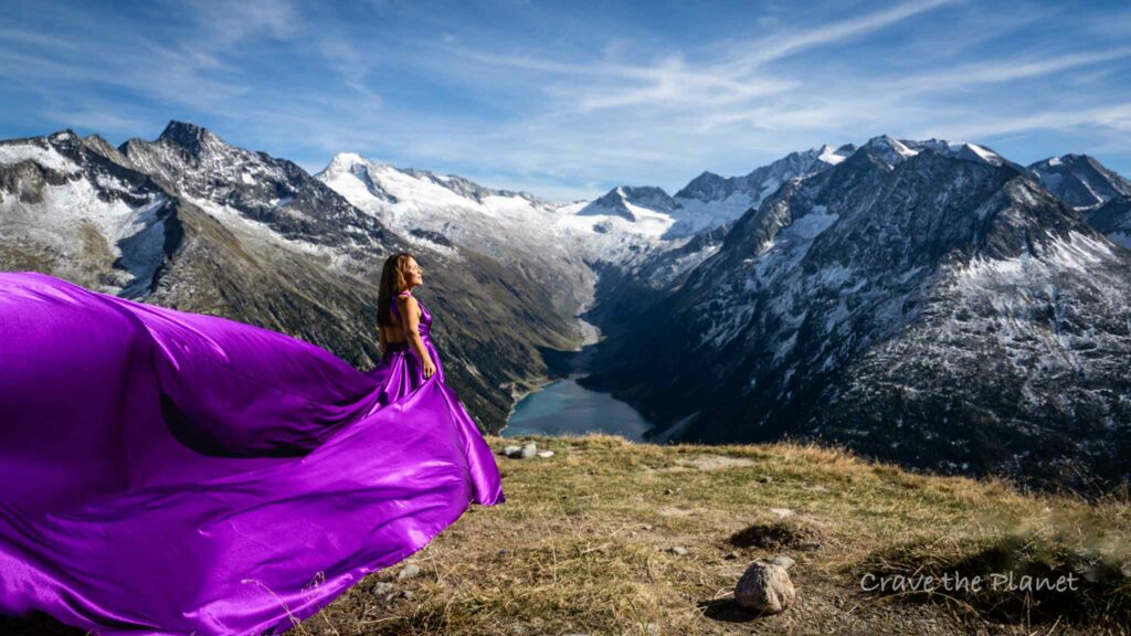
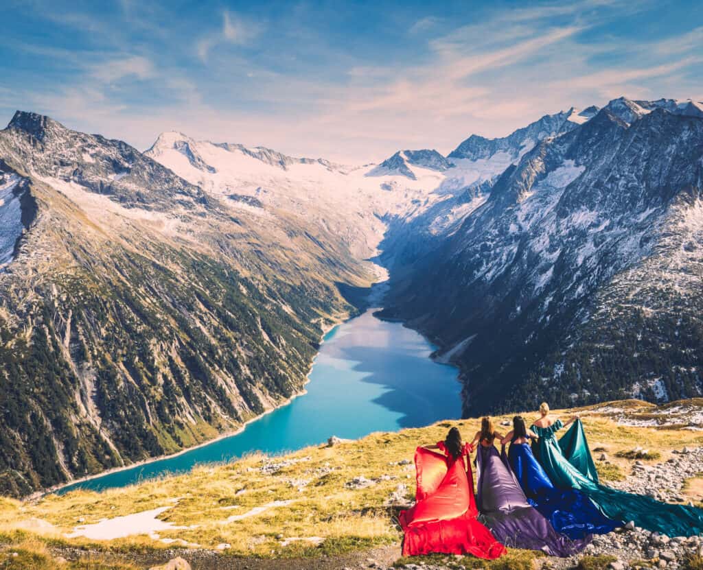
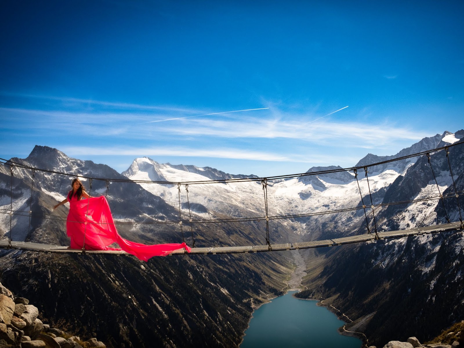
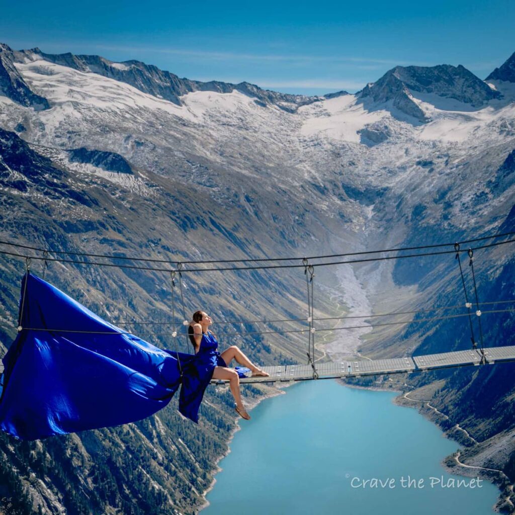
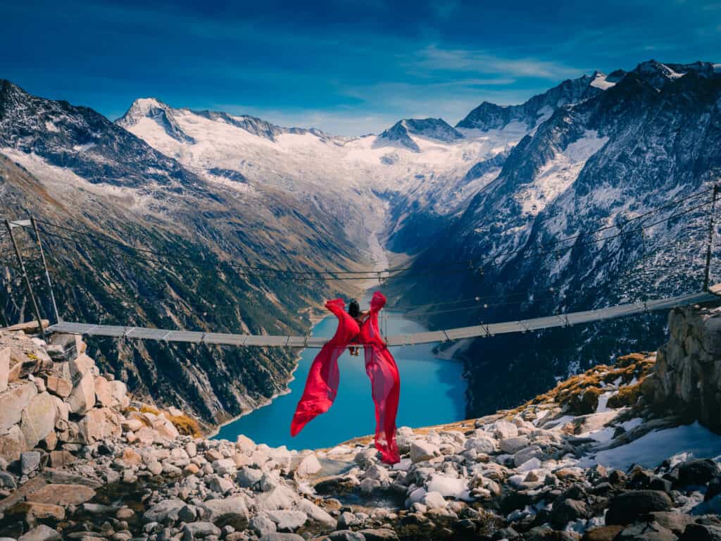
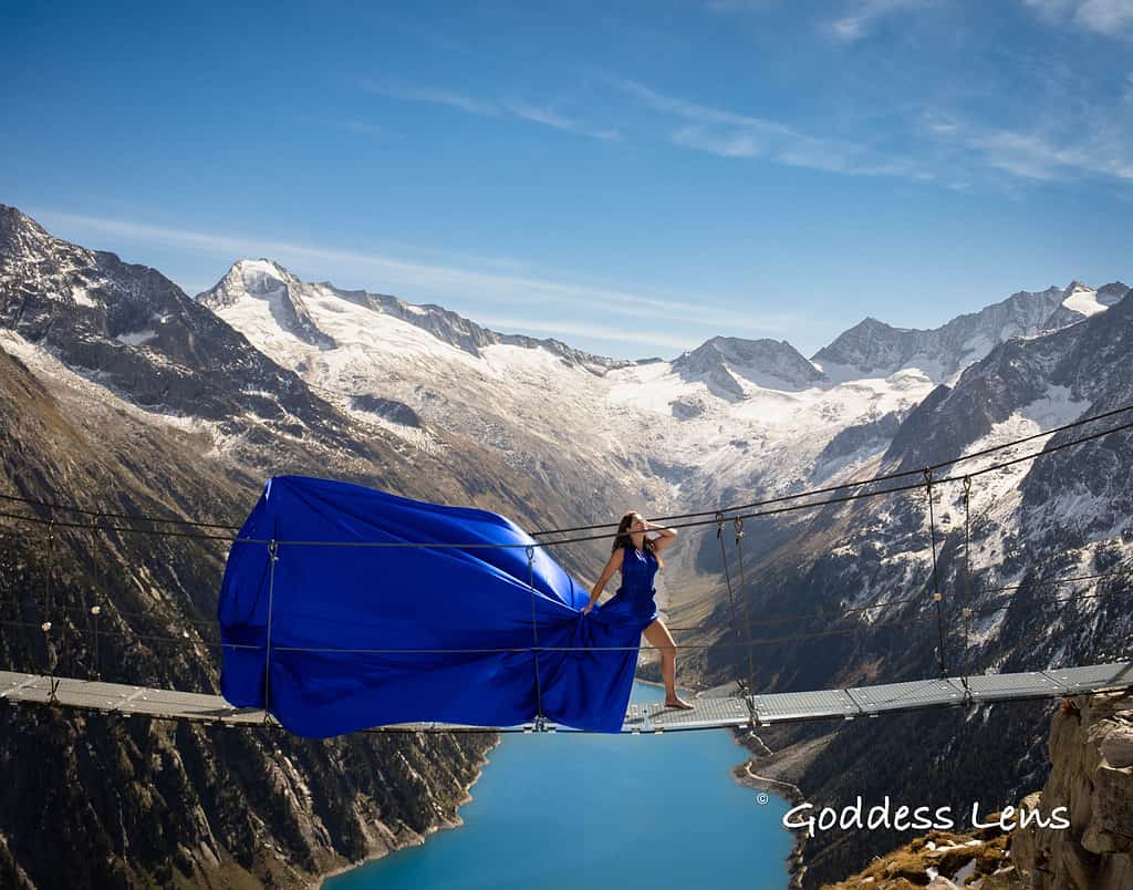
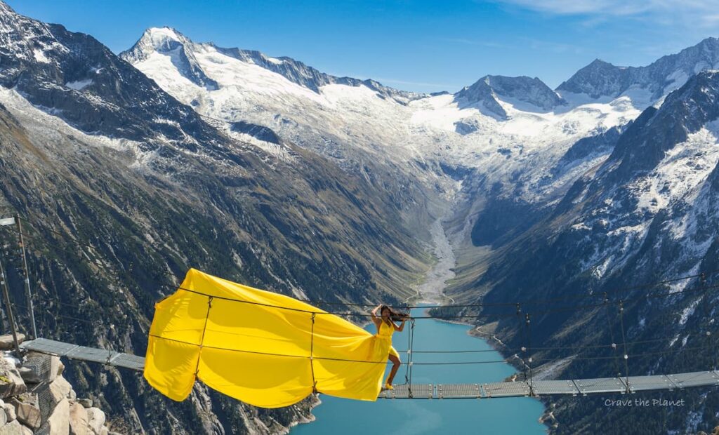
So when my friends wanted to do a lady flying dress photography shoot in the Alps, I thought we should definitely try the famous suspension bridge at Olpererhütte.
😓 Tip: If your knees are like mine and require some TLC a set of hiking poles can really help. Read my review of the best trekking poles based on my experience as a hiker and physical therapist.
We went in mid-September to see the Autumn colors and take photos. Yet again, it definitely amazed us with special plays of light on the lake, delicious wine and food, and gorgeous weather warm enough to wear sleeveless flying dresses without a problem on the top of the mountain.
How to Get There: Schlegeis Stausee Trailhead
The trailhead is on the coast of the secluded mountain lake called “Schlegeisspeicher” or “Schlegeis Stausee”.
Schlegeisspeicher Olpererhütte
Sitting at 1780 meters high, this mountain reservoir shimmers in cerulean, moody aqua and turquoise blue depending upon the time of day and sun conditions. One moment it is beaming blue all the way to the top of the mighty Olperer mountain and then the next draped in moody fog.
The dam is impressive as a tourist destination in its own right. It is 725 meters long and 131 meters high.
You can walk along the top or even jump off the side in a giant swing!
⌚ Explore more with confidence with our top-rated hiking and navigational watch!
If you need a reliable GPS watch for your trip, then my personal recommendation is to choose Garmin Fenix 7X Sapphire Watch, an award winning navigation watch with advanced features like GPS tracking, altimeter and long battery life. Plus with durable and waterproof design, you can take on any weather.
Buy a watch HEREGetting to the Olpererhutte Hike by Car
This natural area of the Zillertal Alps is located at the end of a very long valley accessed by the mountain town of Zell am Ziller.
Plug in the directions to “Dominikushütte – Zillertaler Alpen, Dornauberg, Finkenberg, Austria” in google maps. The bus & parking area is directly below this delicious hut. Stop there for coffee before heading up or after coming down.
There are additional parking lots along the lakeside road if it’s full.
Then to get to Olpererhutte Austria you’ll drive higher through Mayrhofen (bus and train station), then to Ginzling. From here the mountain road is fun and framed with canyoning, climbing and alpine cow watching spots.
You’ll reach a one way mountain road with multiple moody tunnels. Watch out for cows inside the tunnels! They do wear bells so roll down the window to hear them.
During the daytime you’ll need to pay a 14.50 euro toll. If you are after hours and there is no attendant, park your car and walk up to the gate.
There is a red button to push and it’ll start the clock for you for 7-10 minutes to allow any cars in the tunnels to come through. Wait for the green light and proceed up the mountain. No payment needed.
Read ➡️ The Best Paragliding in Mayrhofen in Zillertal Alps
Getting there by Bus or Train Transit – Get to Mayrhofen im Zillertal
Use the train or bus to get to “Mayrhofen im Zillertal”, Austria. For example: the train from Landstuhl, Germany to Mayrhofen im Zillertal takes less than 8 hours.
Then from the town train/bus stop use the bus 4102 to Schlegeisspeicher reservoir. In German, it is “Linie 4102 Mayrhofen – Ginzling/Schlegeis”.
There are different times each day, weekends and times of year. Please check the online bus schedule for up to date information and be prepared to pay at least 20 euros for a return ticket. Mayrhofen is the hub for this mountain area and you can also reach other glacier, ski and hiking areas.
The ride takes about 50 minutes to get to the Olpererhütte trail starting point and you’ll be happier the earlier you go in summer to beat the crowds.
Late Season Hiking Tips
In the Autumn the trail is icy until after the sun hits it around 9:00 am so it’s not worth going up unless you have microspikes before then.
Innsbruck to Olpererhütte : 1.5 – 2 hours
The closest airport in Austria is the Innsbruck airport. From there it’s about 1:45 – 2:15 hour drive to get to the trailhead or a 1:30 hour train ride.
When You Can Hike to Olpererhütte
Otherwise known as the Olpererhütte Wanderung.
Best time to Hike to Olpererhutte is Mid-June to Mid-October
The high season is July and August. September is ideal for warmer weather and less crowds. You’ll want to hike here when the huts are open to enjoy their delicious foods and relaxing ambience.
Most huts open mid-June and close at the end of the first week of October. However, this is subject to change due to the weather and … how tired the hut owners and workers are. They may close a week early to get to Spain to finally get off their feet for the season.
I generally avoid August if at all possible. Most kids are off school for only 6 weeks in Germany and France.
While districts try to stagger vacation, the month of August is the most common time for family vacations and can be challenging if you don’t want to fight for accommodations.
Olpererhütte Weather
This Mayrhofen summer walking map and webcam will keep you updated on the weather at the base of the hiking trail to Olpererhutte.
In July the average high temperature is in the mid-60s and lows in the mid 40’s.
Most of the trail is on a south facing slope so sunshine is abundant when it’s available. It is frequent to experience afternoon thunderstorms in this part of the Alps. Rain is a constant factor.
Olpererhütte Webcam
Bored in the office? Watch the weather and webcam of the emerald green Schlegeis Reservoir to connect to your serenity. You can also watch the Zillertal mountains here.
Zillertal Olpererhütte Travel Guide
❌ Who is This Guide NOT for and What are the Alternatives?
With roaring streams, magnificent glaciers, and stunning mountain scenery the Zillertal Alps make you feel like you’ve stepped into some kind of alpine heaven.
You can stroll over to South Tyrol in Italy and hang from a suspension bridge that makes you appear like you’re on top of the world. However, it’s not for everyone.
This trail has significant elevation change so if you absolutely hate hills, I would not recommend it.
Some small children might be able to tolerate the incline, but most will likely need to be carried at least part of the way.
Also, if you’re the kind of hiker that wants absolute solitude then this hike is not for you. It is popular with Austrians and foreigners.
Where to Stay to Hike Olpererhütte
Most people will be staying in the Zillertal, Austria valley at one of the many and varied accommodations from luxury hotels to camping sites to do the Olpererhütte hike.
Or you can book a bed in one of the mountain huts (hütten). Either directly at Olpererhutte or the Dominikushutte.
Olpererhütte Booking
To stay directly at the mountain hut you can reserve a bed online. You will be sharing rooms with other hikers as this is a mountain hut and not a hotel.
Details: DAV Sektion Neumarkt i.d.Oberpfalz.
Hut phone number: 0043 664 417 65 66
Total sleeping places: 72
Height above sea level: 2389 m
Coordinates: 47° 02,517′ / 11° 41,300′
Mayrhofen Hotels Near the Olpererhütte Hike
Check out the links here from Booking – I always use them for my city and multi-day hikes because they are trustworthy and helpful to keep organized.
Best Accommodation for Families Exploring Nature
You come for the Mayrhofen bridge and stay for the wonderful Alpine culture. The rooftop fairy-tale pool will make this a memorable mountain experience for you and the kids. If you book a stay at the Hotel Neue Post, dinner and breakfast are included to make everything easier for your family.
🛎 Check prices and availability
Best Eco-Friendly Luxury Hotel
Have an Alpine- luxury stay at MalisGarten Green Spa Hotel after your hike to the brücke Zillertal. It’s dog friendly and offers a hammam, sauna, and spa center to make your time Austria truly relaxing.
🛎 Check prices and availability
Best Budget Hotel
Der Siegler B&B is a great value for the money with a hearty protein filled breakfast, dog friendly, ping pong and spacious rooms in the heart of Mayrhofen im Zillertal.
🛎 Check prices and availability
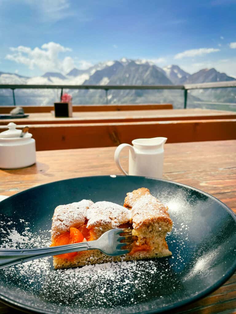
What to Eat : Olpererhütte Menu
🍹The food and views from the dining room and outside deck at Olpererhütte are hard to beat. Often hütten food is good merely because you’ve walked pretty hard uphill to get there. The quality and service at Olpererhütte are excellent in the shoulder season. Definitely try the “Hütten Spritz”, an elderberry infused cocktail.
🥕For an interesting non-meat menu the Guatzesse is a organic permaculture restaurant with vegan and vegetarian options. It is located down in the valley in the town of Stumm, so get it on your drive out of the Zillertal valley.
🥰The käseknödelsoupe is Tirolean food at it’s best. It is cheap, succulent, filling and made from local alpine ingredients. Get your steaming bowl at Dominikushütte near the trailhead on the lake.
6 Best Things to do near Mayrhofen Austria Beyond Hiking
1. Paragliding
Read my review of paragliding in nearby Mayrhofen. I love this paragliding adventure for all levels.
2. Nature’s Ice Palace
You can go inside the Hintertux glacier 365 days a year to visit Nature’s Ice Palace. This ice cave is serviced by 3 gondolas and the whole family can go inside for diving, paddleboards, canyoning and guided tours of the ice cave with stalagmites and stalactites.
Wear warm clothing and hiking boots as it’s 0 degrees year round. Take the “Gletscherbus 3” gondola to experience the world’s highest bicable cable car with amazing panoramic views.
3. Visit Europe’s Biggest Waterfall – Krimml Waterfalls
About one hour drive from Mayrhofen is the 380 meter high multi-tiered Krimml waterfalls. It’s a 10 euro toll to get there.
💦 For more water inspiration, read my post about the top 25 Alps waterfalls.
4. Flying Dress Photography Experience
It’s always memories that count. Get a Zillertal Alps bridge photo that is truly unique.
Goddess Lens Photography is a backpacking, hiking, Nature Loving woman’s dream team for doing legacy-worthy photos of her in wondrous places like the Alps, Mediterranean, Morocco and more in Europe.
5. Zipline on the Dam in the Austrian Alps : Schlegeis 131 Adventure Park
These fr&#(%ing Austrians! Beyond the Zillertal instagram brücke, the Schlegeisspeicher is great for bringing along your family members that want a little adrenaline to go along with your hikes.
The attractions include the Giant Swing, Flying fox zipline, cafe and via ferrata on the Dam itself!
6. Schlegeis 3000 Skyrace near Olperer Hut
A vertical race?!? This extreme trail running race will show you the stuff Austrians are made of.
We hope you enjoy this hidden gem in Austria! Read more of my off-the-beaten path adventure travel and hiking blogs.
More Austrian Travel Blogs
What to Bring on the Hike to the Zillertal Alps Bridge
Epic Hanging Bridge Austria
It really doesn’t take much to do this hike other than a healthy appetite for views. Sturdy hiking shoes or boots, water, raingear and a camera are all you need.
I brought a tripod with me for my selfie on the bridge, but ended up just asking a fellow hiker to do the phone for me.
However, if you’re going to do the routes other than the Direct blue route, you should bring some microspikes to ensure you don’t fall on the snow covered sections.
If you want to take a swim in the Schlegeis Stausee after your hike, bring a towel and swimsuit.
FAQ About Olpererhutte – 2024
-
When is the Olpererhutte hut & Olpererhütte trail open?
It changes year to year due to weather but typically it’s open mid-June until mid-October.
-
Is there a Christmas Market?
Zillertal Austria has an amazing market and it’s absolutely magical. Book a tour of the Christmas market in Mayrhofen.
-
How much time do you need for the Olpererhütte hike?
3-4 hours for the direct route. But you’ll likely want to enjoy the views at the top so add 1-2 hours for photos at the Olpererhütte bridge illusion.
-
How long is Olpererhütte hike?
There are 3 main hiking trails to Olpererhütte from Schlegeis Reservoir and its parking area. The shortest and the easiest trail has an elevation gain of about 600 meters (1,970 ft) and is about 3 km (1.9 mi) one way. It takes about 1.5 – 2 hours to get there and about 1 – 1.5 hours to get back down.

Author profile: Morgan Fielder is a Doctor of Physical Therapy and passionate hiker who believes in exploring the world on foot with good food. Follow her journey as she shares science-based hiking tips and advocates for sustainable tourism.
I hope you enjoyed this Olpererhütte hiking and Zillertal Alps travel guide.