
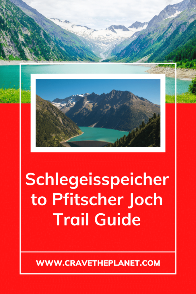
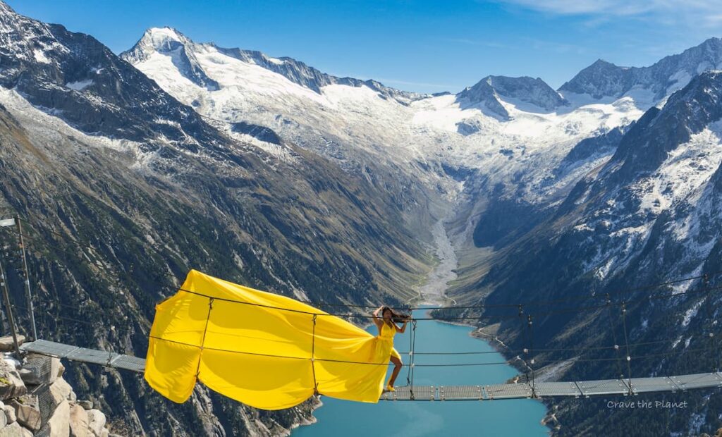
If you’ve found yourself at the stunning Schlegeisspeicher reservoir, you’ve probably come to this secluded pocket of the Zillertal Alps to experience the famous Olpererhütte suspension bridge.
You want a cool photo that makes you look super badass even though the bridge is only 7 feet off the ground.
Like this one taken with my iphone I handed to a fellow hiker and then i used her phone to take a photo of her:
Yes, the Olpererhutte bridge is a killer illusion. Do it!
But then what next? Maybe some paragliding? Or waterfall chasing?
Or you can 🥾 🍽 hike across a path to Italy that people have been walking for 9,000 years to cross over the backbone of the Alps and eat Italian pasta for lunch? And then come back for strudel (or even better, Kaisersschmarnn) in Austria?
Yes, Please.
It starts at the turquoise Schlegeisspeicher (reservoir). It and gradually winds up wide rocky paths to the Pfitscher Joch Haus mountain hut in Italy.
Then it goes over the spine of the Alps filled with dramatic views and stunning waterfalls.
➡️ TL;DR: This hike/walk will inspire Wonder, with a capital W. This is a moderate 8 mile day hike across the spine of the Alps from Austria to Italy.
What You Will Learn
- Short on Time? Zillertal Schlegeisspeicher Hike Summary
- Schlegeisspeicher – Pfitscher Joch Trail and History
- Schlegeisspeicher Pfitscher Joch Trail Hiking Map
- Getting to the Schlegeisspeicher & it’s Breathtaking Views
- Where to Stay : Schlegeisspeicher Austria
- Trailhead Wanderung Schlegeisspeicher Pfitscher Joch
- Webcam Schlegeisspeicher Zillertal + Weather
- Trail Guide
- Olpererhütte Bridge
- Pfitscherjoch Haus
- More Great Hikes Around the Schlegeis Reservoir
- Things to Do in Summer : Zillertal Alps Guide
- Recommended Resources
Short on Time? Zillertal Schlegeisspeicher Hike Summary
Location: Ginzling, Zillertal Alps, Austria
Distance: 7.75 miles, 12.5 km Out and Back – Approximately 5 hours
Elevation: 500 meters, 1625 ft up/down
Difficulty: Easy-Moderate due to rocky terrain and length
Open: Mid-June to Mid-October
Where to Stay: Friendliest – Dominikushütte Mountain Hut
Best Eco-Friendly Luxury – MalisGarten GreenSpa Hotel
Best Budget Hotel – Der Siegler B&B
Best for Families – Hotel Neue Post
It will allow you to eat some of the best mountain food served in both Austria and Italy in the same hike and provide space for you to relax and enjoy the stunning Alpine scenery without the crowds of nearby Olpererhütte.
Sharing a trailhead parking lot, this Austria-Italy border hike makes for a great activity on your second day exploring the Schlegeisspiecher area.
One of the easiest Alps border hikes at high altitude. Ample parking at trailhead and relatively easy wide path, dramatic waterfalls and open views the entire path with delicious mountain hut food and comfortable stays on both ends of the path.
This article will provide step by step directions with GPS guidance so that it’s simple and not frustrating to find your way with food recommendations and history highlights.
This is NOT for hardcore hikers and wild campers that want just directions because I talk about food, a LOT. And NEVER deyhydrated food!!! The GPS here will work, but you’ll get bored by the fascination with local foods, wines, history details and obsession with culture.
It’s a resource for people that want a little comfort and taste on their adventures in Europe’s Great Outdoors because this lifestyle is too good not to share, and I wish someone would have told me about it 20 years ago. There’s really nothing like it in the USA. I hope that changes.
Schlegeisspeicher – Pfitscher Joch Trail and History
Webstories Link: Quick Behind the Scenes iphone story
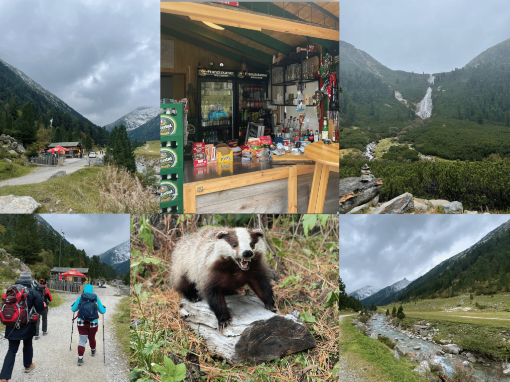
I found my first natural edelweiss here when hiking with my friends on a Nature-Glam photography trip. There were shepherds bringing the sheep down for the winter and it was quite surprising when we got to the top and could all of the sudden see green Italian valleys deep below.
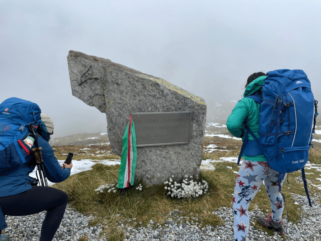
Otherwise known as Passo di Vizze, this pass is 2246 meters high and crosses over the main ridge of the Zillertal Alps. The Pfitscher Joch haus sits on a saddle ridge overlooking Vipiteno, Italy and was built in 1888.
Archaeologists have evidence of people using this Alps crossing for 9,000 years and I can see why. It’s not especially steep and is surrounded by massive glaciers all around. The Berlinhöhenweg runs in this area for the daring hikers on hut to hut journeys.
Compared to the hike up to Olpererhütte this one is longer and much more gradual.
Best alps border hike : Schlegeisspeicher Wandern
Crave the Planet is reader-supported. When you click on links to buy products I may receive money to support the work of building Outdoor Travel & Gear Guides. – Thanks, Morgan
Schlegeisspeicher Pfitscher Joch Trail Hiking Map
Easy Google Map with Links to Places
How to use this map: Use your computer mouse or fingers to zoom in and out. Click on the icons to get more information. Click the arrow on the top left corner for the written index. Click the star next to the title of the map to add this map to your google maps account. To view the saved map on your smartphone or PC, open google maps, click the menu button, and go to “your places”/ “maps.”
Trail Map Schlegeisspeicher Pfitscher Joch – 7.75 miles or 12.5 km
This hike is for you if you want a quiet place to cross over the spine of the Zillertal Alps. It’s high drama and relatively little effort. It is not technical.
Getting to the Schlegeisspeicher & it’s Breathtaking Views
Flights to Schlegeisspeicher
The closest airport in Austria is the Innsbruck airport. From there it’s about 1:45 – 2:15 hour drive to get to the trailhead or a 1:30 hour train ride.
By Schlegeisspeicher Bus
You’ll approach Schlegeis reservoir through the Austrian town of Mayrhofen. There are public transportation links by train and bus to many European travel hubs.
Use the train or bus to get to “Mayrhofen im Zillertal”, Austria. For example: the train from Landstuhl, Germany to Mayrhofen im Zillertal takes less than 8 hours.
Bus Mayrhofen Schlegeisspeicher : 4102
Then from the town train/bus stop use the bus 4102 to Schlegeisspeicher reservoir. In German, it is “Linie 4102 Mayrhofen – Ginzling/Schlegeis”.
Bus Schlegeisspeicher Fahrplan (Schedule)
There are different times each day, weekends and times of year. Please check the online bus schedule for up to date information and be prepared to pay at least 20 euros for a return ticket.
Mayrhofen is the hub for this mountain area and you can also reach other glacier, ski and hiking areas.
The Mayrhofen Schlegeisspeicher bus ride takes about 50 minutes and you’ll be happier the earlier you go in summer to beat the crowds. In the Autumn the trail is icy until after the sun hits it around 9:00 am so it’s not worth going up unless you have microspikes before then.
By Car – Parking at Schlegeisspeicher Parkplatz
This natural area of the Zillertal Alps is located at the end of a very long valley accessed by the mountain town of Zell am Ziller. Then you’ll drive higher through Mayrhofen (bus and train station), then to Ginzling. From here the mountain road is fun and framed with canyoning, climbing and alpine cow watching spots.
You’ll reach a one way mountain road with multiple moody tunnels. Watch out for cows inside the tunnels! They do wear bells so roll down the window to hear them.
During the daytime you’ll need to pay a 14.50 euro toll. If you are after hours and there is no attendant, park your car and walk up to the gate. There is a red button to push and it’ll start the clock for you for 7-10 minutes to allow any cars in the tunnels to come through. Wait for the green light and proceed up the mountain. No payment needed.
Once you pop out of the tunnels and at the lake’s edge, continue driving past the Dominikushütte Schlegeisspeicher. About 2 km along the edge of the lake you’ll see the Zamsereck hütte and the parking lot.
The Schlegeisspeicher parken, or parking lot, is located directly next to the trailhead. You simply park the car for free and walk across the bridge and head away from the lake towards Italy.
Free Parking is located here at trailhead. Motorhomes and trailers are not allowed.
Where to Stay : Schlegeisspeicher Austria
Most people will be staying in the Zillertal valley at one of the many and varied accommodations from luxury hotels to camping sites.
Check out the links here from Booking – I always use them for my city and multi-day hikes because they are trustworthy and helpful to keep organized.
Best Accommodation for Families Exploring Nature
The rooftop fairy-tale pool will make this a memorable mountain experience for you and the kids. If you book a stay at the Hotel Neue Post, dinner and breakfast are included to make everything easier for your family.
Best Eco-Friendly Luxury
Have an Alpine- luxury stay at MalisGarten Green Spa Hotel. It’s dog friendly and offers a hammam, sauna, and spa center to make your time in the Zillertal truly relaxing.
Best Budget
Der Siegler B&B is a great value for the money with a hearty protein filled breakfast, dog friendly, ping pong and spacious rooms in the heart of Mayrhofen im Zillertal.
Super Budget: Car Mattress
Summer can be challenging to get accommodations if you don’t plan early! If you’re out of luck finding a room, try getting a mattress for the back of your SUV as it’s totally legal to sleep one night in your car in Austria. There’s nothing like waking up to Schlegeis Lake in the morning.
Trailhead Wanderung Schlegeisspeicher Pfitscher Joch
The trailhead is on the north west coast of the secluded mountain lake called “Schlegeisspeicher” or “Schlegeis Stausee”.
Schlegeisspeicher means “reservoir”.
It is one of 5 beautiful man made lakes that provide a needed source of electricity to the valleys below.
Sitting at 1780 meters high, this mountain reservoir shimmers in cerulean, moody aqua and turquoise blue depending upon the time of day and sun conditions. One moment it is beaming blue all the way to the top of the mighty Olperer mountain and then the next draped in moody fog.
The dam is impressive as a tourist destination in its own right. It is 725 meters long and 131 meters high. You can walk along the top or even jump off the side in a giant swing!
🥾😓 Feeling Overwhelmed Planning a Hike? Use my custom-built online Hiking Time Calculator for Non-techie People.
Webcam Schlegeisspeicher Zillertal + Weather
Schlegeisspeicher Webcam
This interactive map and webcam will keep you updated on the weather at the base of the hiking trail to Olpererhutte.
Weather near Schlegeisspeicher Pfitscher Joch
In July the average high temperature is in the mid-60s and lows in the mid 40’s.
Most of the trail is on an East-West valley and can get fogged in. It is frequent to experience afternoon thunderstorms in this part of the Alps. Rain is a constant factor.
Best Time to Hike
The best time to hike is mid-June to Mid-october. The access tunnels are closed in winter
Trail Guide
Location: Ginzling, Austria
Type of Hike: Out and Back
Distance: 7.75 miles
Elevation: 1625 feet up and down
Duration: Approx. 5 hours
Difficulty: Easy – Moderate
Start/end point: Parking lot
Kid-friendly: 7+ due to distance
Stroller-friendly: No
Dog-friendly: yes
Fees/Permits: No
Something Good to Eat: Knödelsuppe at Dominikushütte (the best Schlegeisspeicher Hütte) on Austrian side and all the pasta at Pfitscher Joch Haus on the Italian side.
Olpererhütte Bridge
Schlegeisspeicher Hängebrücke
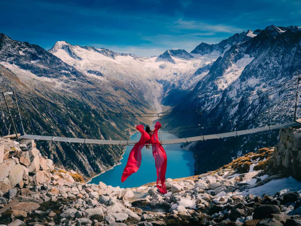
This hike is all about the suspension bridge photo. There are definitely crowds though so it’s likely you’ll wait in line a bit. It’s a steep uphill climb for 1.5 hours but worth the traffic jams.
The hike and day trip is just incredible with views almost the entire way. It’s impossible to get lost and the hut at the top serves above average hut food.
Read about the Olpererhütte hike and how to do rad flying dress photos like we did last September.
Pfitscherjoch Haus
This is the turnaround point on this hike and worthy of a delicious South Tyrolean lunch. You can also stay at this mountain hut overnight. It’s been hosting clients since 1888. Contact them here.
More Great Hikes Around the Schlegeis Reservoir
Check out this Komoot Collection of more great hikes around the reservoir.
For you hut to hut hikers the Peter Habeler Trail and the Berlin Höhenweg emerge through these amazing glacier topped Zillertal Alps between tasty hütten.
Schlegeisspeicher Rundwanderweg – Yellow
A more challenging circular hike that encompasses the Friesenberghaus path 532 is about 6-7 hours and has incredible views of the Schlegeisspeicher reservoir.
Things to Do in Summer : Zillertal Alps Guide
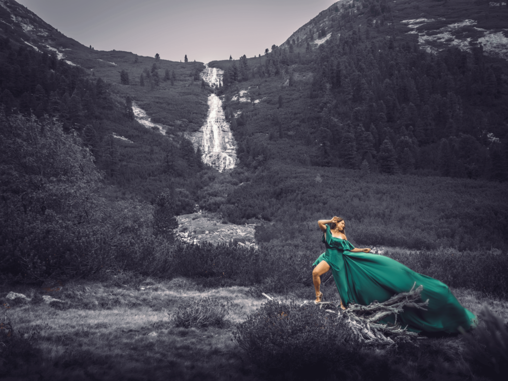
Schrammach Waterfalls
Just a few km from the trailhead are the Schrammach Wasserfal.
Share your favorite part or hidden gem so others can do cool things like take Flying Dress Photos under the Schrammach Waterfall.
Nature’s Ice Palace
You can go inside the Hintertux glacier 365 days a year to visit Nature’s Ice Palace. This ice cave is serviced by 3 gondolas and the whole family can go inside for diving, paddleboards, canyoning and guided tours of the ice cave with stalagmites and stalactites. Wear warm clothing and hiking boots as it’s 0 degrees year round. Take the “Gletscher Bus 3” gondola to experience the world’s highest bicable cable car with amazing panoramic views.
Visit Europe’s Biggest Waterfall – Krimml Waterfalls
About one hour drive from Mayrhofen is the 380 meter high multi-tiered Krimml waterfalls. It’s a 10 euro toll to get there.
Zipline on the Dam in the Austrian Alps : Schlegeis 131 Adventure Park
Austrians are crazy! This location is great for bringing along your family members that want a little adrenaline to go along with your hikes.
The attractions include the Giant Swing, Flying fox zipline, cafe and via ferrata on the Dam itself!
Schlegeis 3000 Skyrace near Olperer Hut
A vertical race?!? This extreme trail running race will show you the stuff Austrians are made of.
Beyond the Best Hikes in Austria: Dolomites in Summer
If you’re looking for a summer vacation with kids ages 10+ that you’ll never forget, you’ll find some amazing mountain adventures with WWI history, check out the Alta Via 1 Hike in the Dolomites. Hike and scramble over the path of the Alpini soldiers and explore the bunkers, via ferratas and outdoor museums at Cinque Torri.
You’ll be immersed in the history of the Italian Front during this gorgeous hike. It’s only possible in summer between mid-June and mid-September. It’s absolutely necessary to plan 6 months ahead of time to get lodging at huts directly on the high elevation trails.
It’s a 2-3 hour drive from Venice or a 7-8 hour drive from Ramstein Air Base. Here’s a detailed packing list of everything you would need to complete a 5 day hut to hut hiking trip to explore the Italian front of WWI.
Recommended Resources
Mayrhofen is a great base from which to explore. Click here for accommodation options at booking.com.
This book will be useful: Trekking in the Zillertal Alps (Cicerone Guides)
Make sure you have the necessary gear and water for a day hike.
We hope you enjoy this hidden gem in Austria! Read more of my off-the-beaten path adventure travel and hiking blogs.
More Austrian Travel Blogs

Author profile: Morgan Fielder is a Doctor of Physical Therapy and passionate hiker who believes in exploring the world on foot with good food. Follow her journey as she shares science-based hiking tips and advocates for sustainable tourism.
Have you experienced the Schlegeisspeicher Pfitscher Joch Trail?