
Are you looking for the best trekking trails in Europe for your next active vacation?
If you’re planning your next European adventure and love hiking, then you’re in luck! I’ve been hiking and trekking with my family all over Europe and I can confidently say there is a trail for almost everyone.
What I love most about trekking in Europe is that there’s usually somewhere to get a cold beer and hot food on the top of a mountain peak.
All that convenience does come at a cost and I’ll share below the pros and cons of trekking in Europe.
tl;dr multi-day trekking in Europe:
- From the Berlin High Trail in Austria to the Fisherman’s Trail in Portugal, there’s something for trekkers of all levels.
- I’ve considered a wide variety of difficulty levels and included multi-day journeys in the mountains and by the sea.
- Each trail is serviced by either high elevation mountain huts, hotel or bed and breakfasts.
- A hut to hut hiking trip can be a mix of huts and hotels.
- The best TMB self-guided planners can help make your trek a reality.
This is not a list of day hikes. Click on my hiking library for day hikes if you’re not ready (or willing) to go a multi-day hike.
Quick Verdict: My Favorite Trail in Europe
Tour du Mont Blanc is a challenging circuit that spans across three countries, Switzerland, Italy, and France. It is approximately 105 miles long and can take up to 11 days to complete.
Overall Best Self Guided Planning Service: Alpenventures Unguided
This firm is great for finding secluded variants (like the one by the La Gorge gondola), private rooms, and providing maps. They have multiple ways to hike the TMB from a short 4 day to 11 days and everything in between. You can also arrange higher levels of "comfort", i.e. private rooms.
- Glacier Filled Raw Beauty
- Fun People
- Wildflowers and Wildlife
- Food is Local and Delicious
- Most Famous Trek in Europe
- Variable Hospitality
- Serious Elevation Gain
- Complicated and Tedious Bookings
- Not for Total Beginners
What You Will Learn
- Quick Table of the 15 Best Trekking Trails in Europe
- Pros and Cons of Trekking in Europe
- Become a European Adventure Travel Insider in Just 5 minutes
- Fisherman’s Trail, Portugal
- Via Transilvanica, Romania
- Tour du Mont Blanc, Italy, Switzerland, France
- Alta Via 1, Italy
- The Rhine Castles Trail, Germany
- Bernese Oberland (Lauterbrunnen), Switzerland
- Berlin High Trail, Austria
- The West Highland Way, Scotland
- The Slovenian Mountain Trail, Slovenia
- Camino De Santiago, Spain (and really everywhere in Europe)
- Gr20, Corsica
- Kungsleden, Sweden
- Laugavegur, Iceland
- Italian Riviera Cinque Terre, Italy
- Haute Route, France and Switzerland
- More Resources
Quick Table of the 15 Best Trekking Trails in Europe
Let’s get to my list of the Top Long Distance Hiking Trails in Europe. Including route, difficulty and comfort to help you plan an epic active vacation.
I’ve done most, but not all the treks listed below personally and share my personal experience. I just can’t get myself to Sweden to hike…yet!
However, I wanted to share a wide range of trails and not just my favorite leaf-carpeted trails in Germany (there are so many, but I’m working against my bias)!
| Trail Name and Location | 🔥 Why it’s Awesome🔥 |
|---|---|
| Fisherman’s Trail in Portugal | Best Wild Coastal |
| Via Transilvanica in Romania | World’s Longest Art Exhibit |
| Tour du Mont Blanc in France, Switzerland and Italy | Best Overall |
| Alta Via 1 in Italy | Most Jaw-Dropping Scenery |
| The Rhine Castles Trail in Germany | Best History |
| Bernese Oberland in Switzerland | Best Waterfalls |
| The West Highland Way in Scotland | Most Friendly |
| Haute Route in France and Switzerland | Best High Elevation |
| Slovenian Mountain Trail | From Mountains to Sea |
| Berlin High Trail in Austria | Most Rugged Peaks with Glaciers |
| Camino de Santiago in Spain | The OG |
| GR20 in Corsica | Most Challenging Terrain |
| Kungsleden in Sweden | Most Isolated |
| Laugavegar in Iceland | Best Volcanoes |
| Italian Riviera Cinque Terre | Best Cultural Coastal |
Pros and Cons of Trekking in Europe
- Stunning Scenery
- Cultural Diversity
- Well-Marked Trails
- Accessible
- Accommodations on Route
- Crowds
- Unpredictable Weather
- Language Barriers
- Little "true" Wild
- Cost - Wild Camping Often Prohibited
Become a European Adventure Travel Insider in Just 5 minutes
✨Unlock Europe’s best-kept secrets with our free bi-weekly newsletter.
Best 15 Trekking Trails in Europe
Fisherman’s Trail, Portugal
Best Wild Coastal : 140 miles
Scenery: Stunning Cliffs and Storks
Difficulty: 4/10
I loved hiking the Fisherman’s Trail in November because it was still warm and there were zero crowds. It feels so authentic and a dose of coastal sunshine is welcome near Thanksgiving.
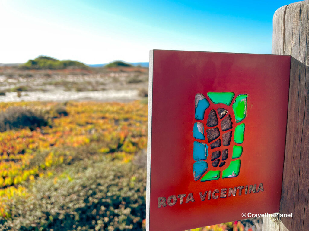
It is the coastal part of the larger Rota Vicentina network. It is a moderate-level hiking trail that runs along the Alentejo and Algarve coasts of Portugal.
The trail is approximately 140 mi long and takes about 10-13 days to complete. The trail is extremely well-marked and easy to follow, but it does require some physical fitness and endurance, as there is a lot of sand along the way.
Route: Sandy, Incredible Views Intermittently, Mostly Flat Oceanside
The Fisherman’s Trail starts in the town of Porto Covo and ends in Cabo de Sao Vicente, following the coastline for the majority of the route. The trail passes through small fishing villages, deserted beaches, and rugged cliffs, offering stunning views of the Atlantic Ocean.
The trail is divided into several stages, ranging from 15 to 25 km in length, and there are plenty of accommodations and restaurants along the way.
Duration: 4-13 days
The Best of the Fisherman’s Trail can be completed in four days. The trail can be hiked year-round, but the best time to hike is from September to June, when the weather is cooler and there are fewer tourists. Another popular trail is the Seven Hanging Valleys in the Algarve, but it’s a day hiking tour.
Via Transilvanica, Romania
Best Art Walk : 870 miles
Scenery: Soft and Pretty & Art
Difficulty: 4/10
The hospitality of hosts at the pensions and inns along the trail cannot be matched. The trails are soft and wildflower filled, but you do have to worry a little about bears and wild dogs. We loved meeting farmers and sheep herders and even wanted to take home some stray dogs, but alas, my husband won’t let me have any more!
The newly built (2018) Via Transilvanica is a long-distance hiking trail that spans over 1400 kilometers across Romania, connecting various communities and showcasing the beauty of Romania’s nature and heritage.
The trail is marked by unique hand carved artful stones and is suitable for hikers of all levels, from beginners to experienced trekkers. The trail is divided into 7 sections, each with its own level of difficulty, ranging from easy to moderate.
Route: Rolling Hills, Mix of Trail and Road Through Villages
The route of Via Transilvanica takes hikers through some of Romania’s most breathtaking landscapes, including the Carpathian Mountains, the Transylvanian Plateau, and the Danube Delta. The trail passes through numerous small villages, offering hikers the opportunity to experience Romania’s rich cultural heritage, as well as its stunning natural beauty. The trail is well-marked and maintained, with numerous rest areas and campsites along the way.
Duration: Long Daily Sections – 40 days
The full hike of Via Transilvanica takes approximately 40 days to complete, but shorter portions of the trail can be taken on day trips or multi-day journeys. The trail can be broken down into 10 sections, each taking between 3 to 6 days to complete. The duration of the hike depends on the chosen route and the hiker’s level of experience.
Tour du Mont Blanc, Italy, Switzerland, France
Best Overall : 105 miles
Scenery: Out of this World Mountains, Glaciers Cute Alpine Villages
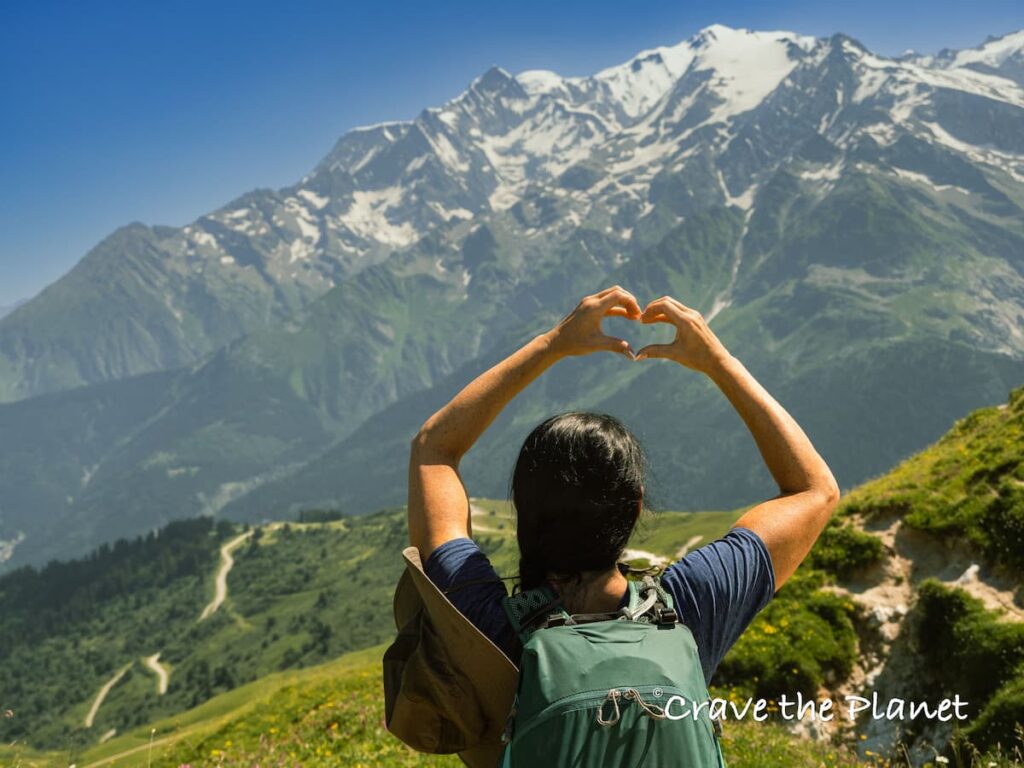
Difficulty: 8/10
The granddaddy of all treks in Europe, the Tour du Mont Blanc hike is a challenging circuit that spans across three countries, Switzerland, Italy, and France. While popular, spaces in huts are limited so it doesn’t ever feel crowded (also we take the variants when possible). Read my guide to the TMB costs here.
The path varies in difficulty, but it’s safe to say that this is not an easy journey or for beginner hikers, even if you use the cable car. My husband was so tired one day he couldn’t even drink beer once we made it to the isolated mountain top TMB refuge.
To be fair, he flew in from Singapore the day before so jet lag was rough for him! Hospitality also varies here…some huts or hotels were amazing, others so-so. Nothing compares to Romanian hospitality 😉
Route: Steep, VIEWS, Rocky, Non-Technical
The Tour du Mont Blanc route starting point begins in Les Houches, France, and then passes through Courmayeur, Italy, and Champex, Switzerland. The path is well-marked and passes through stunning alpine landscapes, offering breathtaking views of the surrounding mountains.
The trek can be done in either direction, but most hikers choose to start in Les Houches and move clockwise around the highest peak in Europe.
Duration: 7-10 Days
The Tour du Mont Blanc trek can take up to 11 days to complete, depending on your pace and the number of stops you make along the way. However, shorter portions of the route can be taken on day trips or over a weekend. If you’re looking for a shorter hike, you can choose to do only the northern or southern part of the trail.
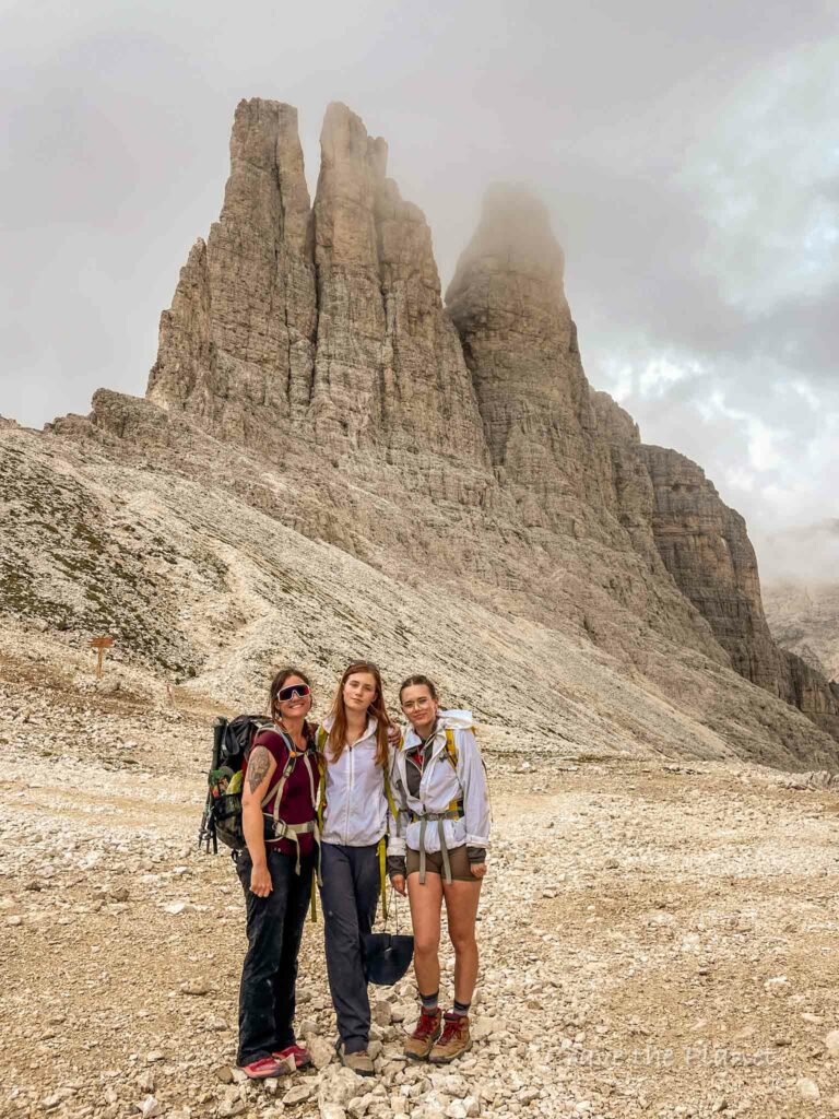
Alta Via 1, Italy
Most Jaw-Dropping Scenery: 75 miles
Scenery: Moonscapes. Pinnacles, Spires, Lakes
Difficulty: 8/10
My first long distance hike and boy was it a grand one. The spires, pinnacles and towers of the Dolomites on the Alta Via 1 hike by day and Italian food served at 2,760 meters, saunas on the deck at rifugios, and delicious Lagrein wine by night. What more can you ask for? Seriously.
This one is probably better than the TMB, I have a hard time choosing. The Alta Via 1 is a challenging hiking trail that spans across the Dolomites mountain range in Italy north to south, starting a Lago di Braies and the ending point at Belluno.
The trail is suitable for hikers who are in good physical condition and have some previous experience with multi-day hikes. The route consists of steep ascents and descents, rocky terrain, and high altitude sections that require proper gear and preparation.
Route: Steep, VIEWS, Rocky, no Via Ferratas
The Alta Via 1 trail is a 75 mile long trek that starts in Dobbiaco and ends in Belluno. The route takes hikers through some of the most stunning landscapes in the Dolomites, including alpine meadows, rugged peaks, and crystal-clear lakes. The trail is divided into 10 stages, each with its own unique challenges and highlights.
Hikers will pass through several mountain passes, including the famous Tre Cime di Lavaredo, and visit charming mountain huts along the way.
Duration: 10-12 Days
Completing the entire Alta Via 1 trail takes around 10-12 days, depending on your pace and itinerary. Hikers can choose to break up the trail into shorter sections and customize their route based on their preferences and abilities.
It is important to note that the trail is only accessible during the summer months, typically from June to September, and hikers should be prepared for changing weather conditions.
The Rhine Castles Trail, Germany
Best History: 130 miles
Scenery: Castles, Leaf Carpeted Trails, Farm Fields
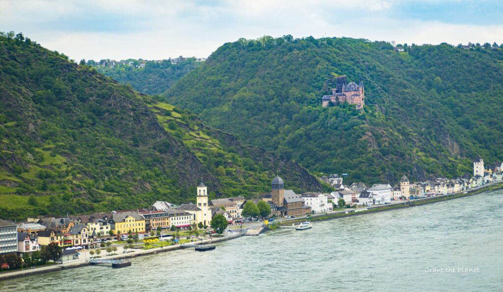
Difficulty: 3/10
This is my backyard trail, you could say I’m a local by now here in Germany. We love the Rhine Castles Hike so much we go at least once a month to either hike, bike, boat or go wine tasting.
There’s a day hiking section of this trail made accessible to wheelchairs by use of gondola. It’s the definition of “soft hiking” or forest bathing and you can even backpack between castle hotels each night.
There are trains, buses and boat ferries so you can mix up your hike or take shortcuts. The Rhine Castles Trail is an easy to moderate level hiking trail. The trail is well-marked and easy to navigate.
There are some steep inclines and declines, but they are not too difficult to manage.There are wine villages near the river filled with hotels and bed and breakfasts and even Rhine castle hotels to stay each night.
Route: Mostly Soft Wooded Trails with Intermittent River Views
The Rhine Castles Trail is located in Germany and follows the Rhine River. The trail is approximately 130 miles long and passes through several medieval castles and charming villages. The route is well-maintained and offers stunning views of the Rhine River and surrounding landscapes. Its sister trail, the Rheinsteig, is just on the other side of the river. You can switch easily between them using the ferry system.
Duration: 10 -14 days
The duration of the hike depends on the pace of the hiker. On average, it takes about 10-14 days to complete the entire trail. However, shorter portions of the trail can be taken on day trips or multi-day hikes.
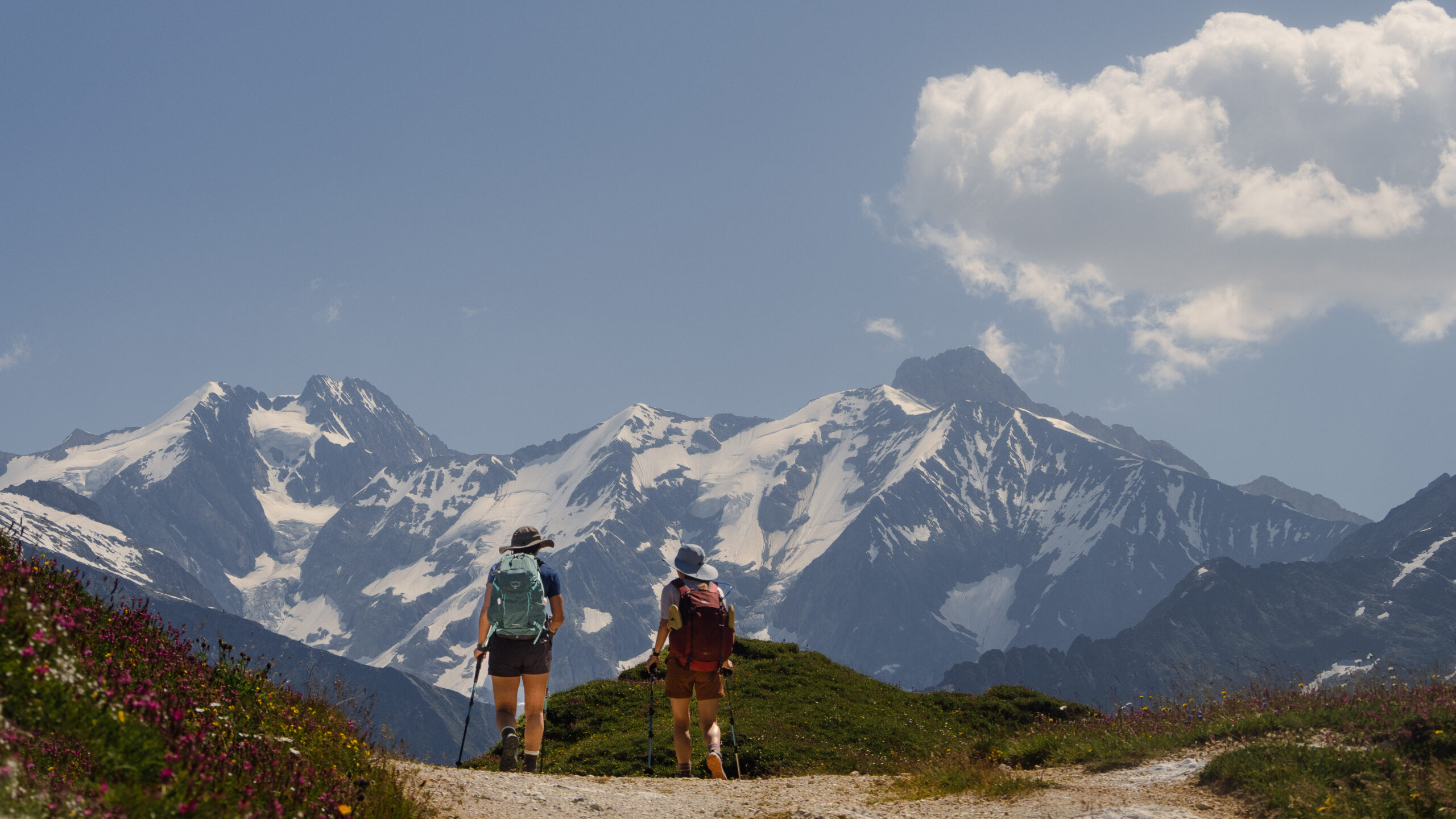
Bernese Oberland (Lauterbrunnen), Switzerland
Best Waterfalls: 52 miles
Scenery: Waterfalls, Wildflowers, Green Steep Mountains
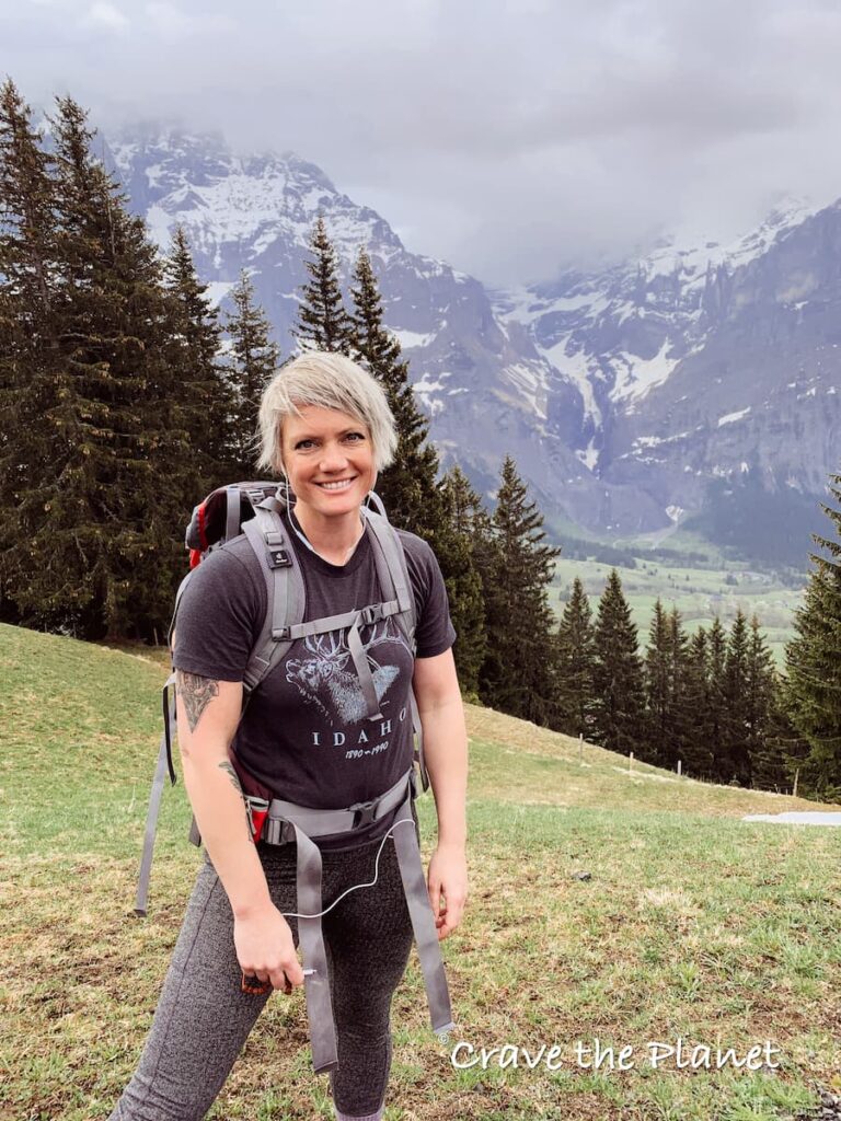
Difficulty: 8/10
The Bernese Oberland hike is considered to be a challenging Swiss hut to hut hike. The trail is well-maintained and provides stunning views of the surrounding Eiger, Monch and Jungfrau Alps and multiple waterfalls.
Route: Steep, Serious Views, Single Track, Impossibly Cute Alpine Villages
The hike begins in the tiny village of Meiringen, located in a glacial valley in Switzerland. From there, you can take an easy day hike to Grindelwald, Lauterbrunnen Mürren And more.
Duration: 7 Days
The trail is a relatively difficult hike approximately 52 miles that can be completed in 7 days. The trail is suitable for most trekkers but can be crowded at times.
Berlin High Trail, Austria
Best Glaciers: 46 miles
Scenery: Almost Always Glaciers and High Mountain Lakes
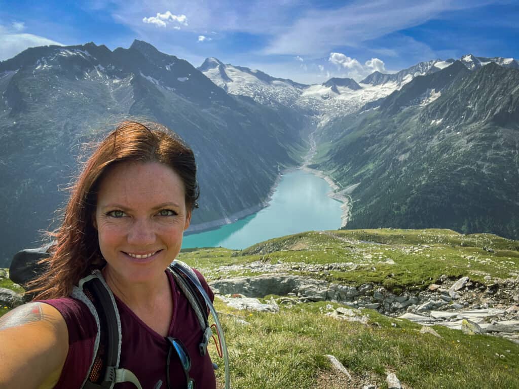
Difficulty: 9/10
The Berlin High Trail, also known as the Berliner Höhenweg, is a challenging trek in the Zillertal Alps of Austria that passes by the world famous Olpererhutte bridge hike. The trail is considered to be very difficult, with steep ascents and descents, narrow paths, long sections and rocky terrain. Hikers should be physically fit and experienced in alpine hiking.
I’ve only done sections of this trail and can say it’s out of this world beautiful, but there are places with snow even in summer. Hot tip: Bring microspikes if you’re undertaking this trek.
Route: Steep, Rocky, Exposed, Snow
The Berlin High Trail is a circular route that begins and ends in Mayrhofen. The trail is approximately 46 miles long and takes about 7-8 days to complete. The route follows the high alpine terrain, offering stunning views of the surrounding mountains and glaciers.
The trail passes through several mountain passes, including the Pfitscher Joch pass, and crosses several glaciers.
Duration: 7-8 Days
The Berlin High Trail takes about 7-8 days to complete, depending on the hiker’s pace and the weather conditions. Hikers can choose to stay at several mountain huts along the way, including the Olpererhütte, Friesenberghaus, and Greizerhütte. The trail is only open from mid-June to mid-September, and hikers should check the weather conditions before embarking on the trek.
The West Highland Way, Scotland
Most Friendly : 100 miles
Difficulty: 4/10
The West Highland Way is an intermediate level hiking trail that is considered to be manageable for most people. The trail covers a distance of around 100 miles and takes up to a week to complete. It is Scotland’s most popular long-distance hiking trail, with thousands of people completing the entire trail each year, which is why I’m saving this one until I’m a little older. I’ve heard it’s fun and beautiful, but rather expensive.
Route: Soft Wooded Paths and Roads, Some Elevation
The West Highland Way traverses through some of Scotland’s most beautiful landscapes, providing hikers with an opportunity to see the Scottish highlands up close and personal. The trail begins in Milngavie, a suburb of Glasgow, and ends in Fort William, a small town located at the foot of Ben Nevis, the highest mountain in the British Isles. Along the way, hikers will pass through picturesque villages, rolling hills, and stunning lochs.
Duration: 7-8 Days
The West Highland Way takes around a week to complete, but shorter portions of the trail can be taken on four-day trips. The trail is open all year round, but the best time to hike it is from April to October when the weather is milder. Hikers can choose to camp or stay in accommodations along the way, with options ranging from basic campsites to luxurious hotels.
The Slovenian Mountain Trail, Slovenia
From Mountains to Sea: 375 miles
Scenery: Like a Green Rocky Mountains with Green-Blue Lakes
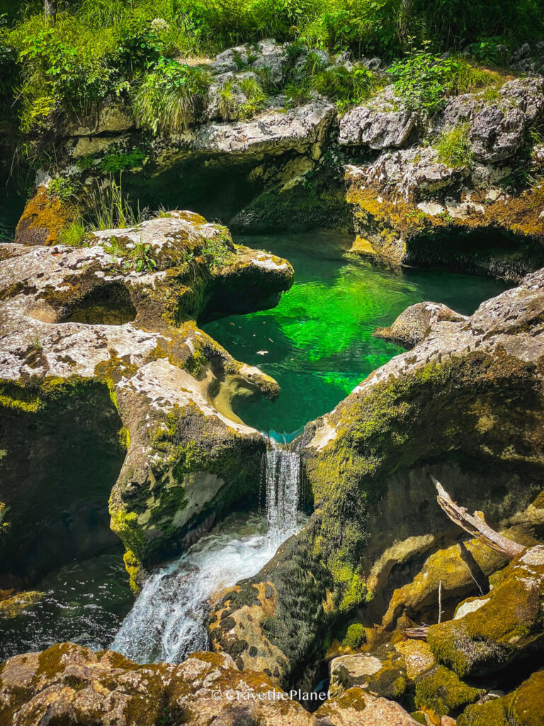
Difficulty: 7/10
This is on my bucket list! Having done day hikes near Lake Bohinj and Triglav National Park and experiencing the emerald green waters and mountains reminiscent of a “green Rocky mountains”, I am ready to get a hut to hut trip booked here. Probably not the entire trail though as I’m not down with via ferrata.
The Slovenian Mountain Trail is a hiking trail that spans much of Slovenia’s territory, covering 375 miles and built in 1953. The trail was conceptualized by Professor and mountaineer Yvonne Giulia in the 20th century, with the idea of connecting Slovenia’s various mountain ranges with footpaths.
It would be a full mountain to sea trail from the northeast of Slovenia to Koper on the Adriatic coast.
Route: Mix: Mountain Trails Moderately Steep, Wooded
The Slovenian Mountain Trail traverses a multitude of terrain including places where you’ll need to carry via ferrata gear. You can easily do shorter sections that don’t require so much alpinism. The modern trail begins in Maribor and goes through various mountainous areas like Lake Bled, Mount Triglav and the Julian Alps.
Duration: 30-40 Days
The full hike of the Slovenian Mountain Trail takes about a month to complete, but shorter portions of it can be taken on four-day trips.
The hike is considered to be of challenging difficulty level, and it is recommended for experienced hikers. The trail offers a unique opportunity to experience Slovenia’s natural beauty up close and personal.
Camino De Santiago, Spain (and really everywhere in Europe)
The Original Way: 485 miles
Scenery: Mix of Farm, City, Vineyard, Wooded Hills
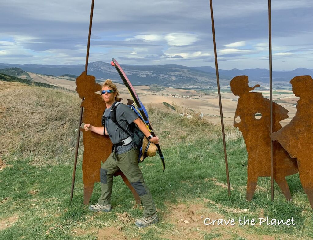
Historical Significance
I live on a distant small artery of the Camino de Santiago, or Jakobsweg, as it’s known in German.
I love the interconnectedness that the Camino brings to Europe.
However, most people think of the Way of Saint James as the popular trek from the French Pyrenees to Santiago de Compostela. It was my very first multi-day hike and as such we did a 7 day section in a somewhat bougie way by staying in bed and breakfast each night vs albergues. I even walked with a pastor carrying his surfboard on his back.
Difficulty: 4/10
This may be helpful for people not used to long distance hiking and need a gentle break-in to the lifestyle. The Camino de Santiago, also known as the Way of St. James, is a network of pilgrimage routes that lead to the Cathedral of Santiago de Compostela in Galicia, northwestern Spain where the remains of Saint James the Greater are said to be buried.
The Camino has been a significant pilgrimage site for centuries, attracting religious trekkers from all over the world. Today, it is also a popular hiking trail for those seeking a spiritual and cultural experience.
Routes: Mostly Flat or Rolling Farm Roads, Hard Road and Some Trails
The Camino de Santiago has many routes, but the most popular one is the Camino Frances, which starts in France and ends in Santiago de Compostela. The Camino Frances is approximately 780 kilometers long and takes about 5-6 weeks to complete on foot. Other popular routes include the Camino Portugues, which starts in Lisbon, Portugal and ends in Santiago de Compostela, and the Camino del Norte, which follows the northern coast of Spain.
Duration: Long Daily Sections 35-45 Days
The duration of the Camino de Santiago varies depending on the route and the pace of the hiker. The Camino Frances takes about 5-6 weeks to complete on foot, while shorter routes like the Camino Portugues can take 2-3 weeks. Many hikers choose to break up their journey into smaller sections and complete it over a longer period of time.
Gr20, Corsica
Most Challenging Terrain: 100 miles
Difficulty: 9/10
The Gr20 trail in Corsica is an expert-level mountainous trail that spans over 100 miles in length. It takes about two weeks to complete, but it can be separated into the northern or southern part of the trail. The hike is challenging, and it’s recommended for experienced hikers. I’ve not done it because I heard bedbugs are really common. Also, I prefer Sardinia to Corsica because the Italians are just more fun than the French (sorry, not sorry).
Route: Steep, Rocky
The Gr20 trail in Corsica spans almost the entire length of the island, from the north to the south. The trail takes you through stunning mountainous areas, including the Vizzavona forest, the Monte Cinto massif, and the Bavella peaks. You’ll also pass through several beautiful lakes and rivers.
Duration: 14-16 Days
Completing the entire Gr20 trail takes about two weeks, but shorter portions of the trail can be taken on four-day trips. The trail can be separated into two parts by the midpoint of Vizzavona. The northern part of the trail is about 50 miles long, and the southern part is about 56 miles long. The trail is challenging and requires a good level of fitness.
Kungsleden, Sweden
Most Isolated: 275 miles
Difficulty
Let’s not forget our neighbors to the north! My husband goes to Sweden every year for cornhole, but I must admit that I have only researched this trail vs hiked it. It would be really great though for people who don’t want to spend money on hotels as wild camping is actually legal in most of Scandinavia.
Route
The Kungsleden Trail, also known as the King’s Trail, is a 440-kilometer-long hiking trail in northern Sweden that stretches from Abisko in the north to Hemavan in the south. It passes through some of the most spectacular and remote areas of the Swedish Lapland mountain landscape, including the Vindelfjällen Nature Reserve, one of the largest protected areas in Europe.
Duration
The full Kungsleden Trail is approximately 440 kilometers long and takes about four to six weeks to complete. However, most hikers choose to hike only one or two sections of the trail, which can take anywhere from a few days to a few weeks to complete, depending on the section and the pace of the hiker. For example, the most commonly hiked section of the trail, from Abisko to Nikkaluokta, is about 105 kilometers long and takes about a week to complete.
Laugavegur, Iceland
Best Volcanoes: 34 miles
Difficulty: 7/10
According to my friend Dave who did this with his brothers the year after we did the Alta Via 1, you’ll likely get into snow and a blizzard, even in summer! Despite that, he thought it was more beautiful than the Dolomites!And according to my friend Jill who did it after we did the Camino, it’s possible to take it slow and do the trek even with bad knees (just bring trekking poles).
This trail is considered to be of moderate difficulty, with some steep ascents and descents along the way. The terrain can be rocky and uneven, and hikers should be prepared for changing weather conditions, including rain, wind, and even snow in some areas.
Route: Weather Makes it Hard, Moderately Steep Trails
The Laugavegur trail is a 55-kilometer journey that takes hikers through some of Iceland’s most stunning landscapes. The trail starts in Landmannalaugar, a geothermal area known for its colorful rhyolite mountains and hot springs. From there, hikers will trek through the Highlands, passing by glaciers, rivers, and valleys along the way. The trail ends in Þórsmörk, a lush valley surrounded by glaciers and mountains.
Duration: 4-5 Days
The full Laugavegur trail typically takes around 4-5 days to complete, with hikers covering an average of 12-15 kilometers per day. However, shorter versions of the trail are also available, ranging from 2-3 days. It’s important to note that the trail is only open during the summer months, from late June to early September, due to harsh weather conditions during the rest of the year.
Italian Riviera Cinque Terre, Italy
Best Coastal Cultural: 25 miles
Difficulty: 5/10
The Ligurian coast in northern Italy is famous for the UNESCO Cinque Terre region and for good reason. It was my first trip when I moved to Europe and I can’t wait to go back. The Italian Riviera path is a moderate, but steep hiking trail that is suitable for hikers with some experience.
It’s also known as the Sentiero Azzurro (or Blue trail in English). One of the most popular sections, the Cinque Terre Lover’s Lane has been closed for a decade due to a landslide. However, the Via dell’Amore is set to reopen in 2024.
The trail is well-maintained and marked with clear signs, but there are some steep inclines and uneven terrain that require careful footing. Hikers should be prepared for a challenging but rewarding hike with stunning views of the Ligurian coastline. Heavy rain can make the trails dangerous and if there are mudslides you will have to walk around.
Route: Steep Seaside Trails, Rocky
The Cinque Terre network of footpaths that connect the five coastal villages of the region. It’s possible to start at Sestri Levante and walk through the 5 villages of the Cinque Terre stopping in each one for the night to stay at a hotel. As there are multiple paths between villages you must choose which ones are open (mudslides will close) but they range from 2 miles to 7.7 miles.
Duration: Very Short Days – 5 Days to hit each Village
This trail can be completed in 5 days, but it is recommended to take your time and enjoy the scenery along the way. Hikers should plan for a full day trip to allow for breaks and time to explore the villages at either end of the trail. It is important to note that portions of the trail may be closed due to environmental factors, so it is best to check ahead of time and plan accordingly.
Haute Route, France and Switzerland
Best High Elevation: 130 miles
Difficulty: 9.5/10
This hike is seriously challenging as you hike from Mont Blanc in Chamonix, France to the Matterhorn in Zermatt, Switzerland. It’s a serious trek and not for the faint of heart. It’s on my bucket list, but I want a few more summers worth of practice before I try it. A lady in my hiking group did it while pregnant, so it’s not impossible, but hard.
Route: High, Rocky, Steep, Long Daily Sections
The trail is not family-friendly and not accessible to most beginner hikers. The best part is that you will have solitude and you can say you literally walked from the highest mountain in Europe to the Matterhorn.
Duration: 13-15 Days
The Haute Route is 130 miles and takes people from 13-15 days typically. You will need some serious stamina.
European Long Distance Hiking Youtube
More Resources
Discover gear that elevates your outdoor adventures. As a physical therapist, I’ve curated product comparisons to enhance safety and enjoyment, perfect for beginners or those with weary knees.
Physical Therapist Curated Gear Guides for Hikers & Skiers
- 🧎 Make your knees feel better while hiking and walking: Best Knee Braces for Hiking
- 🌳Make the downhills stop hurting and hike with more confidence Best Trekking Poles Review
- ⌚ Never get lost on the trail and navigate the wilderness safely with My Review of the Best GPS Watches for Hiking
- ❄️ Go hiking on uneven terrain safely: The Best Hiking Boots with Ankle Support
- Don’t get lost in the backcountry with : My Review of the Best 2 Way Radios for the Mountains
My Guides to Bucketlist Hikes in Europe
(That I’ve personally done and loved.)
We hope this guide filled with interesting information about the best trekking trails in Europe has given you the proper information to plan your next adventure.
Author profile: Morgan Fielder is a Doctor of Physical Therapy and passionate hiker who believes in exploring the world on foot with good food. Follow her journey as she shares science-based hiking tips and advocates for sustainable tourism.