
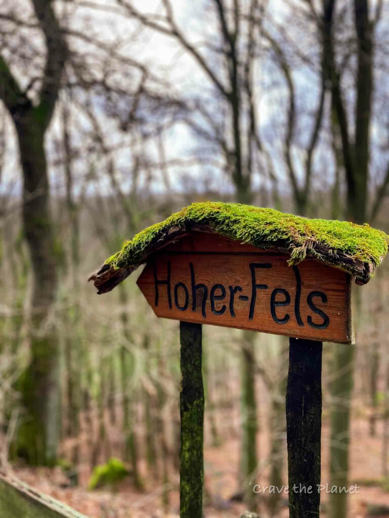
If you’re looking to do something near Kaiserslautern that offers a glimpse into the past, the Zum Hohen Fels hike offers a lovely look into the rural lifestyle, ancient Celtic history and has 2 really cute huts along the path to eat and grab a drink.
Located not far from St. Wendel, this hike is off-the-beaten path. I ran into exactly 4 other hikers on this 5 mile loop that can easily be shortened.
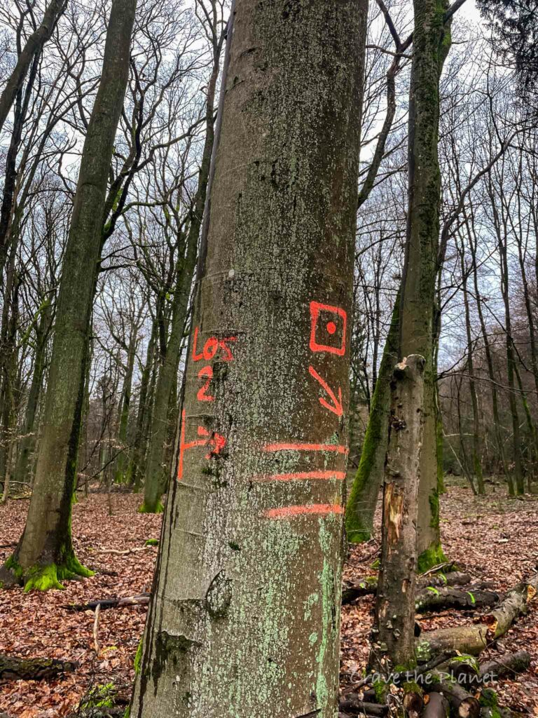
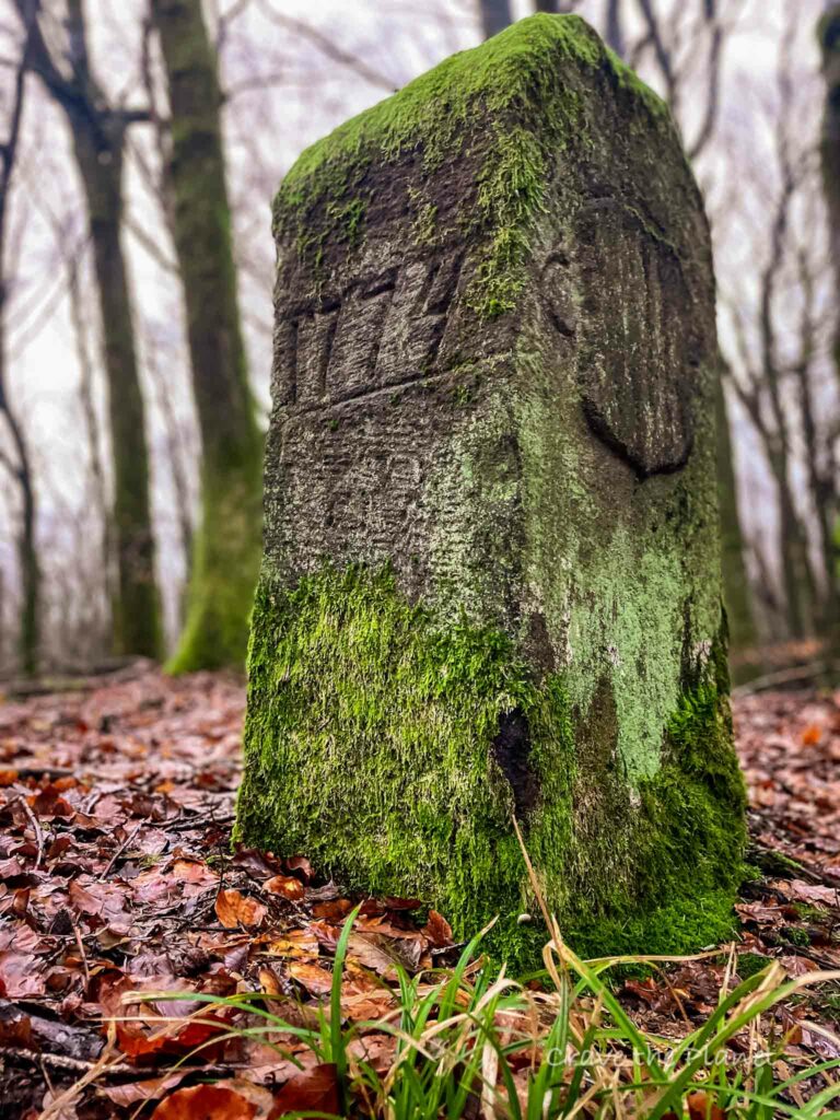
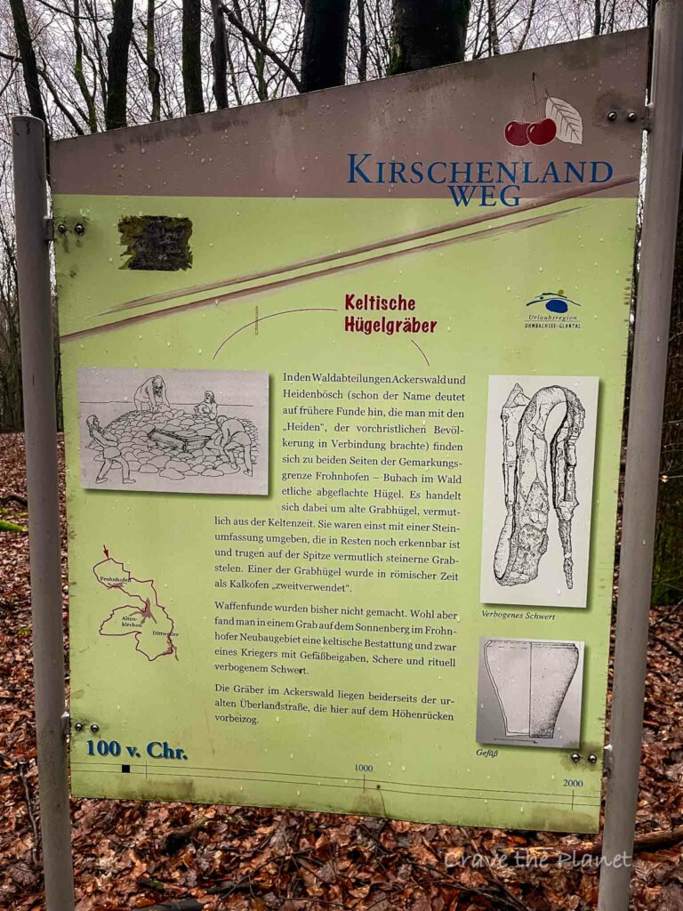
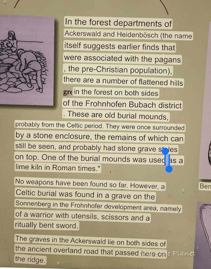
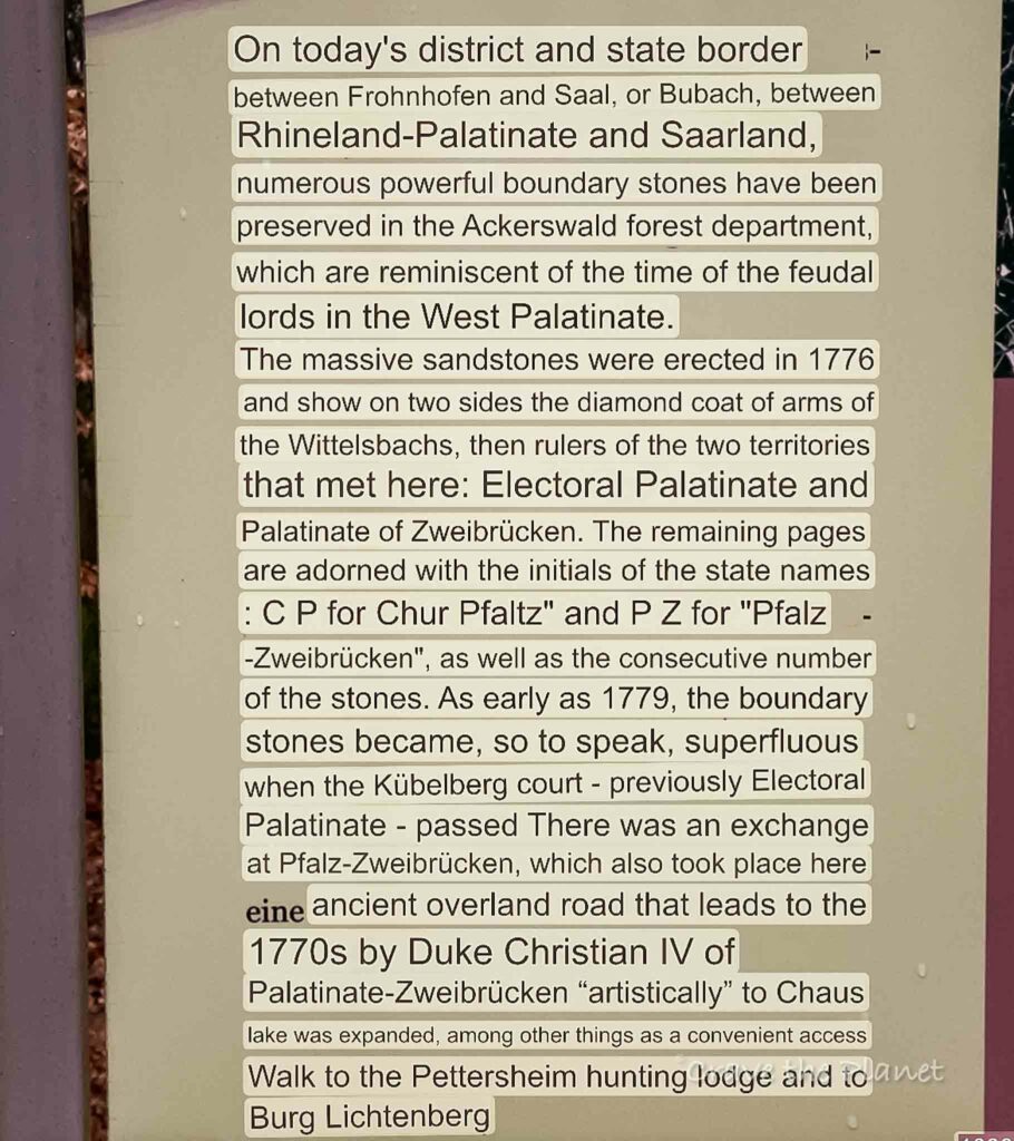
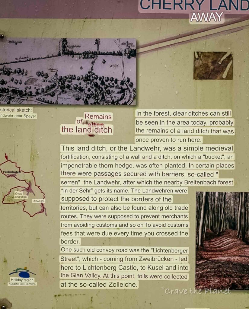
What I really loved was the section that merged with the “Cherry Path” that included ancient granite stone markers, history placards and a walk along an old Celtic ridge path.
This is along the border of Rhineland Pfalz and Zweibrucken and demonstrates a lot of history like the nearby Adlerbogen hike or the hikes around Nanstein castle with their pagan and medieval history.
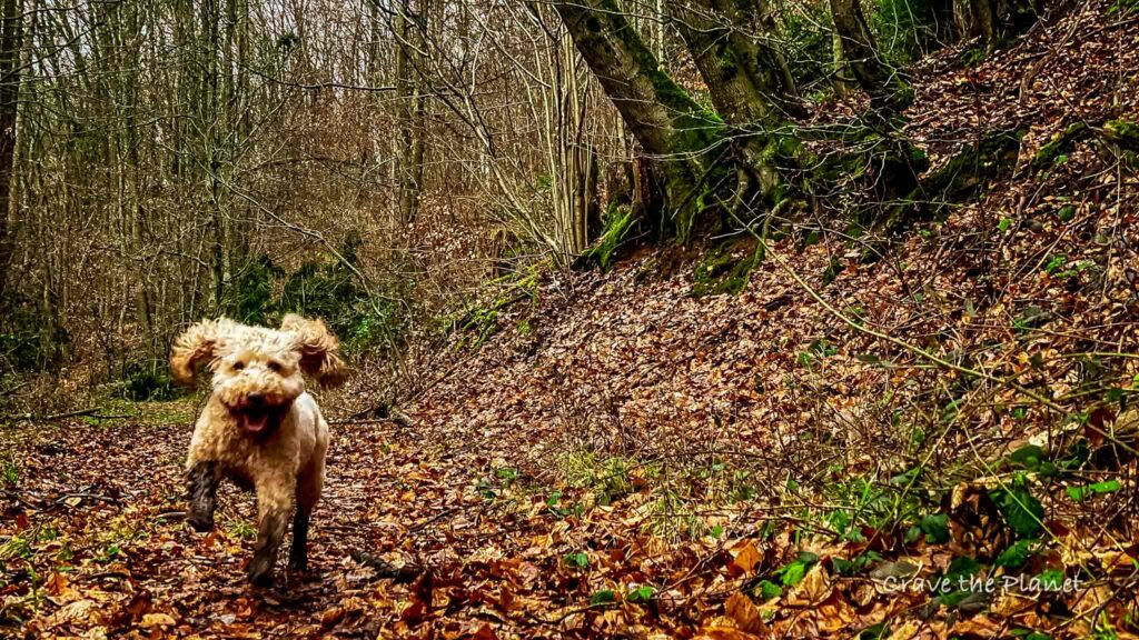
Author’s tl;dr: The Zum Hoher Fels hike located near Kaiserslautern is rustic Germany, a bit muddy, and has 2 active hutten along the trail. Filled with history placards and dark forests. Including GPX stages for your phone and food and cultural highlights. Dog friendly. 5.3 miles but easily shortened, 4 different loops.
Morgan’s Hiking video by PWV Krottelbach
Zum Hoher Fels Hike Overview
2 Hutten Hike
- Location: Pfalzer Bergland, Germany
- When to Hike: Year Round
- Distance: I did the 5.3 mile loop
- Up/down: 600 feet
- Time: 2:15 hours
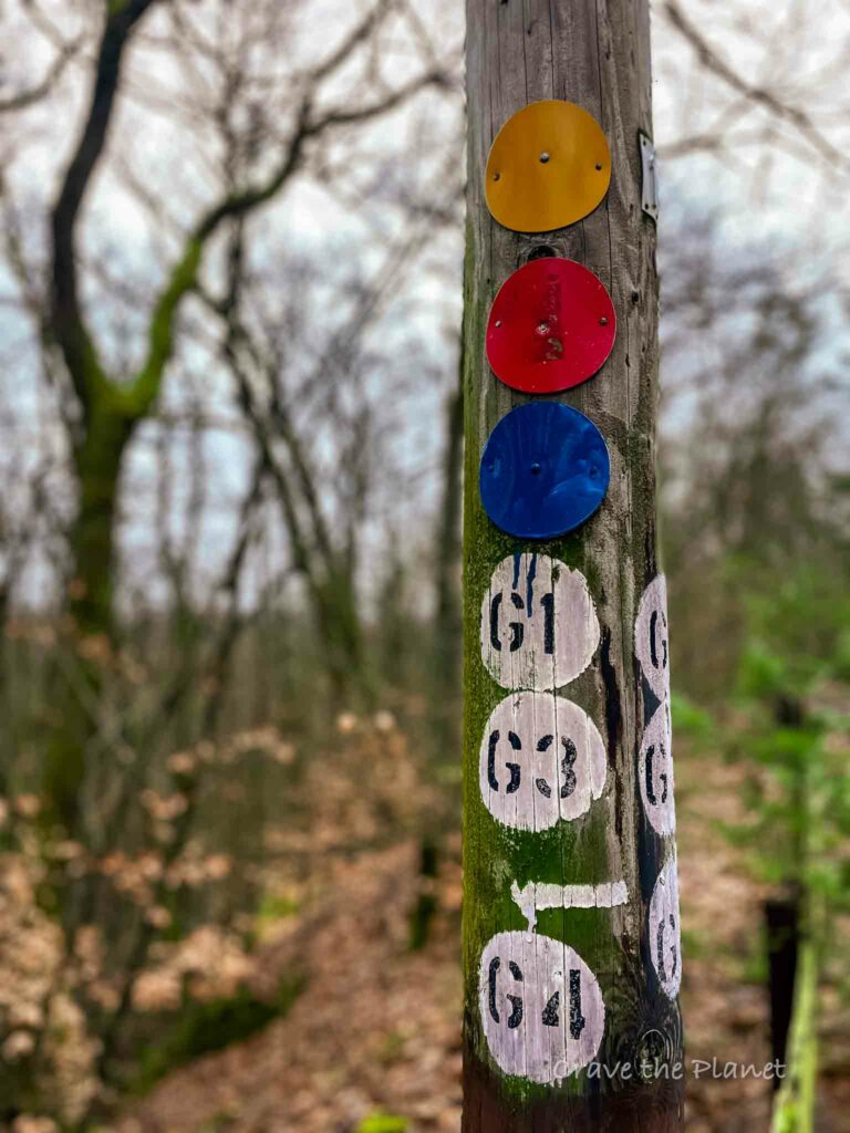
- Options: Red loop 7.5 km, Blue 5 km, Yellow 4.5 km, Green 2.5 km
- Difficulty: Easy, but not stroller friendly
- Points of Interest: Cherry path, 1776 granite markers, pond, the Hoher Fels, 2 huts to eat
- Transport: You need to drive, parking is here.
Become a European Adventure Travel Insider in Just 5 minutes
✨Unlock Europe’s best-kept secrets with our free bi-weekly newsletter.
Krottelbach Loop Hike Map
How to Use This Map:
Click on the icon on the top left-hand corner. You will now see an interactive list.
For more info on each, click on the map icons.
To see the map in more detail, click on the [ ] in the top right-hand corner. This will open a larger map where the details of each point can be found by clicking on the location point name in the list on the left.
You can also save the map for your own use by clicking the next to the map name. This will save the map to your Google Maps, where you can make a copy and use it for your own trip planning.
To view the saved map on your phone, open Google Maps, click “saved” on the bottom, and then “maps” on the lower right.
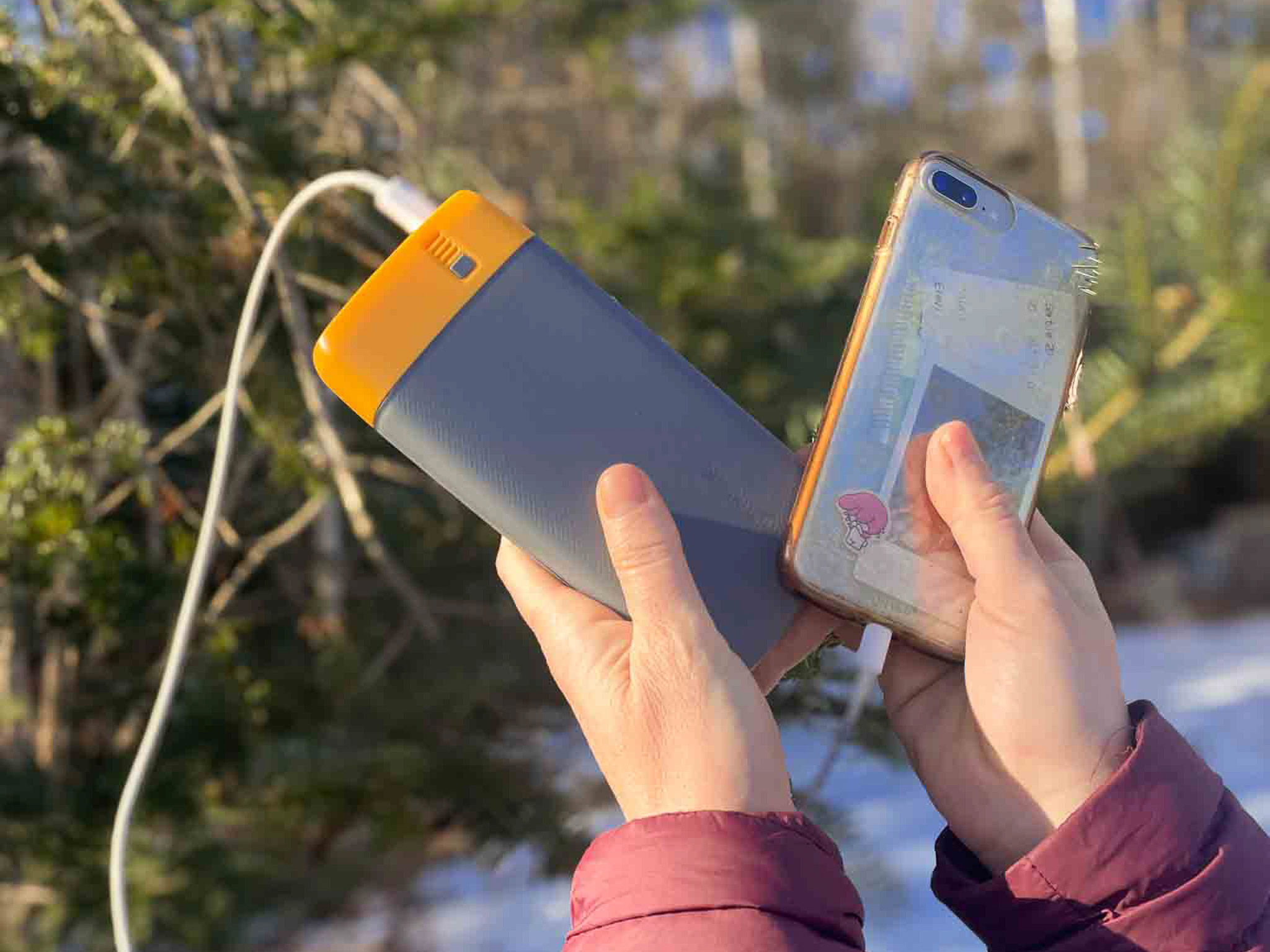
What We Liked About the BioLite Power Bank:
- It lasts so long
- 18 watt USB-C input/output and two 3.0 USB-A
- The 20,000 mAh battery fully charges in 5 hours
- Weighing 16.4 ounces and measuring 6.7 x 3.2 x 1.0 inches
- Comes with Charge 80 PD, USB-A to USB-C
✨ The Peace of Mind to have GPS when I get lost hiking....is invaluable.
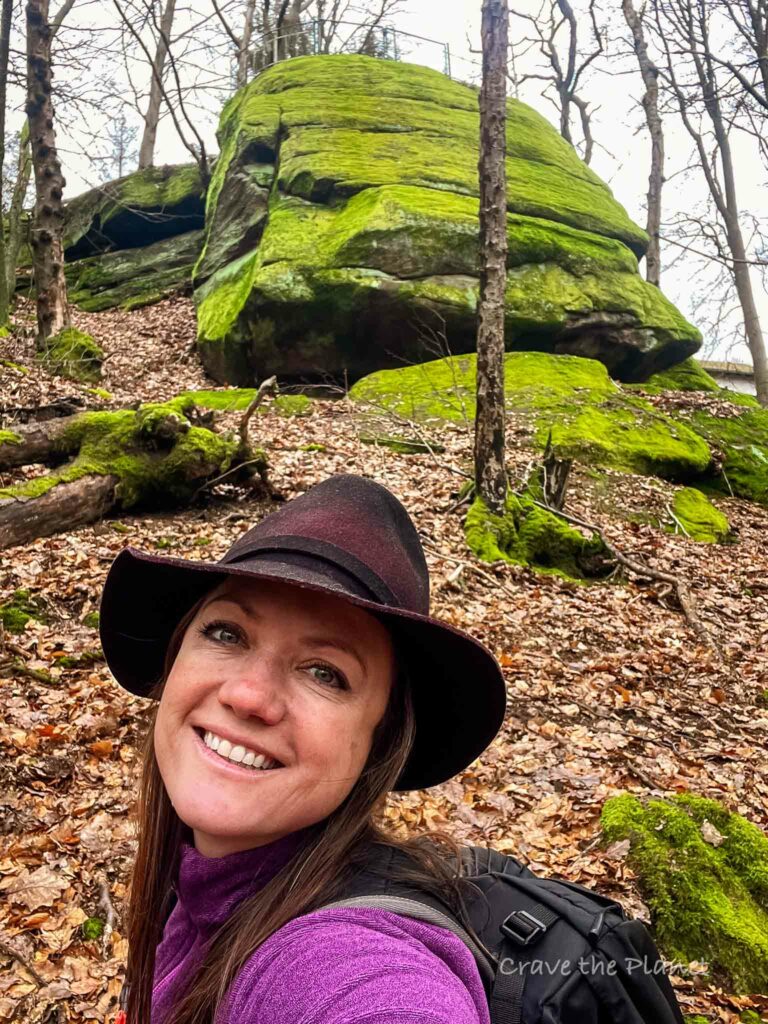
Hoher Fels Hike My Experience
Parking Lot – PWV Krottelbach – Fels (:05)
This hike starts off with a bang. You park at the hutte and the fels are directly next to the parking lot.
This hut actually has the possibility for overnight stays, read until the end for more details. There are 4 different trails here marked with red, yellow, green and blue dots on the trees.
PWV Krottelbach – Entenweiher Frohnhofen Hutte (1 hour)
After descending to the bottom of the hill you’ll walk along a farm road. There’s a really cool effect where the bushes and trees create an archway.
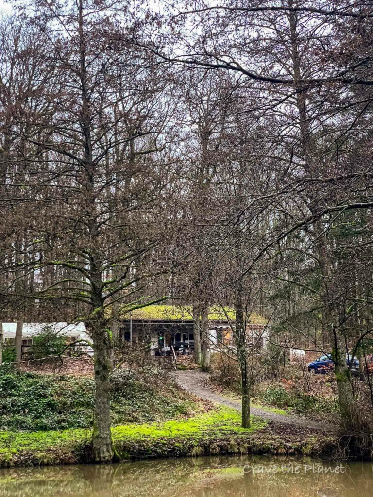
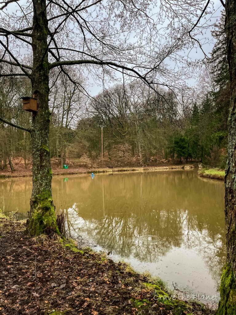
Soon, you’ll meet a cascading waterfall. After an hour, you’ll reach the second hut. It’s next to a muddy pond with an outdoor BBQ.
The hut is really cute and has Morocco vibes and seems to be a local’s hangout. I want to come back here with a fiction novel.
Entenweiher Frohnhofen Hutte – PWV Krottelbach (2:15)
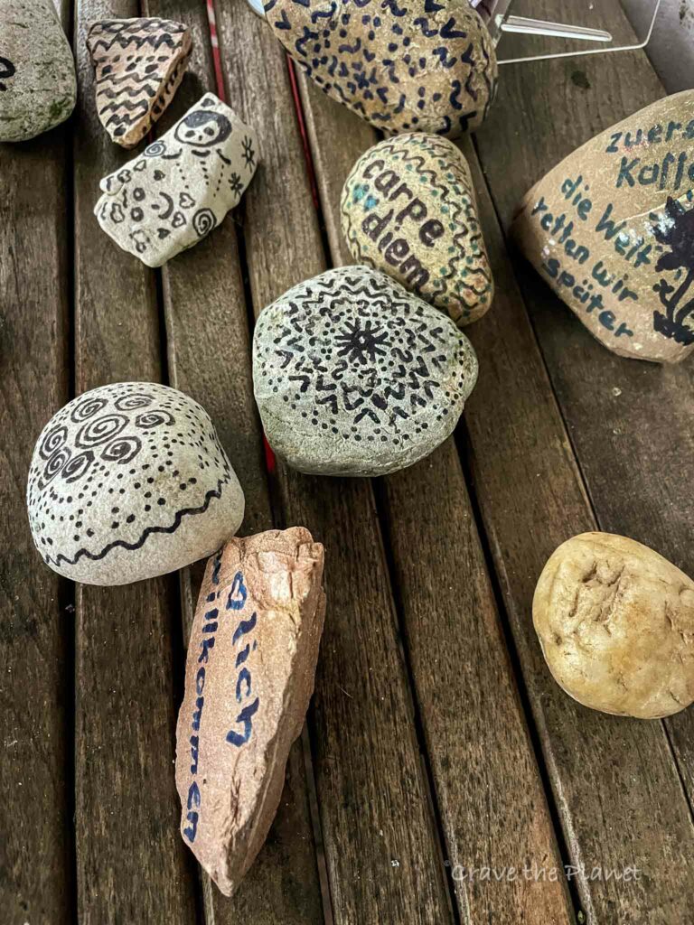
The real highlight of this hike is upcoming. You’ll join the “cherry path” for a section and it’s filled with cool history placards. There’s so much history here and also it’s a border walk for a long stretch.
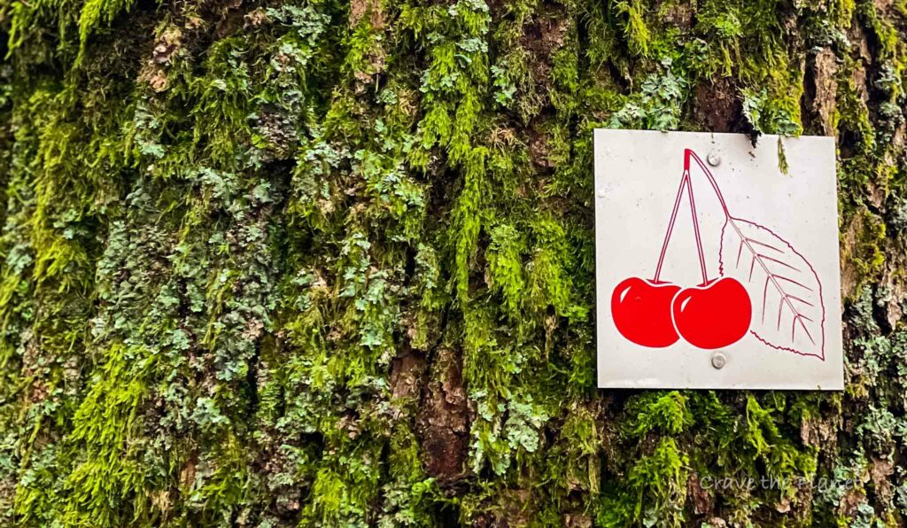
I really liked the granite stone markers that were carved, it really makes you take stock of how insignificant we are.
History
Krottelbach is a small, picturesque municipality nestled in the Rhineland-Palatinate region of Germany. Its history, like many rural German villages, is steeped in agricultural tradition and a close-knit community life.
While detailed historical records of Krottelbach are not extensively documented, it is a place that has likely seen the passage of various European cultural and political shifts over the centuries.
You will also like my related history hiking guide: The Dragon’s Teeth series of hikes
💗 Hiking? Read
👉 Gelterswoog Lake Hike
Things to Know About the Pfälzer bergland
This area is known to be where forests and farmland merges. Things are fairly cheap and well-kept but there’s not a huge amount of tourism here. There’s really not much at all really, but some stand out places include:
- The hay hotel in Konken where you can board your horse overnight
- The falcon show in Potzberg
- Anything St. Wendel
- Draisinen tour from Altenglan to Lauterecken
⛰️ Looking for an epic yet accessible hiking travel adventure?
Unlock the secrets of hut-to-hut hiking in Europe with our FREE course! Transform the way you trek and prepare for the journey of a lifetime. Try my course What to Expect Hut to Hut Hiking to reduce fear and answer all your questions.
Enroll Now for FreeRhineland Pfalz Hiking Huts
There are 2 serviced huts on this trail, making it very attractive for culture lovers. We parked at the first hut and went by the second hut about halfway through the circular hike.
PWV Krottelbach
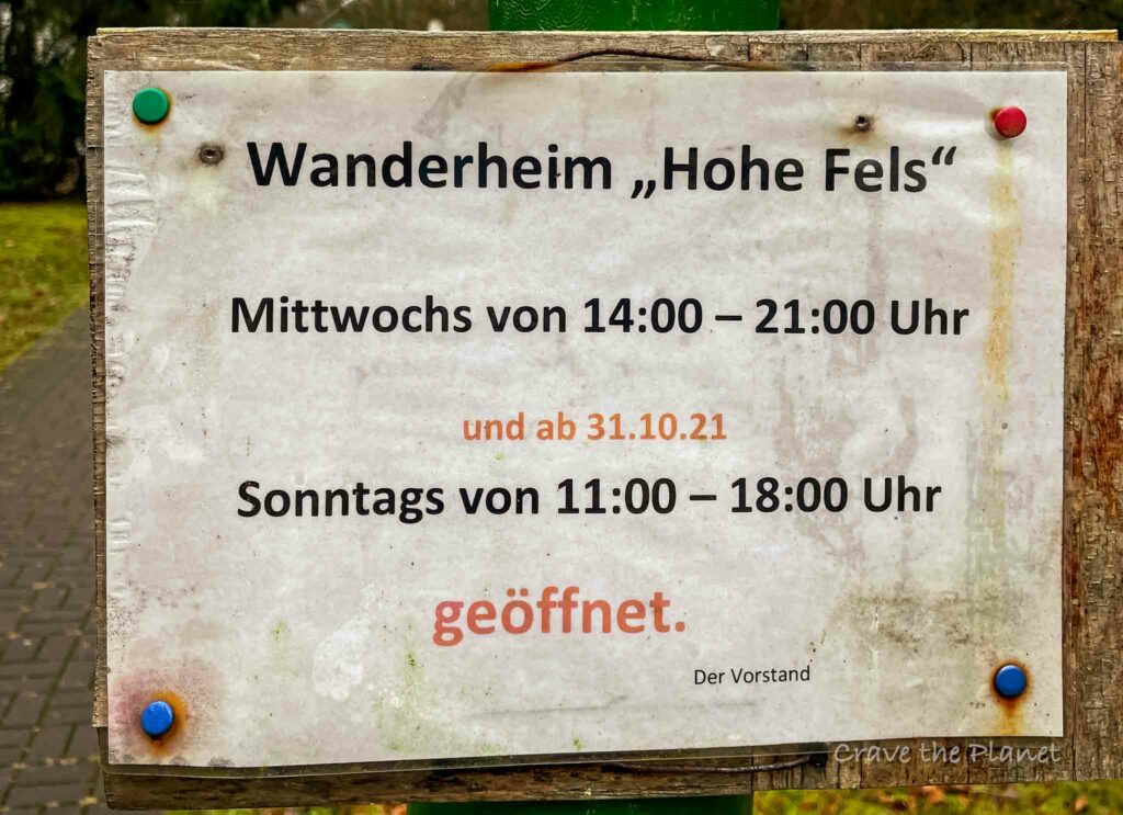
This is where we started. Here’s their contact information and opening times. It looks like you can book a room to stay over night if you’re on a hut to hut hike.
Hohe Fels Hiking Home
Opening times :
Monday-Saturday from 2 p.m., Sundays and public holidays from 10 a.m.
24.12. and 25.12. closed
Contact person: Kurt Wagner
66909 Krottelbach
Telephone: 06386/ 1828 and 5470 (hut)
130 seats/ 23 beds
Entenweiher Frohnhofen
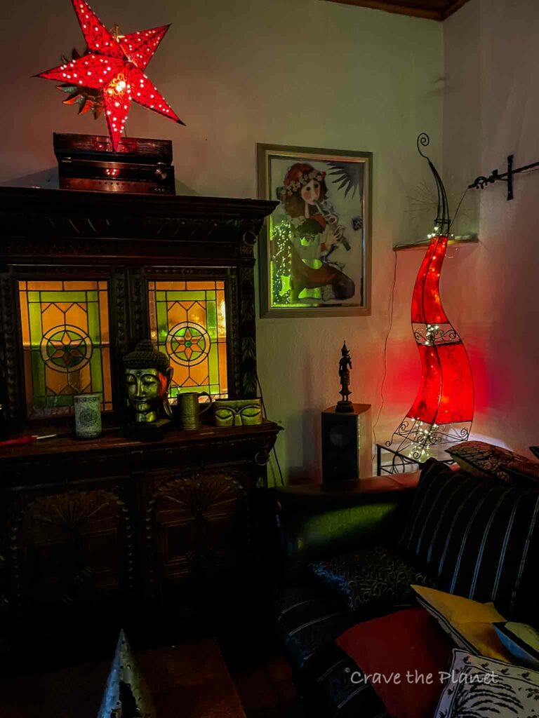
This cozy hutte has a total Morocco vibe. I walked into a cozy fire in the wood stove, couches and tables filled with locals on a rainy Saturday afternoon. It’s near a muddy pond and a great place to chill.
Hütte am Entenweiher
Öffnungszeiten:
Dienstags-Samstags von 14-21 Uhr Sonntags und Feiertags von 10-21 Uhr
Ansprechpartner: Sabine Schillo
66903 Frohnhofen
Telefon: 06386/ 246 und 7011 (Hütte)
More Rhineland Pfalz Travel Blogs
Craving a Hut to Hut Hiking Adventure?
Hut to Hut Hiking in the Dolomites Free Course
Curious about hut-to-hut hiking in the Dolomites, but not sure where to start or what to expect? Sign up for our newsletter that simplifies and educates so you can focus on the views and vino. Get curious, get ready, and let’s get started! Sign up here👇🏼
- Free Email Course to Learn : Everything You Need to Know About Hut to Hut Hiking
We hope this guide filled with interesting information about the Hoher Fels hike has given you the proper information to plan your next adventure.

Author profile: Morgan Fielder is a Doctor of Physical Therapy and passionate hiker who believes in exploring the world on foot with good food. Follow her journey as she shares science-based hiking tips and advocates for sustainable tourism.