
Tiktok or Youtube fatigue? Kids and teens need to soak up Mother Nature to counteract screen time, but the loud complaints keep many of us parents from dealing with the protests of a “hike with nothing to do”. Here’s where the Steinwenden Germany Sculpture hike comes in- it’s a treasurehunt!
Heck, us parents too.
We’re all in some serious nature deficit disorder – aka, going slowly irritable, bored and lacking wonder in our lives.
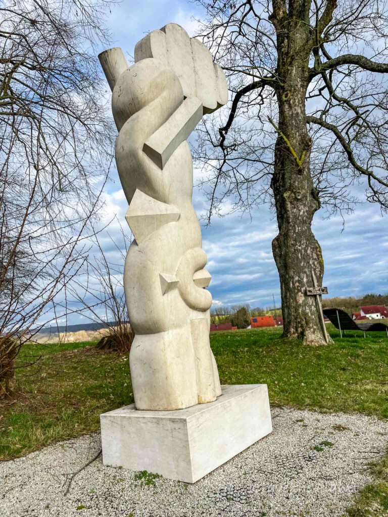
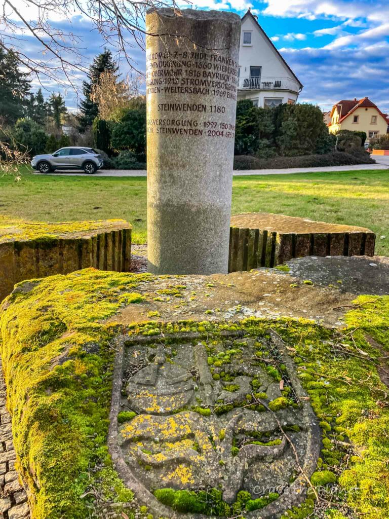
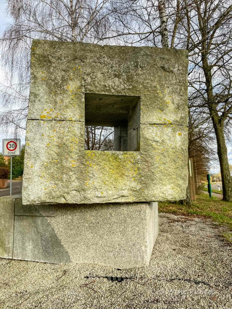
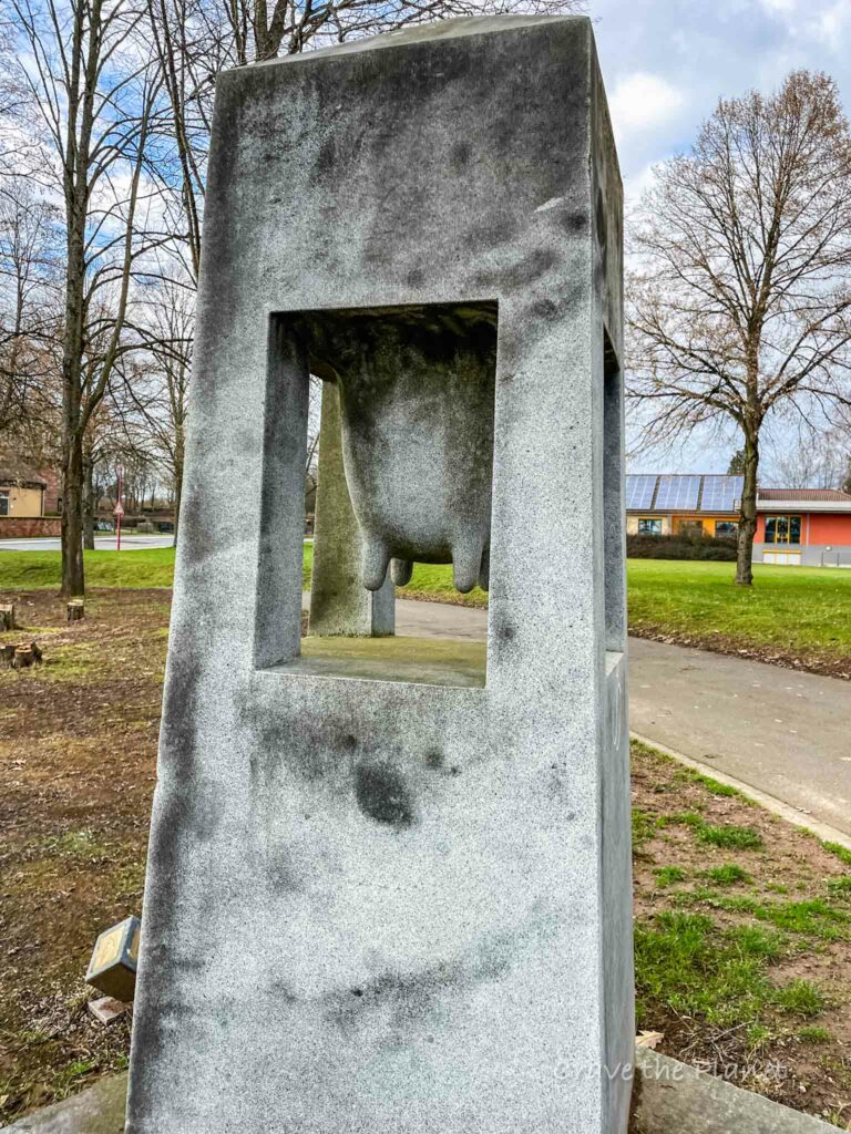
Thankfully, just a few minutes from Ramstein Air Base in Germany, lies a smooth, easy “Steinwenden Skulpturenweg” or Sculpture Path – a hike dotted with 12 interesting and unusual stone sculptures to keep the engagement high and complaining to a low while delivering tranquility on this path through villages, farmlands and woods.
Steinwenden Germany Sculpture Hike Overview

Author’s TL:DR: 4.5 mile mostly paved, family friendly hike just a few minutes from Ramstein Air Base with 12 interesting sculptures to meander amongst and great views.
Morgan’s Video of Steinwenden Germany Hike
Click on “youtube” to watch in full screen and please ❤️ LIKE and subscribe while you are there.
Steinwenden Hike Trail Guide in Rheinland-Pfalz
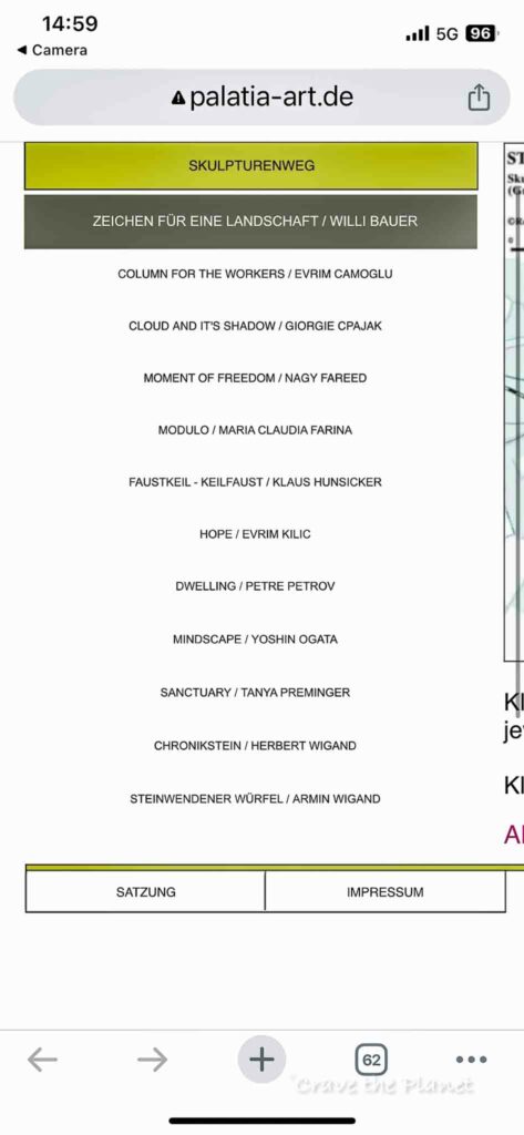
Trail Guide: Steinwenden Sculpture Hike
Location: Steinwenden, Germany
Type of Hike: 1 Loop
Distance: 4.5 miles, 7.25 km
Elevation: 250 ft up, 275 ft down
Duration: 1.5 – 2 hours
Difficulty: Easy
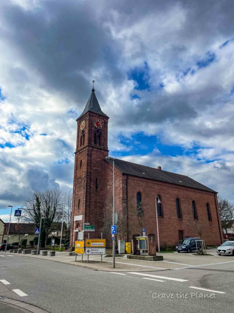
Start/end point: Protestant church
Kid-friendly: yes
Stroller-friendly: yes
Dog-friendly: yes
Fees: No
Camino de Santiago: No
Something Good to Eat: Sascha’s Doner: Amazing döner – salads, yogurt sauce highlights. Easy to split between two people, the yufka is like a burrito version.
Hint: ask for “wenig fleisch, viele gemuse” (ven-egg, feel geh-mooza) version – basically less meat with extra veggies. The amount of meat given is insane (like you could possibly process more than 25 gm of protein at once) and the veggies are soooo fresh and good, but Germany is the land of meeeeeeeeeat!
Become a European Adventure Travel Insider in Just 5 minutes
✨Unlock Europe’s best-kept secrets with our free bi-weekly newsletter.
Trail Map Steinwenden Germany Sculpture Stroller Hike – 4.5 Miles or 7.25 km
This hike is for you if you want somewhere to take the kids and hunt sculptures along the stroller friendly path.
How to use this map: Use your computer mouse or fingers to zoom in and out. Click on the icons to get more information. Click the arrow on the top left corner for the written index. Click the star next to the title of the map to add this map to your google maps account. To view the saved map on your smartphone or PC, open google maps, click the menu button, and go to “your places”/ “maps.”
Tips for Steinwenden Sculpture Stroller Hike
These paths are really easy and very well marked and any shoes would be fine. However, it is 1-1.5 hours so make sure your feet are comfortable and your crocs don’t cause blisters. A vast majority of the time the path is paved, but about ⅓ is packed dirt.
Start by going out of town to the north following the cemetery on your left and the schools on your right.
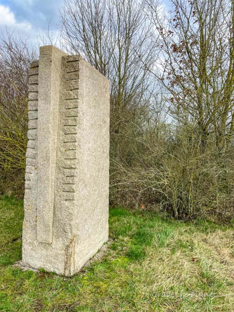
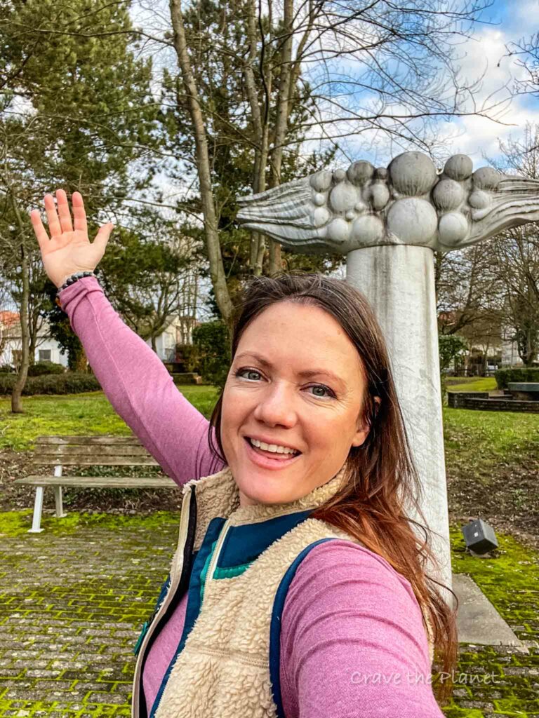
The first sculpture is really obvious and cool.
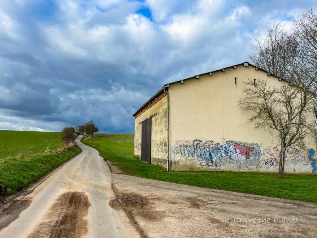
Then the hill starts up after the elementary school.
Once you get into the farmland, you’ll make a left after the only hill.
Then you’ll wind upward a bit and have great overlooks of the next village.
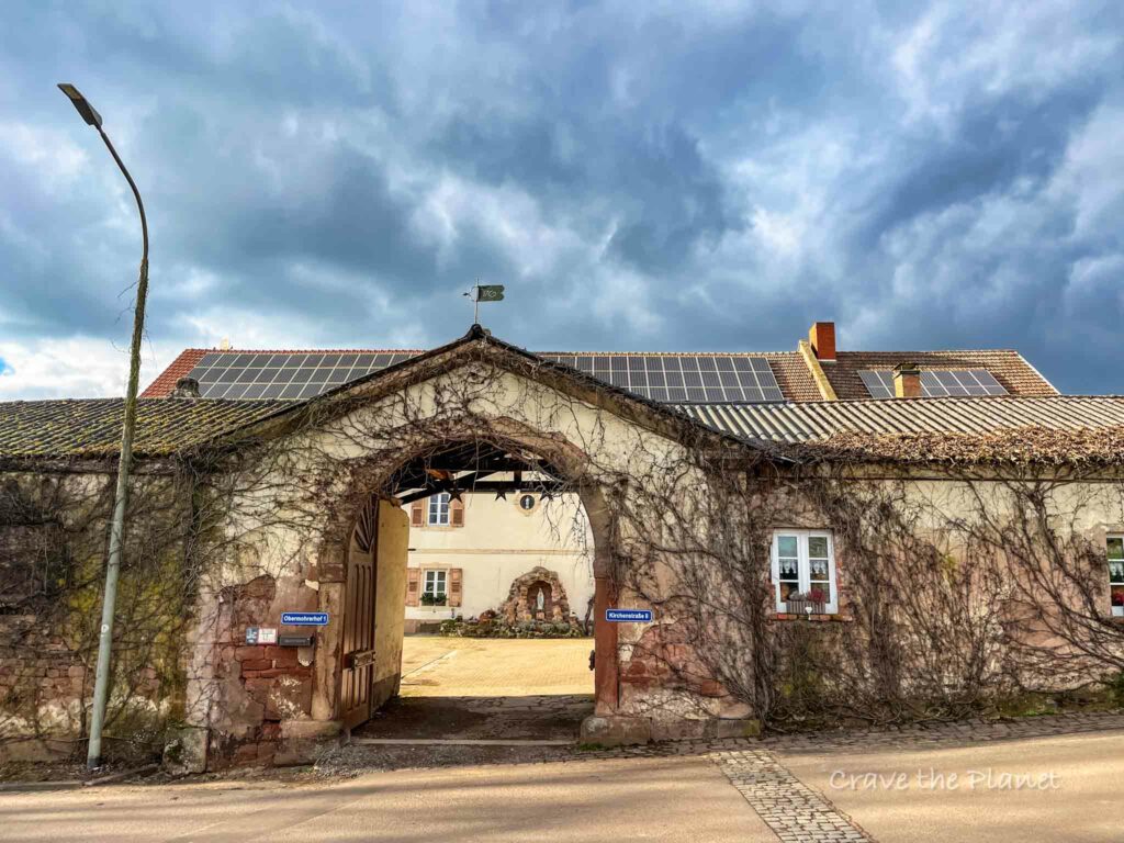
You’ll go through Obermohr and then take a hard left on the main road back towards Steinwenden. You’ll walk along the sidewalk to see the strange statue below. Then cross the street and head across the stream.
Do better than me with keeping your dog off the tracks. Gosh, he just doesn’t understand trains!
You’ll cross the train tracks toward the south and go into the village of Weltersbach.
Then the trail goes through a nice neighborhood before getting back to the main road near the cemetary. Turn left and there’s a bike path along the road. You’ll pass the Italian restaurant and sport complex.
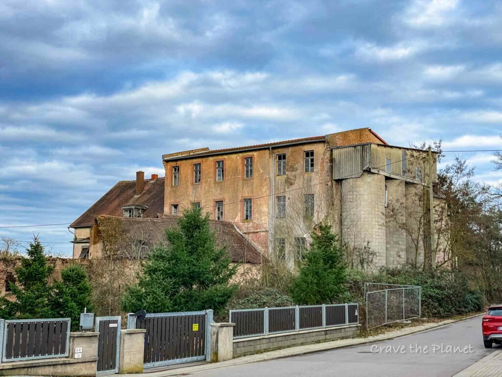
Walk toward the banhof or train station. But first you’ll walk by the creepiest abandoned building.
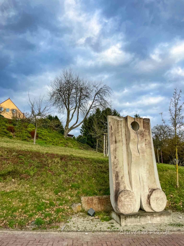
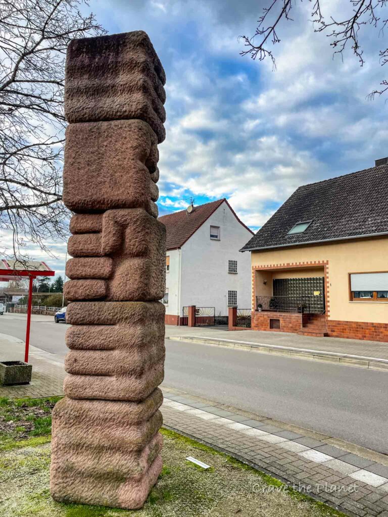
Once you get to the banhof, you’ll see this cool statue. Double back to the train tracks and turn left to follow the pedestrian path alongside the tracks.
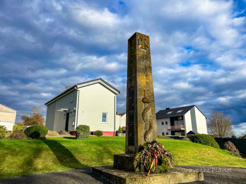
You’ll get back to the main road and see a nice statue and basically head back to the start along Moorstrasse.
Getting to Steinwenden & KMC Area Guide
The trailhead is at the Protestant church in the center of the Steinwenden village.
The best way to access the Steinwenden Sculptures hikes is by train. The (only) train station in Steinwenden is located less than 1/4 mile from the Church and a flat easy walk.
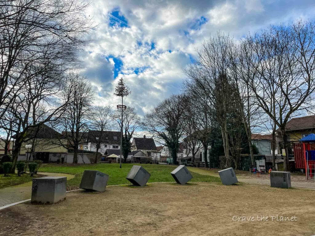
This quaint village houses multiple cemeteries, parks and an elementary school. Along with the Skulpturenweg, it’s popular for walkers and families both German and American alike and very accessible.
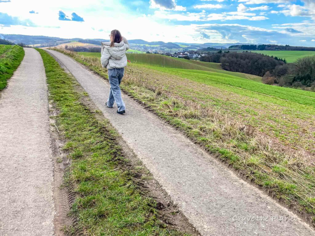
It doesn’t take long to get out of the village and look out over the gorgeous hills in the gorgeous patchwork farmland that sits in the lowlands between the Hunsruck forest and Pfälzerwald (Palatinate forest).
Of note, the Pfälzerwald is the largest single patch of forest in Germany and part of a UNESCO world heritage site.
Pilgerweg Wendlinus
This sculpture path is part of a larger network of sculpture trails that stretch from Russia to Spain.
Another section nearby is in the amazing town of St. Wendel or Sankt Wendel with it’s adventure races, tasty restaurants, pilgrimage paths, bones of a saint in the church and kick ass hiking trails.

Alternative Hikes
This guide is for people who want a rolling, ambling walk and suitable for strollers. If you’re looking for something a bit more strenuous, check out the Breitenwald Fels Loop Hike just a few minutes away in Landstuhl. That will get your heart pumping and engage those quads!!
If you want to explore with more outdoor nature exhibits check out the Henschtal Germany squirrel hike near Glan Munchweiler, it has a wonderful bee, bug and animal outdoor exhibit to learn from.
On a Journey: Best Hikes in Rhineland Pfalz
Thanks for reading! I hope you enjoy rambling around Steinwenden and catching some outdoor history and culture with this sculpture walk. How cool is that?
Have you experienced a cool trail nearby? We would love to hear how it was over on our facebook group European Adventure Travel Planning.
More Rhineland Pfalz Travel Blogs


Author profile: Morgan Fielder is a Doctor of Physical Therapy and passionate hiker who believes in exploring the world on foot with good food. Follow her journey as she shares science-based hiking tips and advocates for sustainable tourism.