
If you’re seeking a peaceful hike through the forest that culminates in a serene, mirror-like lake, ideal for stand-up paddleboarding, swimming, or unwinding with a refreshing beer, then the Gelterswoog Lake hike is the perfect choice for you.

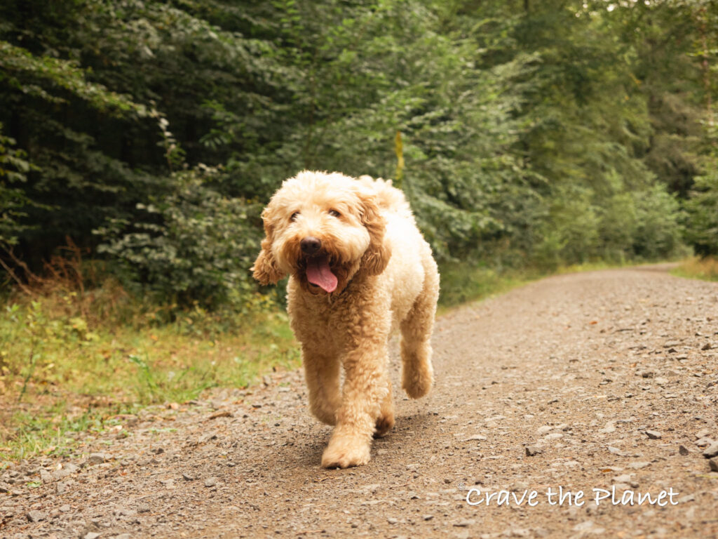
The Gelterswoog Lake trail is a flat, quiet and easy hike that provides a perfect escape from the hustle and bustle of Kaiserslautern, and as someone who has been coming here for 8 years to bikejor with my husky in winter or hike and paddle board with my doodle in summer, I can confidently say that it’s the best lake near Ramstein Air Base.
Soft Trails
Forest Bath
- Calm
Swim and Beers at the End
It’s Very Easy
Low Challenge
Event Days Crowded
Mostly Shaded
It’s not a challenging hike, but I love coming here because it is so close to the city, yet you feel completely immersed into the forest.

Once you walk 5 minutes away from the parking lot it’s like you have the forest to yourself, despite having an incredible amount of amenities at the lake like mini-golf, paddleboarding, a hotel and a restaurant.
tl;dr: Gelterswoog Lake Hiking Trail Travel Guide located in Kaiserslautern Germany at the northern edge of the Palatinate Forest. Including GPX stages for your phone and food and cultural highlights. Dog and sport stroller friendly.
It’s really perfect for a group where some people just want to sit and drink beer and the others want Nature’s solitude. Those that want some Mother Natch can get it and everyone meets back up for a swim. It’s one of my favorite things to do in Kaiserslautern.
Gelterswoog Lake Hike Overview

- Trailhead: Gelterswoog Lake Parking Lot
- Distance: 6.7 mi circuit
- Time Needed: 3:00 hours
- Elevation Gain/Loss: 325 feet
- Difficulty: Very Easy
- Terrain: Soft, Trail, Dirt Roads
- When to Hike: All Seasons
You will also like my related hiking guide: Dragon’s teeth Siegfried Line Hike or the Dragon’s Rock Hike in Wasgau
Morgan’s Gelterswoog Germany Youtube
Gelterswoog Rhineland-Palatinate Route Map
How to Use This Map:
Click on the icon on the top left-hand corner. You will now see an interactive list.
For more info on each, click on the map icons.
To see the map in more detail, click on the [ ] in the top right-hand corner. This will open a larger map where the details of each point can be found by clicking on the location point name in the list on the left.
You can also save the map for your own use by clicking the next to the map name. This will save the map to your Google Maps, where you can make a copy and use it for your own trip planning.
To view the saved map on your phone, open Google Maps, click “saved” on the bottom, and then “maps” on the lower right.
These same trails lead to the backside of Landstuhl and Kindsbach. You can also get to Bann and Quidersbach easily.
There are few people running, horseback riding and mountain biking here and I’m not sure why. It’s idyllic.

The only problem I have is if my dog is off lead and horses come by, I’m sure to leash up.
Gelterswoog Lake Hike: My Experience
Parking Lot – Gelterswoog Valley – Wahlmuhltal Natural Springs (1:30)
Ruby and I went after work on a busy summer day and were so happy that there were hardly any people there. I love the golden hour for hikes in the forest, especially when I know I am not racing against the sun to beat the boars. It’s one of the best hikes in Kaiserslautern area.
Anyways, the trail starts immediately from the parking lot on a single track that circumnavigates the west side of the lake. You’ll get onto a very flat dirt road that winds away from the lake and into the Nature preserve.

You’ll take your first left at the intersection and cross a bridge. Then at the next intersection take a right getting onto the Camino de Santiago. The path is well marked with a blue and yellow shell sign.
The point of the rays on the sign point toward Santiago (in Spain). There should be a sign to Burg Nanstein, it’s also on the camino and known as the Landstuhl castle.

You’ll pass a very small buffalo farm before getting onto a road where you overlook the multiple small lakes at the bottom of the “Gelterswoog Valley.”
When you get to the next intersection, you’ll take a hard right onto a single track leaf carpeted forest trail. This is the only part of the trail that isn’t completely flat with a small grade downhill.
You’ll have a few roots to step over and/or push the sports stroller. You’ll get down to the creek at the bottom of the ravine where you have the Wahlmuhltal Springs.
It’s a great place to have a picnic as there is a babbling spring, tables and a serene place to relax.
Wahlmuhltal Springs – Gelterswoog Valley – Lake (2:30)

This part of the walk is absolutely perfect at the golden hour as you’ll pass several small still ponds that reflect the trees and hills perfectly. They are filled with lily ponds and draping willows. The trail is a dirt road that is completely flat.
When we were there I noticed very few people, but I think the springs are known for their healing properties.

I saw 2 city people on crappy bikes with empty plastic water bottles on the back on the way to the springs and then they were full when they were riding back toward the city.
Keep an eye out for mushrooms here, we found many amanita mushrooms in August even.

Lake – Parking Lot (3:00)
You’ll criss-cross sides of the valley, and take the trail across the same bridge as we took at the beginning to get to the southern edge of the lake. Now you’ll walk by the restaurant, camping place and lake back to the parking lot.

You will also like my related hiking guide: Adlerbogen Hike
How to Get to the Gelterswoog Lake (Gelterswoog See in German)
By Car
This hike is very easy to get to from Kaiserslautern. It takes about 15 minutes from the center of Kaiserslautern to Gelterswoog on the B270. The parking lot is well marked and free and I’ve listed it on the google map above.
By Bus
There is a bus stop directly in front of the lake named “Kanuvereine” or a few minutes walk down the street called. “Breitenau Gasthaus” It takes approximately 30 minutes for a direct bus from the Kaiserslautern Hauptbahnhof.
Comprehensive Hiking Gear Guides
Physical Therapist Curated Gear Guides for Hikers
- 🧎 Make your knees feel better while hiking and walking: Best Knee Braces for Hiking
- 🌳Make the downhills stop hurting and hike with more confidence Best Trekking Poles Review
- ⌚ Never get lost on the trail and navigate the wilderness safely with My Review of the Best GPS Watches for Hiking
- ❄️ Go hiking in the winter or on icy surfaces safely: The Best Microspikes for Hiking
- 💰 Save money by making your SUV a hotel the night before a big hike: My Review of the BEST Air Mattress for Your SUV
Things to Know About Gelterswoog Recreation
This place sits near a Nature reserve and offers not only swimming, but picnic areas, BBQ facilities, wildlife, birdwatching and scenic views.

Swimming, Fishing, Boating:
There is an entrance fee to swim, however if you go away from the 300 meter long sandy beach area (lido) we’ve never had problems getting in with paddleboards for free. Many people like to fish, boat, kayak and paddle board here. There is a yacht club here for people that want to keep boats.
Gelterswoog Mini-Golf:
This is a very popular activity at the Gelterswoog and very affordable.
Gelterswoog Restaurant and Hotel:
The hotel at Gelterswoog, Germany offers a total of 37 rooms, including 10 standard single rooms, 4 standard double rooms, 22 comfort double rooms (including 10 with lake views), and 1 apartment with a bedroom, living room, furnished kitchen, and balcony.

Events:
This lake often hosts flea markets and Middle Age markets. Check out their website to stay up to date for events.
Gelterswoog Camping:
The sites are right along the lakeside and very relaxing at the Gelterswoog campingplatz. If you want to reserve a spot you’ve got to email or call them.
You will also like my related hiking guide: Heidenfelsen Pagan Hike Landstuhl
More Germany Hiking Blogs
Author profile: Morgan Fielder is a Doctor of Physical Therapy and passionate hiker who believes in exploring the world on foot with good food. Follow her journey as she shares science-based hiking tips and advocates for sustainable tourism.