
From free flowing waterfalls to cliffside trails and expansive views of castles and mountains– this Swabian Alb day hike is perfect for beginners that want to be amazed by Nature’s bounty. There’s even Fire Salamanders next to the trail!~

Author’s tl;dr: The Bad Urach Waterfall hike located in the Swabian Alb UNESCO Biosphere reserve is magical, mystical and can easily be shortened. Including GPX stages for your phone and food and cultural highlights. Dog friendly. 6.7 miles, easy public transportation. Keep an eye out for the protected Fire Salamanders next to trail.
Morgan’s Hiking Video Bad Urach Waterfall
Click on “Youtube” button to watch it in full screen, and while you are there please subscribe!
The Bad Urach Waterfall Germany hike, in the region of Baden-Württemberg, is a stunning natural attraction where you can enjoy the beauty of a 37-meter high limestone cascade, whitewashed clifftop walk and several delicious huts serving hyper local food and wine.
We went in February and had a great time, even walking barefoot through the waterfall. Watch my video to get a feel for the incredible range of experience you can have on this 10km loop.
What I really loved was the homemade Maultaschen halfway through the hike at Rohrauer Hutte and the neon feuersalamanders in the trailside pools.

This guide is for people wanting to go beyond the flat walk from the train station to the Urach waterfall, because the smaller waterfalls beyond are even more impressive.
Travel tip: The spa town of Bad Urach make a great day trip from Stuttgart, but it is worth a weekend in and of itself.
If you like waterfalls, you may also like my articles on the nearby Breitachklamm gorge hike, Ehrbachklamm hike or my review of the best waterfalls in Europe.
bad urach Waterfall Germany Hike
Double Waterfall Hike
- Location: Schwäbische Alb, Bad Urach, Germany
- When to Hike: Year Round
- Distance: 6.7 mile loop
- Up/down: 1100 feet
- Time: 3:15 hours
- Difficulty: Easy-Moderate (no high heels)
- Points of Interest: Urach & Gütersteiner Waterfall, Rutschenfelsen
- Transport: Paid parking, Train Stop
Become a European Adventure Travel Insider in Just 5 minutes
✨Unlock Europe’s best-kept secrets with our free bi-weekly newsletter.

Bad Urach Wasserfallsteig Loop Hike Map
How to Use This Map:
Click on the icon on the top left-hand corner. You will now see an interactive list.
For more info on each, click on the map icons.
To see the map in more detail, click on the [ ] in the top right-hand corner. This will open a larger map where the details of each point can be found by clicking on the location point name in the list on the left.
You can also save the map for your own use by clicking the next to the map name. This will save the map to your Google Maps, where you can make a copy and use it for your own trip planning.
To view the saved map on your phone, open Google Maps, click “saved” on the bottom, and then “maps” on the lower right.
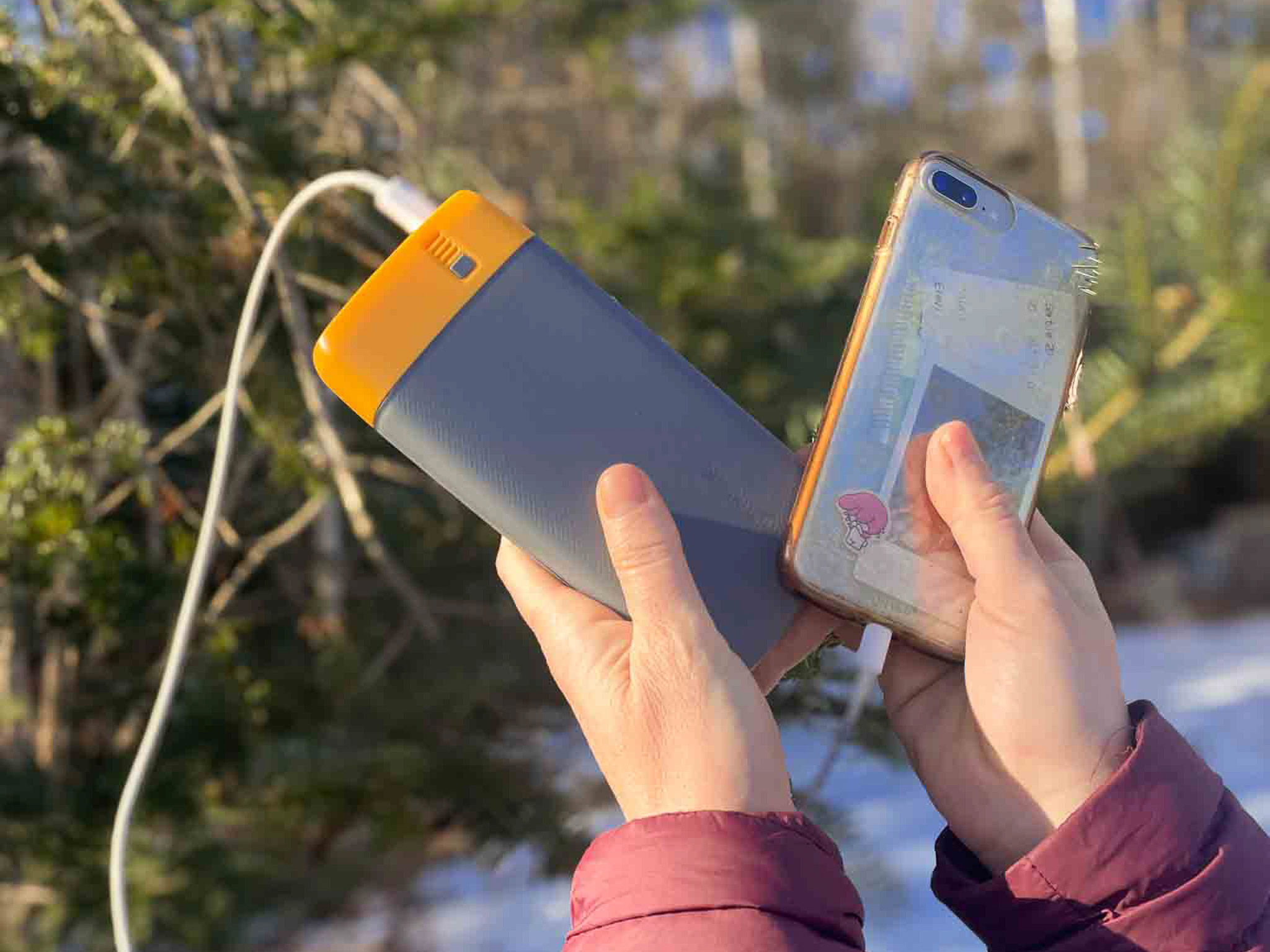
What We Liked About the BioLite Power Bank:
- It lasts so long
- 18 watt USB-C input/output and two 3.0 USB-A
- The 20,000 mAh battery fully charges in 5 hours
- Weighing 16.4 ounces and measuring 6.7 x 3.2 x 1.0 inches
- Comes with Charge 80 PD, USB-A to USB-C
✨ The Peace of Mind to have GPS when I get lost hiking....is invaluable.
Urach Waterfall Hike My Experience

Parking Lot – Base of Waterfall – Fels (:30)

This hike starts off near the Maisentalstube parking area. The trail here is wide and flat and would be just fine for a stroller.
There’s a hilarious sign with a high heeled shoe being not allowed. Gotta love the Swabische.


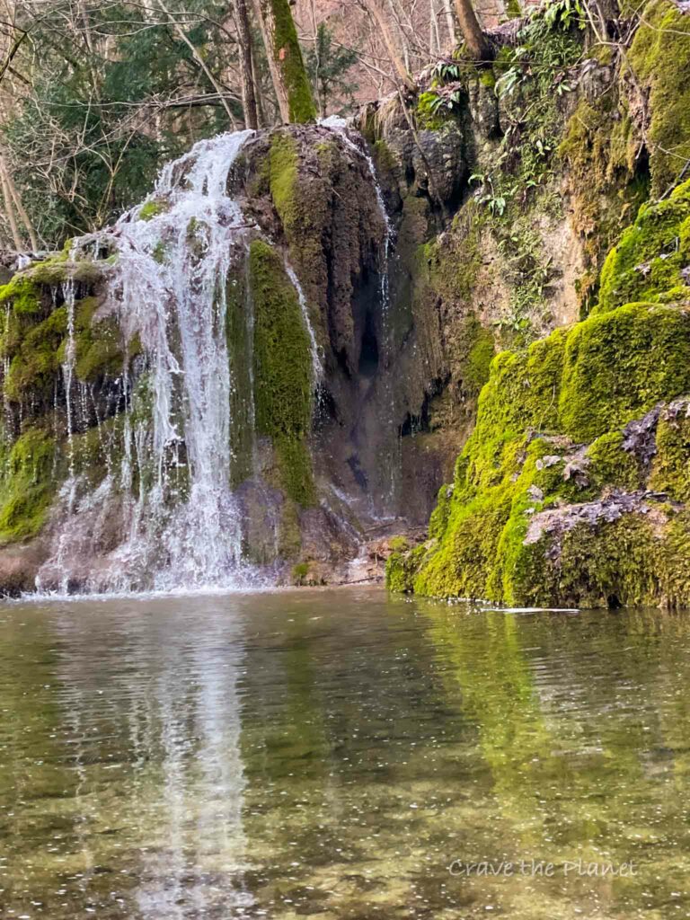
There’s a lovely gushing stream next to the trail and within a mile you’ll reach the base of the magnificent Urach Wasserfalle. Take your time here to enjoy this cascading and impressive waterfall.

Urach Waterfall – Rohrauer-Hütte (1:30 hour)
We had to take off our shoes due to the granite staircase being covered in waterfall water. There was a bit of a workaround but I found it to be like a nice cold plunge for my feet. Once you get to the top the trail goes off to the right but you’ll want to get a view over the top of the waterfall.
There’s an impressive view of the castle ruins and the waterfall truly goes off a cliff.
The hutte at top was closed when we went in February but the door stated it opens in March and serves typical hut food and drinks.

The trail here starts to get very steep. It’s a hard hike to the top of the white cliffs, where you’ll then walk along the top for a mile or so.
The cliffs are impressive, they look like something I’ve seen along the coast of UK (sans ocean of course).
Rohrauer-Hütte – Maisentalstube (3:15)

The real highlight of this hike is upcoming. If you have time stop at this hutte and get the homemade Maultaschen (the meat was not as good as the spinach, but the menu changes).
You’ll descend lovely single track and walk down the Rutschenfelsen with many small waterfalls and lovely views.

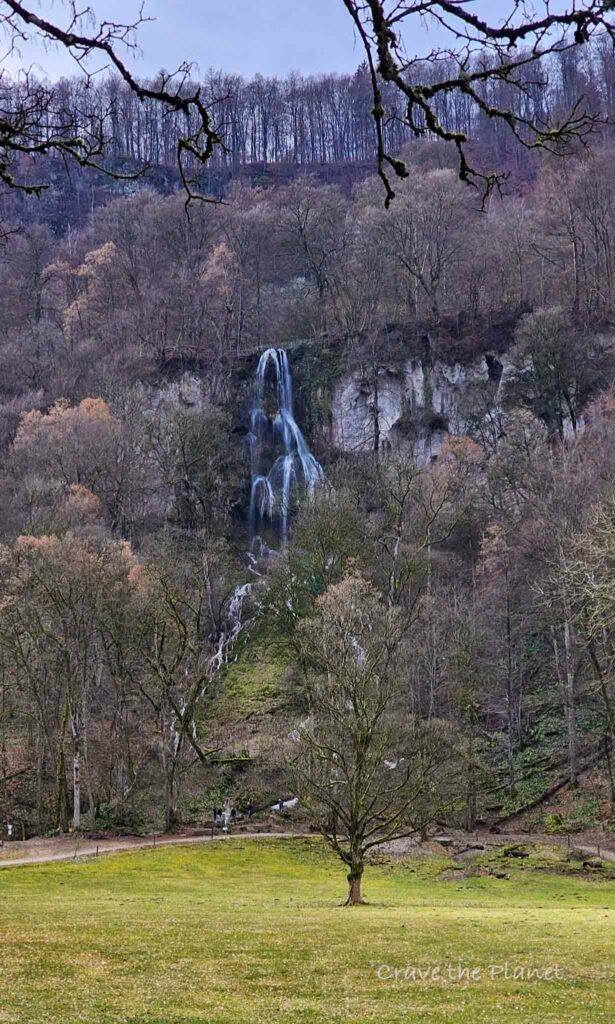
The Gütersteiner Wasserfall is like something out of a movie and not at all crowded (when we went).
It’s a lovely mermaid pool and somewhat prettier than the main Urach waterfall in my opinion. It’s more serene.


After you come off the mountainside you’ll walk past a beautiful barn and back to the parking lot.

You will also like my related history Waterfall Hiking guide: Best Alps Waterfalls with hikes
History
Bad Urach is a small, picturesque municipality nestled in the Baden-Württemberg region of Germany.
Known for its therapeutic thermal springs and captivating waterfalls, the town invites relaxation and exploration and Bad Urach is definitely worth visiting if you love hidden gems.
Bad Urach’s attractions extend beyond its natural spa; the town holds a valuable spot in history with timber-framed houses and the well-preserved ruins of Urach Castle.
⛰️ Looking for an epic yet accessible hiking travel adventure?
Unlock the secrets of hut-to-hut hiking in Europe with our FREE course! Transform the way you trek and prepare for the journey of a lifetime. Try my course What to Expect Hut to Hut Hiking to reduce fear and answer all your questions.
Enroll Now for FreeThings to Know About the Bad Urach

The town of Bad Urach, situated about 30 minutes south of Stuttgart, is surrounded by the scenic Swabian Alb and offers not just the waterfall, but also a range of hiking trails, streams, and the fresh air of the forest.
The waterfall itself is easily reachable with its own railway station, allowing visitors to embark on a pleasant walk through the valley to witness the spectacular natural feature
Here’s some stand out places:
- Bad Urach Therme (Bad Urach Spa)
- Half Timbered Old Town
- Outlet Shopping
- Hiking
- Royal Palace Bad Urach
- Hohenurach ruins
Long Distance Hikes in the Schwäbische Alb

This is a great place to do a hut to hut hike during the summer, spring or Fall season. The Swabian long distance path is called the Albsteig or HW1. It’s about 360 km with at least 16 stages and unlike the Alps, it’s not limited to only July and August as it’s lower elevation and you can stay in villages.
💗 Long Distance Hiking? Read 👉 Rhine Castles Trail
Bad Urach Hiking Huts

There are at least 3 serviced huts on this trail, making it very attractive for foodies. We parked at the first hut, the waterfall hut at the top was closed in February, and we ate lunch at the beared hut about halfway through the circular hike.
Maissentalstuble
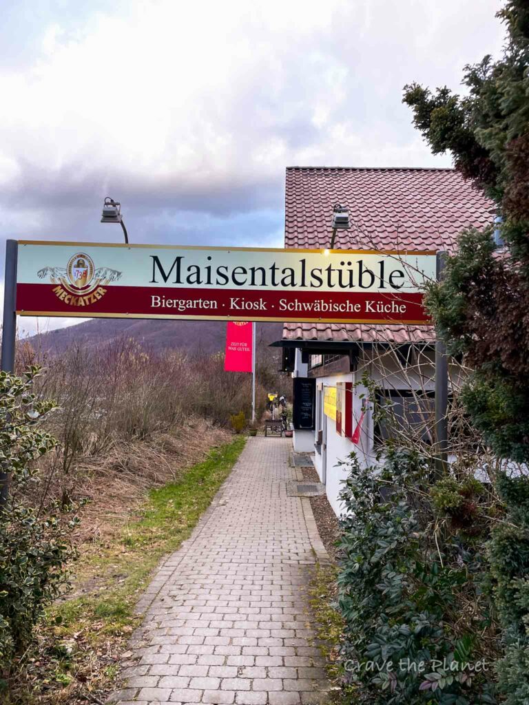
This is where we had dinner and it was one of my favorite steaks of all time. Here’s their contact information and opening times.
Near Parking
Opening times :
Monday-Saturday from 11:30am to 9:30pm
Vorderes Maisental 5, 72574 Bad Urach

Rohrauer-Hütte (Overnight Stays)
This cozy hutte has a total Swabian vibe. They even have the inflation costs listed for each item 😉

Local Cuisine: It was simple and delicious!
Monday to Wednesday: day off
Thursday and Friday
11:00 a.m. to 6:00 p.m: Kitchen until 5:00 p.m
Saturday, Sunday and public holidays
10:00 a.m. to 6:00 p.m: Kitchen until 5:00 p.m
Room of the Rohrauer Hut
There are 30 beds available:
4 double rooms (some with bunk beds)
2 four-bed rooms (some with bunk beds)
14 bed rooms (only bunk beds)
Telephone
Tel.: 07122 9763
Directions/address Rohrauer-Hütte:
Rohrauer-Hütte
72813 St.Johann/Bleichstetten
Access via the Bleichstetten hiking car park on the K6708
Email: [email protected]
Internet: www.rohrauer-huette.de


Bad Urach Accommodations

- Budget: Hotel Quellenhof
- Midrange: Flair Hotel
- Luxury: Bischoffs
More Outdoor Europe Travel Blogs
Craving a Hut to Hut Hiking Adventure?
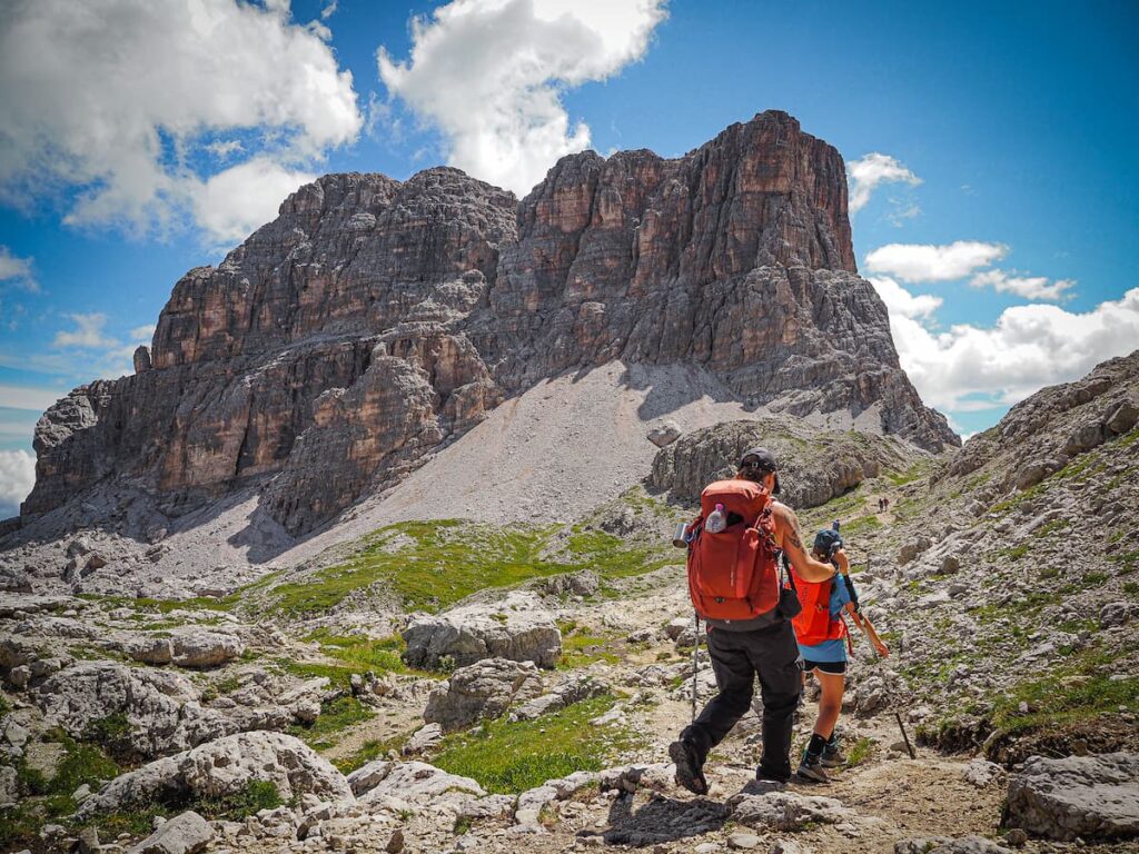
Hut to Hut Hiking in the Dolomites Free Course
Curious about hut-to-hut hiking in the Dolomites, but not sure where to start or what to expect? Sign up for our newsletter that simplifies and educates so you can focus on the views and vino. Get curious, get ready, and let’s get started! Sign up here👇🏼
- Free Email Course to Learn : Everything You Need to Know About Hut to Hut Hiking
We hope this guide filled with interesting information about the Bad Urach Waterfall Germany Hike has given you the proper information to plan your next adventure.

Author profile: Morgan Fielder is a Doctor of Physical Therapy and passionate hiker who believes in exploring the world on foot with good food. Follow her journey as she shares science-based hiking tips and advocates for sustainable tourism.