
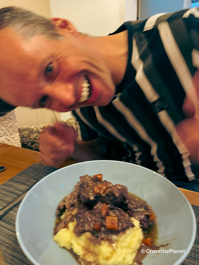
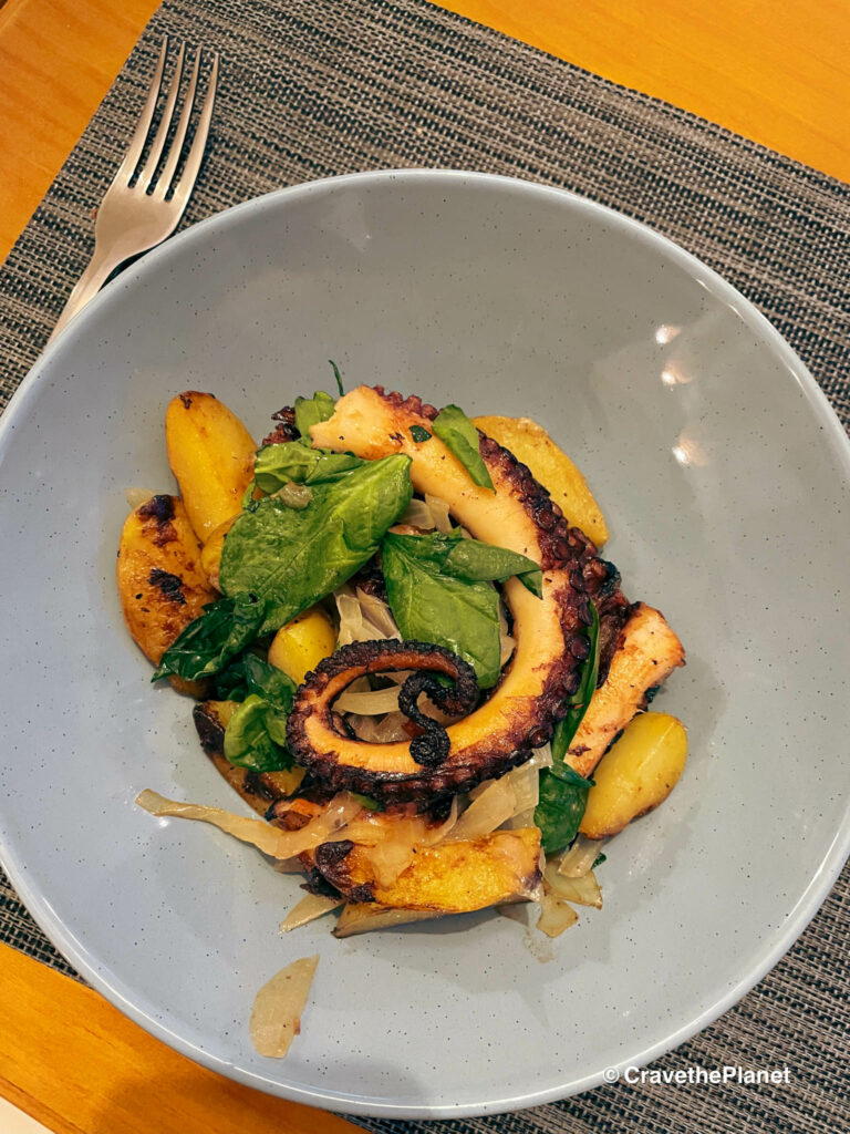
The highlight of trekking in Europe is the food, especially along the wild Portuguese coast on the Fisherman’s Trail.
I’ve put together the best of the Fisherman’s trail Portugal Map for you to download to your phone or GPS device.
Why choose the Fisherman’s Trail for a non-summer adventure:
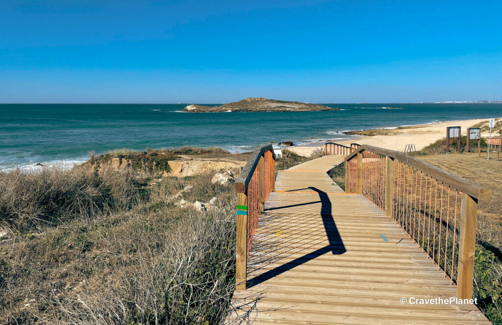
- Rugged Atlantic coastal walk mostly undeveloped (**unlike the Algarve)
- Multi-day trekking with comfortable beds and hot meals
- Step back in time by staying in tiny fishing villages in small hotels, BnBs, and guest houses
- Delicious wine and seafood right on the trail
- Accessible trail – it’s not especially difficult or technical
Read the Full Fisherman’s Trail Guide for accommodations, trailhead in Porto Covo, Lisbon bus transfers and food highlights.
What You Will Learn
- tl;dr:
- Quick Guide to Fishermen’s Trail Stages
- Fishermen’s Trail Portugal Map
- Daily Stages: Fisherman’s Trail Maps
- Fishermen’s Trail Stage 1: Porto Covo to Vila Nova Milfontes
- Fishermen’s Trail Stage 2: Vila Nova Milfontes to Almograve
- Fishermen’s Trail Stage 3: Almograve to Zambujeira do Mar
- Fishermen’s Trail Stage 4: Zambujeira do Mar to Odeceixe
- PDF Fisherman’s Trail Places to Stay
- FAQ Fisherman’s Trail
tl;dr:
Easily download the GPX files and daily stages of the best of the Fisherman’s Trail on the Rota Vicentina in Portugal.
Read until the end where I share a done-for-you accommodation guide to book hotels, hostels and even some luxury farm stays right along the trail.
What to pack? Read my minimalist guide on what to pack for the fisherman’s trail in Portugal.
Quick Guide to Fishermen’s Trail Stages
Best of the Fishermen’s Trail
Arrival Day: Get to Porto Covo: (Lisbon to Porto Covo 2.5 hours bus)
Stage 1: Porto Covo to Vila Nova Milfontes 12 miles, 20 km
Stage 2: Vila Nova Milfontes to Almograve 9 miles, 15 km
Stage 3: Almograve to Zambujeira do Mar 13 miles, 21 km
Stage 4: Zambujeira do Mar to Odeceixe 11 miles, 18 km
Wild campers could follow this itinerary also but please note it is illegal to camp in the nature reserve.
What I saw campers do was find a spot just outside the villages or they would meet people at the bars and restaurants and ask to camp in their backyard. It was definitely a shock to my American sensibilities but it’s surprisingly common and charming.
And really, that’s the point of a hike like this. It feels like stepping back in time. It’s what I imagine the central coast of California might have been like 40 years ago.
▶️ Ready to plan your SELF GUIDED multi day walk along the last wild coast in Europe?
I got you! Just use these maps + packing list + my ➡️ Fisherman’s Trail Places to Stay Spreadsheet and you’re pretty much covered. I use booking.com to arrange my stays along the Fishermen’s Trail because it’s very reliable and organized for a multi-day trek.
Want a visual of the hike, check out my Fisherman’s Trail webstories.
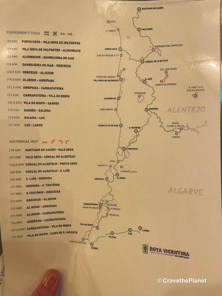
Fishermen’s Trail Portugal Map
Google Map: Rota Vicentina Best of Fishermen’s Trail
Download the Fisherman’s Trail GPX on Komoot here. New to hiking apps? Learn how to use Komoot for hiking here. You will get one region of Komoot free that you can download to save data.
Once you open the GPX click on the 3 dots on the upper right hand corner of your phone. Click “export gpx file”.
Or you can just use this google map if you don’t want yet another app on your phone.
How to Use This Map:
Click on the icon on the top left-hand corner. You will now see an interactive list.
For more info on each, click on the map icons.
To see the map in more detail, click on the [ ] in the top right-hand corner. This will open a larger map where the details of each point can be found by clicking on the location point name in the list on the left.
You can also save the map for your own use by clicking the next to the map name. This will save the map to your Google Maps, where you can make a copy and use it for your own trip planning.
To view the saved map on your phone, open Google Maps, click “saved” on the bottom, and then “maps” on the lower right.
Sections of the Fisherman’s Trail
The stages outlined in this guide average about 5-6 hours of easy walking time each day at 15-21 km (9-13 miles).
The length of the Best of the Fishermen’s Trail is 76 km (47 miles) long and 4 days.
My new hiking buddy went here multiple years in a row and basically told me that outside these stages it was less about the scenery and just more about the walking.
Most hikers will find some bus routes to avoid boring sections on the Rota Vicentina. So if you’re short on time, these are the best four days for breathtaking scenery.
How Long is the Fishermen’s Trail in Portugal
This Cicerone Guidebook is a very helpful for planning, but not necessary. I just used komoot and google maps. It’s not highly technical.
Fisherman’s Trail Full Route is 13 days and 225km (140 miles).
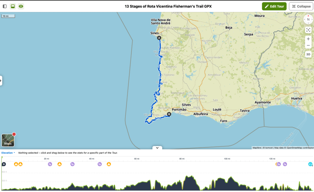
- São Torpes to Porto Covo (10 kilometers, difficulty: easy)
- Porto Covo to Vila Nova de Milfontes (20 kilometers, difficulty: moderate)
- Vila Nova de Milfontes to Almograve (15.5 kilometers, difficulty: easy)
- Almograve to Zambujeira do Mar (22 kilometers, difficulty: easy)
- Zambujeira do Mar to Odeceixe (19 kilometers, difficulty: easy)
- Odeceixe to Aljezur (22.5 kilometers, difficulty: average)
- Aljezur to Arrifana (17.5 kilometers, difficulty: average)
- Arrifana to Carrapateira (20 or 21.5 kilometers, difficulty: average)
- Carrapateira to Vila do Bispo (16 kilometers, difficulty: moderate)
- Vila do Bispo to Sagres (20.5 kilometers, difficulty: average)
- Sagres to Salema (19.5 kilometers, difficulty: moderate)
- Salema to Luz (12 kilometers, difficulty: average)
- Luz to Lagos (11 kilometers, difficulty: easy)
If you want to tackle the entire trek – check out the official Rota Vicentina Fishermen’s Trail website as it provides helpful information and an app to plan the entire way.
Fisherman’s Trail Portugal Map of Full Route
Accommodations on the Fisherman’s Trail Route
A range of budget hostels, mid-range hotels and luxurious farm stays are available as shown above but these are my favorites for the upper fisherman’s trail section.
| Stage | Distance Walked | My Favorite Places to Stay on the Trail |
|---|---|---|
| Day 0 | Porto Covo: Mute | |
| Day 1 | 12 mi | Vila Nova de Milfontes: Vila Eira Boutique House |
| Day 2 | 9 mi | Almograve: Almograve Beach Hostel |
| Day 3 | 13 mi | Zambujeira do Mar: Monte Das Alpenduradas |
| Day 4 | 11 mi | Odeceixe: Bohemian Antique Guesthouse |
| Travel Days | Lisbon, Lagos |
Daily Stages: Fisherman’s Trail Maps
Arrival Day: Get to Porto Covo (trailhead) from Lisbon
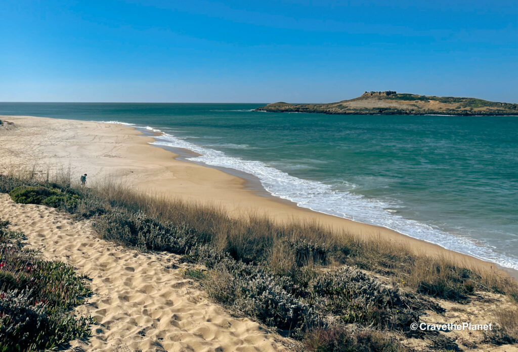
Fishermen’s Trail Stage 1: Porto Covo to Vila Nova Milfontes
Click here to Download GPX Day 1
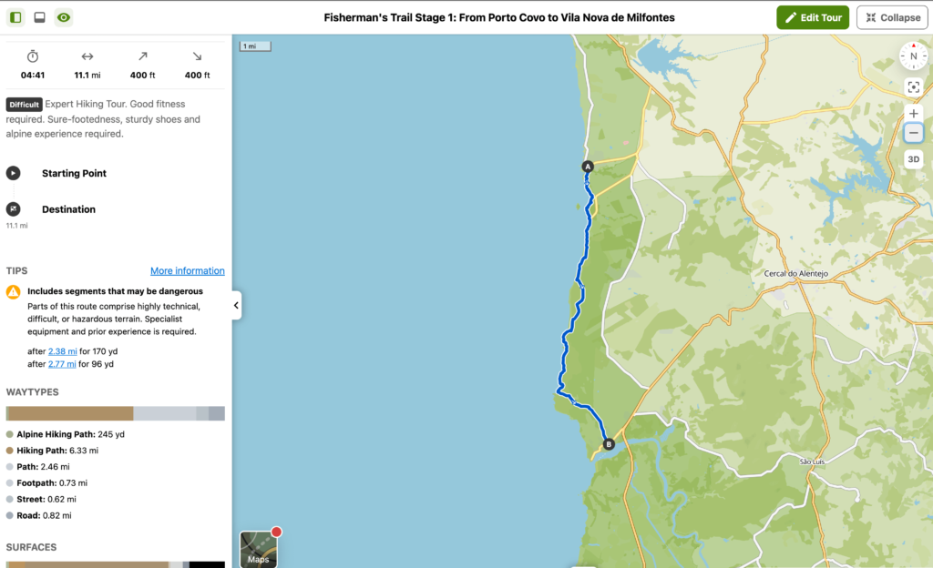
Distance: 19 km, 11 miles
Difficulty: Moderate only due to sand
Time: 6-6:30
Ascent/Descent: Mild about 400 ft
Fishermen’s Trail Stage 2: Vila Nova Milfontes to Almograve
Click here to download Day 2 GPX Fisherman’s Trail Route
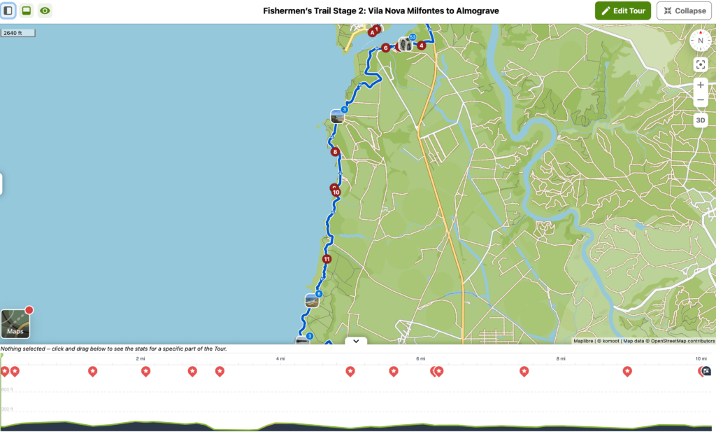
Distance: 15 km, 9 miles
Difficulty: Easy – Moderate
Ascent/Descent: Easy, about 510 ft
Time: 4:30 Short Route, 5:30-6:00 Fun Route
Fishermen’s Trail Stage 3: Almograve to Zambujeira do Mar
Download Day 3 Fisherman’s Trail Portugal Map GPX here.
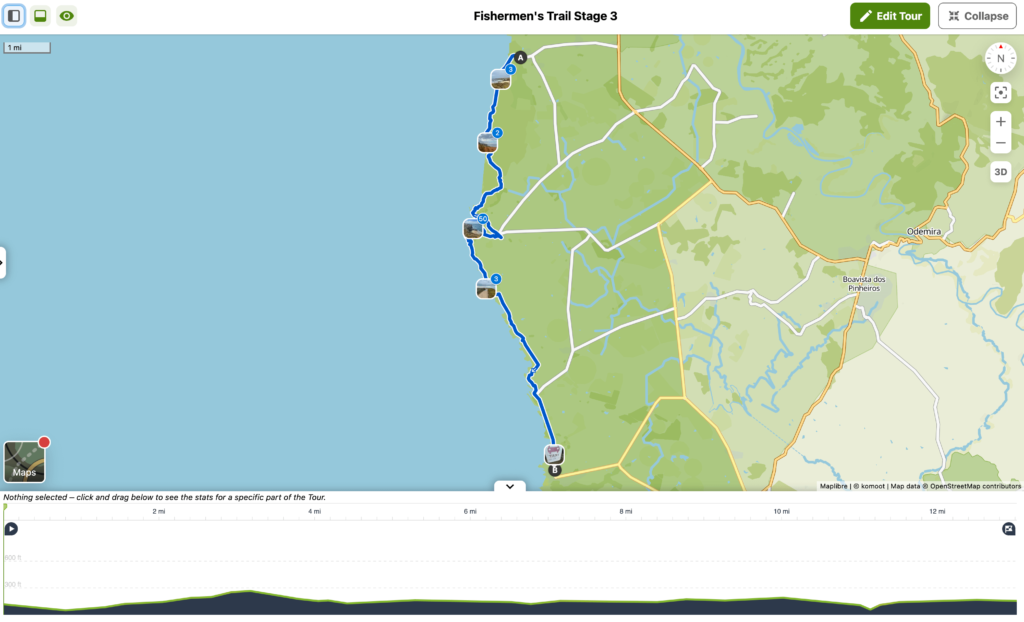
Distance: 21 km, 13 miles
Difficulty: Moderate
Ascent/Descent: Easy-Moderate, about 500 ft
Time: 5:30-6 hours
Fishermen’s Trail Stage 4: Zambujeira do Mar to Odeceixe
Download Day 4 Fisherman’s Trail Portugal map here.
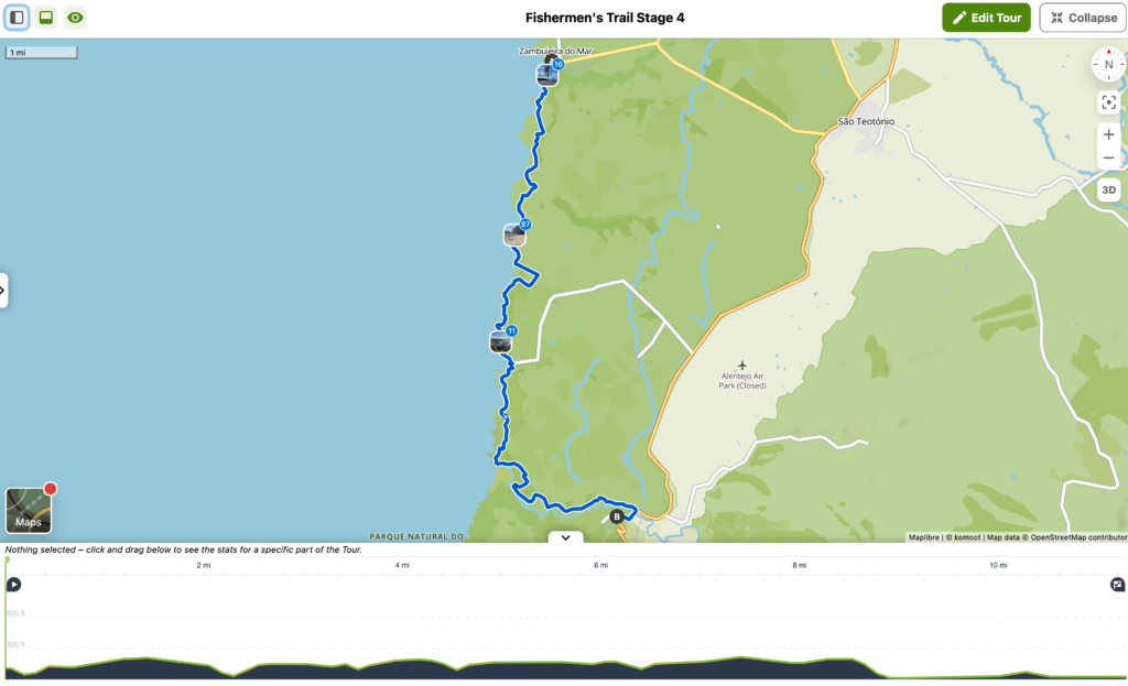
Distance: 19 km, 12 miles
Difficulty: Easy – Moderate
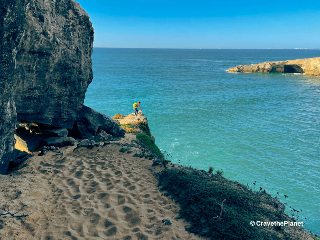
Ascent/Descent: Moderate – It Gets Fun here going up and down the cliffs a bit. About 800 ft.
Time: 5-5:30 hours
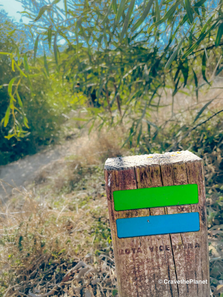
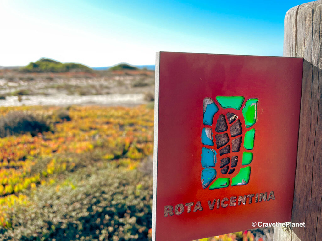
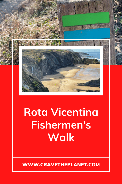
Rota Vicentina Fisherman’s Trail Signs + Tips:
Don’t go in the summer. It’s really hot.
The hike is accessible September through June.
(Perfect for Fall, Winter, and Spring Multi-day Hikes).
This is especially great for hikers that don’t want to travel to South America or New Zealand to hike September to June.
July and August are not ideal due to the heat and lack of luggage transfers.
Follow the teal and blue signs, it’s almost impossible to miss. When presented with a fork in the path, it will be marked in teal and blue with a hash to indicate you’re going the wrong way.

1. For a lighter load use the luggage transfer, because with only a daypack you can explore the cliffs, dunes and mysterious abandoned mansions with ease.
2. Avoid boots and use lighter weight trail running shoes. Your boots will fill up fast and are heavy in the sand.
3. Bring sun and eye protection even in the winter months, there’s very little shade.
4. The Rota Vicentina app or Cicerone guidebook can help you navigate.
5. For a full gear guide that I personally tested check out the full list here.
PDF Fisherman’s Trail Places to Stay
If you don’t want to pay for a guide or self-guided plans from a tour company you can simply use this list of hotels, hostels and BnBs along the trail. They are located either directly in the fishing villages, or a short walk or taxi ride inland.
➡️ Fisherman’s Trail Accommodation Spreadsheet
Make it easy to plan your trek and find the best places to eat.
➡️ Prefer PDF? Download a list of the accommodations directly on the Fishermen’s trail.
There are options for budget and luxury however some of the villages may require a taxi to get to a true luxury stay.
FAQ Fisherman’s Trail
How long is the fisherman’s trail Portugal?
The Fisherman’s Trail Full Route is 13 days and 225km (140 miles). It goes from Sines to Lagos.
What is the best part of the Fisherman’s trail Portugal?

The hike is accessible September through June.
(Perfect for Fall, Winter, and Spring Multi-day Hikes).
This is especially great for hikers that don’t want to travel to South America or New Zealand to hike September to June.
July and August are less than ideal due to the heat and luggage transfers aren’t available.
Fisherman’s Trail Summary with Travel Guides for Each Village
Arrival Day: Get to Porto Covo: (Lisbon to Porto Covo 2.5 hours bus)
Stage 1: Porto Covo to Vila Nova Milfontes 12 miles, 20 km
Stage 2: Vila Nova Milfontes to Almograve 9 miles, 15 km
Stage 3: Almograve to Zambujeira do Mar 13 miles, 21 km
Stage 4: Zambujeira do Mar to Odeceixe 11 miles, 18 km
Download: ➡️ Fisherman’s Trail GPX
➡️ Minimalist Packing List
Ultimate Guide : Rota Vicentina Fisherman’s Trail
Pin It
MORE EUROPEAN HIKING TRAVEL BLOGS
Get more CULTURE + NATURE HIKING travel tips here 👎🏻
- Itinerary for the Alta Via 1 Hike in the Dolomites
- Plan Your Own Dolomites Hut to Hut Hike
- 🥾 Hike Through Europe’s Steepest Vineyard – Calmont Klettersteig Germany
- Tour du Mont Blanc Itinerary for a 5 Day Hut to Hut Hike
- Rhine Castles Trail along the Upper Middle Rhine Gorge : 13 Stages

Author profile: Morgan Fielder is a Doctor of Physical Therapy and passionate hiker who believes in exploring the world on foot with good food. Follow her journey as she shares science-based hiking tips and advocates for sustainable tourism.
Overall, I highly recommend the experience of multi-day hiking in Portugal. The Fisherman’s Trail Portugal map should help you plan a unique and memorable experience that you won’t want to miss.